Directions to Here To Help (Wichita) with public transportation
The following transit lines have routes that pass near Here To Help
 Bus: ROUTE22: S BDWY-, SOUTHEAST HIGH.
How to get to Here To Help by bus?
Click on the bus route to see step by step directions with maps, line arrival times and updated time schedules.
From 37th and Rock Rd, Wichita
46 minFrom Wichita Area Roman Catholic Churches, Wichita
48 minFrom The Sunflower Plaza, Wichita
33 minFrom Bodycote, Wichita
43 minFrom Enk 07, Wichita
46 minFrom Equality Kansas, Wichita
42 minFrom Taco Shop, Wichita
51 minFrom Riverside Custom Painting, Wichita
68 minFrom All Right Heating & Air, Wichita
58 minFrom W M Sales & Leasing, Wichita
46 min
Bus stops near Here To Help in Wichita
Bus lines to Here To Help in Wichita
What are the closest stations to Here To Help?
The closest stations to Here To Help are:
- Harry And Breckenridge Ib is 264 yards away, 4 min walk.
- Harry And Cypress Ob is 634 yards away, 8 min walk.
Which bus line stops near Here To Help?
ROUTE22: S BDWY- (2201ob)
What’s the nearest bus station to Here To Help in Wichita?
The nearest bus station to Here To Help in Wichita is Harry And Breckenridge Ib. It’s a 4 min walk away.
What time is the first bus to Here To Help in Wichita?
The ROUTE22: S BDWY- is the first bus that goes to Here To Help in Wichita. It stops nearby at 5:22 AM.
What time is the last bus to Here To Help in Wichita?
The ROUTE22: S BDWY- is the last bus that goes to Here To Help in Wichita. It stops nearby at 10:02 PM.
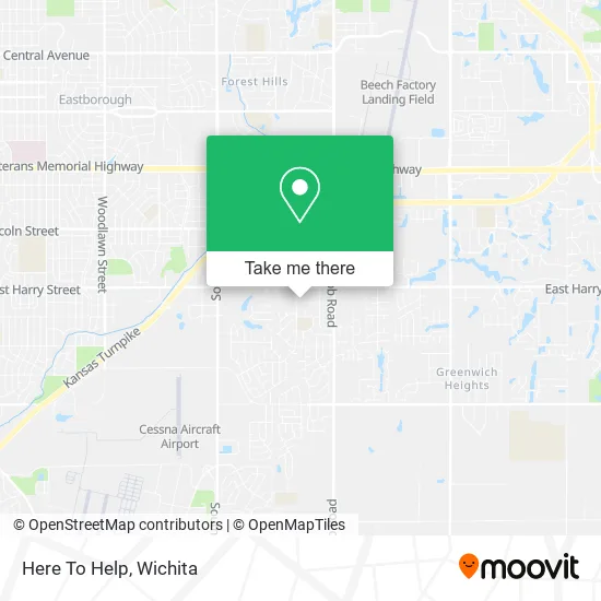
See Here To Help, Wichita, on the map
Public Transit to Here To Help in Wichita
Wondering how to get to Here To Help in Wichita? Moovit helps you find the best way to get to Here To Help with step-by-step directions from the nearest public transit station.
Moovit provides free maps and live directions to help you navigate through your city. View schedules, routes, timetables, and find out how long does it take to get to Here To Help in real time.
Looking for the nearest stop or station to Here To Help? Check out this list of stops closest to your destination: Harry And Breckenridge Ib; Harry And Cypress Ob.
Bus: ROUTE22: S BDWY-, SOUTHEAST HIGH.
Want to see if there’s another route that gets you there at an earlier time? Moovit helps you find alternative routes or times. Get directions from and directions to Here To Help easily from the Moovit App or Website.
We make riding to Here To Help easy, which is why over 1.5 million users, including users in Wichita, trust Moovit as the best app for public transit. You don’t need to download an individual bus app or train app, Moovit is your all-in-one transit app that helps you find the best bus time or train time available.
For information on prices of bus, costs and ride fares to Here To Help, please check the Moovit app.
Use the app to navigate to popular places including to the airport, hospital, stadium, grocery store, mall, coffee shop, school, college, and university.
Here To Help Address: 9211 E Harry St Wichita, KS 67207 street in Wichita
- Vicki Gordon Farm,
- Wichita KS Dental,
- Angle Niche,
- Breathe Physical Therapy,
- RE/MAX,
- Kathy Richard Ins Agy,
- Healthy Green Nutrition (Healthy Green KS),
- Ada Marciniak NCTMB,
- Packy's Brokerage Co,
- 8809 E Harry St,
- TACO BELL,
- Harry & Webb Dillons,
- Master Garage Pros,
- Mr & Mrs Clean Total Home Care Cleaning Services,
- Huffmaster Home Improvements,
- Market Weaverz,
- Optimal Advertising Professionals,
- Doo It All Dave's Remodeling and Services,
- RJ's Tree Surgeons,
- Althouse Sound and Lighting
Places Near Here To Help (Wichita)
- Afghan Halal Market, Wichita,
- East 21st Street North and Webb Road, Wichita,
- winfield, Wichita,
- Sena African Hair Braiding LLC, Wichita,
- Westside Athletic Field (Friends University Baseball Field), Wichita,
- Paige Place Apartments, Wichita,
- Four Corners Cafe @ Wesley Medical Center, Wichita,
- Hubb's glory hole, Wichita,
- Bmer Tech Automotive, Wichita,
- Spirit Aerosystems Inc, Building 1-198D,
- North High School, Wichita,
- Total Card Solutions, Wichita,
- Ascencion Via Christi Hospital St Francis, Wichita,
- Spirit AeroSystems, Bldg 2-280J (Section 9),
- McConnell Air Force Base, Mcconnell Afb,
- Towne East Mall, Wichita,
- Wichita Dwight D. Eisenhower National Airport (ICT) (Wichita Eisenhower National Airport), Wichita,
- Cookies by Design, Wichita,
- Spirit Aerosystems,
- Ratcliff Auto and Truck Repair, Wichita
How to get to popular places in Wichita with public transit
Get around Wichita by public transit!
Traveling around Wichita has never been so easy. See step by step directions as you travel to any attraction, street or major public transit station. View bus and train schedules, arrival times, service alerts and detailed routes on a map, so you know exactly how to get to anywhere in Wichita.
When traveling to any destination around Wichita use Moovit's Live Directions with Get Off Notifications to know exactly where and how far to walk, how long to wait for your line, and how many stops are left. Moovit will alert you when it's time to get off — no need to constantly re-check whether yours is the next stop.
Wondering how to use public transit in Wichita or how to pay for public transit in Wichita? Moovit public transit app can help you navigate your way with public transit easily, and at minimum cost. It includes public transit fees, ticket prices, and costs. Looking for a map of Wichita public transit lines? Moovit public transit app shows all public transit maps in Wichita with all bus routes and stops on an interactive map.
Wichita has 1 transit type(s), including: bus, operated by several transit agencies, including Wichita Transit, Greyhound-us and FlixBus-us