Directions to Herlev Kommune with public transportation
The following transit lines have routes that pass near Herlev Kommune
 Bus: 164, 165, 168.
- Train: B, C, H.
How to get to Herlev Kommune by bus?
Click on the bus route to see step by step directions with maps, line arrival times and updated time schedules.
How to get to Herlev Kommune by train?
Click on the train route to see step by step directions with maps, line arrival times and updated time schedules.
Bus stops near Herlev Kommune
- Peberhaven (Sennepshaven), 1 min walk,
- Borgerdiget (Hjortespringvej), 4 min walk,
- Havnsøvej (Sennepshaven), 4 min walk,
Train stations near Herlev Kommune
- Herlev St., 18 min walk,
- Hareskov St., 55 min walk,
Light Rail stations near Herlev Kommune
- Rødovre Nord (Letbane), 42 min walk,
Bus lines to Herlev Kommune
- 164, Oceankaj,
- 165, Hjortespringbad,
- 168, Peberhaven (Sennepshaven),
What are the closest stations to Herlev Kommune?
The closest stations to Herlev Kommune are:
- Peberhaven (Sennepshaven) is 40 meters away, 1 min walk.
- Borgerdiget (Hjortespringvej) is 246 meters away, 4 min walk.
- Havnsøvej (Sennepshaven) is 278 meters away, 4 min walk.
- Herlev St. is 1391 meters away, 18 min walk.
- Rødovre Nord (Letbane) is 3266 meters away, 42 min walk.
- Hareskov St. is 4310 meters away, 55 min walk.
Which bus lines stop near Herlev Kommune?
These bus lines stop near Herlev Kommune: 164, 165, 168.
Which train lines stop near Herlev Kommune?
These train lines stop near Herlev Kommune: B, C.
What’s the nearest train station to Herlev Kommune?
The nearest train station to Herlev Kommune is Herlev St.. It’s a 18 min walk away.
What’s the nearest bus station to Herlev Kommune?
The nearest bus station to Herlev Kommune is Peberhaven (Sennepshaven). It’s a 1 min walk away.
What time is the first light rail to Herlev Kommune?
The L is the first light rail that goes to Herlev Kommune. It stops nearby at 5:20 AM.
What time is the last light rail to Herlev Kommune?
The L is the last light rail that goes to Herlev Kommune. It stops nearby at 1:01 AM.
What time is the first train to Herlev Kommune?
The C is the first train that goes to Herlev Kommune. It stops nearby at 3:01 AM.
What time is the last train to Herlev Kommune?
The B is the last train that goes to Herlev Kommune. It stops nearby at 12:57 AM.
What time is the first bus to Herlev Kommune?
The 164 is the first bus that goes to Herlev Kommune. It stops nearby at 6:12 AM.
What time is the last bus to Herlev Kommune?
The 164 is the last bus that goes to Herlev Kommune. It stops nearby at 12:59 AM.
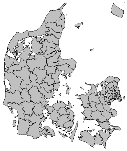
See Herlev Kommune on the map
Public Transportation to Herlev Kommune
Wondering how to get to Herlev Kommune? Moovit helps you find the best way to get to Herlev Kommune with step-by-step directions from the nearest public transit station.
Moovit provides free maps and live directions to help you navigate through your city. View schedules, routes, timetables, and find out how long does it take to get to Herlev Kommune in real time.
Looking for the nearest stop or station to Herlev Kommune? Check out this list of stops closest to your destination: Peberhaven (Sennepshaven); Borgerdiget (Hjortespringvej); Havnsøvej (Sennepshaven); Herlev St.; Rødovre Nord (Letbane); Hareskov St..
Bus: 164, 165, 168.Train: B, C, H.
Want to see if there’s another route that gets you there at an earlier time? Moovit helps you find alternative routes or times. Get directions from and directions to Herlev Kommune easily from the Moovit App or Website.
We make riding to Herlev Kommune easy, which is why over 1.5 million users, including users in Herlev, trust Moovit as the best app for public transit. You don’t need to download an individual bus app or train app, Moovit is your all-in-one transit app that helps you find the best bus time or train time available.
For information on prices of bus, train and metro, costs and ride fares to Herlev Kommune, please check the Moovit app.
Use the app to navigate to popular places including to the airport, hospital, stadium, grocery store, mall, coffee shop, school, college, and university.
Herlev Kommune Address: Persillehaven 22 2730 Herlev street in Herlev
- Mælkevejen,
- Lærkegaard Center,
- Sundhedshuset,
- Atlas Vagt Group,
- Hjortespringkollegiet,
- Lp Service Aps,
- Costa Smeralda Pizzeria Aps,
- Stamhuset, Peberhaven,
- Lille Birkholm Center, Dagcenter,
- Sennepshaven 2,
- Bofællesskaberne,
- Boligforeningen 3b Hjortegården 1018,
- Gamle Hjortespringskole,
- Klausdalsbrovej,
- Dansk Musik Transport V / Bjarne Hansen,
- Hjortespring,
- 365discount Herlev Dildhaven,
- Md Salon,
- Il Forno Pizza,
- Sortsø
Places Near Herlev Kommune
- Operaen, København,
- Rigshospitalet, København,
- Christiania, København,
- Havnebus 993 (Nyhavn - Operaen),
- Fisketorvet, København,
- Bakken, København,
- Eventyrpigerne, Sorø,
- Nyhavn, København,
- Dr Koncerthuset, København,
- Field's, København,
- Bella Center, København,
- Seduction Girls, Rødovre,
- Den Sorte Diamant, København,
- Ikea, Århus,
- Bispebjerg Hospital, København,
- Reffen, København,
- Royal Arena, København,
- Carlsberg Byen, København,
- Refshaleøen, København,
- Copenhagen Street Food - Reffen, København
How to get to popular places in Denmark with public transit
Get around Herlev by public transit!
Traveling around Herlev has never been so easy. See step by step directions as you travel to any attraction, street or major public transit station. View bus and train schedules, arrival times, service alerts and detailed routes on a map, so you know exactly how to get to anywhere in Herlev.
When traveling to any destination around Herlev use Moovit's Live Directions with Get Off Notifications to know exactly where and how far to walk, how long to wait for your line, and how many stops are left. Moovit will alert you when it's time to get off — no need to constantly re-check whether yours is the next stop.
Wondering how to use public transit in Herlev or how to pay for public transit in Herlev? Moovit public transit app can help you navigate your way with public transit easily, and at minimum cost. It includes public transit fees, ticket prices, and costs. Looking for a map of Herlev public transit lines? Moovit public transit app shows all public transit maps in Herlev with all Bus, Train, Metro, Light Rail and Ferry routes and stops on an interactive map.
Denmark has 5 transit type(s), including: Bus, Train, Metro, Light Rail and Ferry, operated by several transit agencies, including Metroselskabet, DSB S-tog, Lokaltog A/S, Midttrafik, Odense Letbane, DSB, NT, GoCollective, Skånetrafiken, Movia, FYNBUS, Sydtrafik, Bornholms Trafik, Citybus and Ærø Kommune