How to get to Hermann Pflumm by bus?
Click on the bus route to see step by step directions with maps, line arrival times and updated time schedules.
From Gewerbliche Schule Derendingen, Tübingen
175 minFrom Konrad-Adenauer-Straße, Tübingen
178 minFrom Landratsamt Tübingen, Tübingen
181 minFrom Neckar-Camping Tübingen, Tübingen
199 minFrom Arbeitsagentur, Tübingen
178 minFrom Beatparade, Verwaltungsgemeinschaft Horb am Neckar
238 minFrom Festplatz, Tübingen
193 minFrom Sudhaus Tübingen, Tübingen
182 minFrom Bläsibad, Tübingen
184 minFrom Paul-Horn-Arena, Tübingen
189 min
How to get to Hermann Pflumm by train?
Click on the train route to see step by step directions with maps, line arrival times and updated time schedules.
From Gewerbliche Schule Derendingen, Tübingen
79 minFrom Konrad-Adenauer-Straße, Tübingen
80 minFrom Landratsamt Tübingen, Tübingen
81 minFrom Neckar-Camping Tübingen, Tübingen
97 minFrom Arbeitsagentur, Tübingen
82 minFrom Festplatz, Tübingen
93 minFrom Sudhaus Tübingen, Tübingen
86 minFrom Paul-Horn-Arena, Tübingen
89 min
Bus stop near Hermann Pflumm in Gemeindeverwaltungsverband Bisingen
- Wessingen Rathaus, 7 min walk,VIEW
Train station near Hermann Pflumm in Gemeindeverwaltungsverband Bisingen
- Bisingen Bahnhof, 48 min walk,VIEW
Bus lines to Hermann Pflumm in Gemeindeverwaltungsverband Bisingen
- 305, Hechingen Fürstenstr.,VIEW
What are the closest stations to Hermann Pflumm?
The closest stations to Hermann Pflumm are:
- Wessingen Rathaus is 501 meters away, 7 min walk.
- Bisingen Bahnhof is 3740 meters away, 48 min walk.
Which train line stops near Hermann Pflumm?
RB66 (Albstadt-Ebingen)
Which bus line stops near Hermann Pflumm?
305 (Bisingen Bahnhof)
What’s the nearest bus station to Hermann Pflumm in Gemeindeverwaltungsverband Bisingen?
The nearest bus station to Hermann Pflumm in Gemeindeverwaltungsverband Bisingen is Wessingen Rathaus. It’s a 7 min walk away.
What time is the first train to Hermann Pflumm in Gemeindeverwaltungsverband Bisingen?
The RB66 is the first train that goes to Hermann Pflumm in Gemeindeverwaltungsverband Bisingen. It stops nearby at 5:23 AM.
What time is the last train to Hermann Pflumm in Gemeindeverwaltungsverband Bisingen?
The RB66 is the last train that goes to Hermann Pflumm in Gemeindeverwaltungsverband Bisingen. It stops nearby at 11:09 PM.
What time is the first bus to Hermann Pflumm in Gemeindeverwaltungsverband Bisingen?
The 305 is the first bus that goes to Hermann Pflumm in Gemeindeverwaltungsverband Bisingen. It stops nearby at 5:55 AM.
What time is the last bus to Hermann Pflumm in Gemeindeverwaltungsverband Bisingen?
The 305 is the last bus that goes to Hermann Pflumm in Gemeindeverwaltungsverband Bisingen. It stops nearby at 9:15 PM.
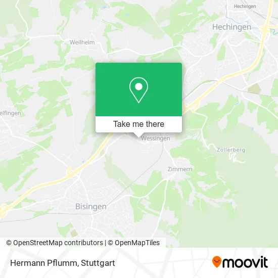
See Hermann Pflumm, Gemeindeverwaltungsverband Bisingen, on the map
Public Transit to Hermann Pflumm in Gemeindeverwaltungsverband Bisingen
Wondering how to get to Hermann Pflumm in Gemeindeverwaltungsverband Bisingen? Moovit helps you find the best way to get to Hermann Pflumm with step-by-step directions from the nearest public transit station.
Moovit provides free maps and live directions to help you navigate through your city. View schedules, routes, timetables, and find out how long does it take to get to Hermann Pflumm in real time.
Looking for the nearest stop or station to Hermann Pflumm? Check out this list of stops closest to your destination: Wessingen Rathaus; Bisingen Bahnhof.
Train: RB66, RE6.Bus: 305.
Want to see if there’s another route that gets you there at an earlier time? Moovit helps you find alternative routes or times. Get directions from and directions to Hermann Pflumm easily from the Moovit App or Website.
We make riding to Hermann Pflumm easy, which is why over 1.5 million users, including users in Gemeindeverwaltungsverband Bisingen, trust Moovit as the best app for public transit. You don’t need to download an individual bus app or train app, Moovit is your all-in-one transit app that helps you find the best bus time or train time available.
For information on prices of bus and train, costs and ride fares to Hermann Pflumm, please check the Moovit app.
Use the app to navigate to popular places including to the airport, hospital, stadium, grocery store, mall, coffee shop, school, college, and university.
Hermann Pflumm Address: Zaunäcker 7 Wessingen, 72406 Bisingen street in Gemeindeverwaltungsverband Bisingen
- Strickzutaten Würth,
- Bernhard Locher Innenausbau,
- Genußscheuer,
- Prowerb 64 Grafik,
- Olschewski Elektrotechnik,
- Labradorzucht vom Hohenzollerngrund,
- Schlosserei Lehre,
- Wolfgang Barthelmes,
- Markus Mayer & Edwin Mayer,
- Walter Futschik,
- Gemeindehalle,
- Heinz-Josef Schlemmer,
- Löwen,
- Reusch Hannes,
- Mecklenburgische Versicherung, Generalvertretung Markus Bächle,
- Schraitle Maßivhaus, Emil Schraitle,
- Frisuren Peter,
- Gemeindekindergarten Sonnenschein,
- Zollern-Albmetall,
- Artur Schlaier
Places Near Hermann Pflumm (Gemeindeverwaltungsverband Bisingen)
- Geilhaus Haus 33a, Reutlingen-Betzingen,
- Mercedes-Benz Museum (Mercedes Museum Stuttgart), Bad Cannstatt,
- Wilhelma (U-Bahn Wilhelma), Bad Cannstatt,
- Klinikum Stuttgart - Katharinenhospital, Stuttgart-Mitte,
- Hanns-Martin-Schleyer-Halle (Stuttgart Hans-Martin-Schleyerhalle), Bad Cannstatt,
- FlixBus Haltestelle, Stuttgart,
- Waldfriedhof, Degerloch,
- Mettingen Eros-Center Puff Laufhaus, Esslingen Am Neckar,
- Hanns-Martin-Schleyer-Halle, Bad Cannstatt,
- Im Wizemann (Halle), Bad Cannstatt,
- SI-Centrum, Möhringen,
- Marmorsaal Im Weissenburgpark, Stuttgart-Süd,
- Schleyerhalle, Bad Cannstatt,
- Gasometer Pforzheim, Pforzheim,
- Porsche Museum, Zuffenhausen,
- Porsche-Arena, Bad Cannstatt,
- Gleis 101/102 (tief), Stuttgart-Mitte,
- Hauptbahnhof Stuttgart, Stuttgart-Mitte,
- Pariser Platz Stuttgart, Stuttgart-Mitte,
- Mercedes-Benz Museum, Bad Cannstatt
How to get to popular places in Stuttgart with public transit
Get around Gemeindeverwaltungsverband Bisingen by public transit!
Traveling around Gemeindeverwaltungsverband Bisingen has never been so easy. See step by step directions as you travel to any attraction, street or major public transit station. View bus and train schedules, arrival times, service alerts and detailed routes on a map, so you know exactly how to get to anywhere in Gemeindeverwaltungsverband Bisingen.
When traveling to any destination around Gemeindeverwaltungsverband Bisingen use Moovit's Live Directions with Get Off Notifications to know exactly where and how far to walk, how long to wait for your line, and how many stops are left. Moovit will alert you when it's time to get off — no need to constantly re-check whether yours is the next stop.
Wondering how to use public transit in Gemeindeverwaltungsverband Bisingen or how to pay for public transit in Gemeindeverwaltungsverband Bisingen? Moovit public transit app can help you navigate your way with public transit easily, and at minimum cost. It includes public transit fees, ticket prices, and costs. Looking for a map of Gemeindeverwaltungsverband Bisingen public transit lines? Moovit public transit app shows all public transit maps in Gemeindeverwaltungsverband Bisingen with all Bus, Train, Subway, Light Rail, Ferry, S-Bahn and Funicular routes and stops on an interactive map.
Stuttgart has 7 transit type(s), including: Bus, Train, Subway, Light Rail, Ferry, S-Bahn and Funicular, operated by several transit agencies, including SSB - Stadtbahn, SSB, SSB - Seilbahn / Zacke, S-Bahn Stuttgart, Rhein-Neckar-Verkehr GmbH (rnv), Karlsruher Verkehrsverbund, DB AG, DB Regiobus BW, Arverio Baden-Württemberg GmbH, DB RegioNetz Verkehrs GmbH Westfrankenbahn, DB Regio AG Baden-Württemberg, Südwestdeutsche Verkehrs-AG, DB Regio AG Mitte Region Hessen, DB and Bodensee-Oberschwaben-Bahn