How to get to Hess Express by bus?
Click on the bus route to see step by step directions with maps, line arrival times and updated time schedules.
From Clarence M. Mitchell, Jr. Courthouse, Baltimore
46 minFrom Baltimore Penn Station, Baltimore
36 minFrom Fells Point, Baltimore
53 minFrom Social Security Administration, Baltimore
39 minFrom Hippodrome Theatre, Baltimore
44 minFrom Patterson Park, Baltimore
66 minFrom Enoch Pratt Free Library - Central Library, Baltimore
43 minFrom Walmart Supercenter, Baltimore County
71 minFrom I-695 @ Exit 27 (Dulaney Valley Road/MD 146), Baltimore County
55 minFrom Walmart, Baltimore County
70 min
How to get to Hess Express by metro?
Click on the metro route to see step by step directions with maps, line arrival times and updated time schedules.
Bus stops near Hess Express in Baltimore
Metro station near Hess Express in Baltimore
- West Cold Spring Metro, 18 min walk,VIEW
Light Rail stations near Hess Express in Baltimore
- Woodberry, 19 min walk,VIEW
Bus lines to Hess Express in Baltimore
What are the closest stations to Hess Express?
The closest stations to Hess Express are:
- Reisterstown Rd & Belvedere Ave FS Sb is 32 yards away, 1 min walk.
- Belvedere Ave & Reisterstown Rd Eb is 58 yards away, 1 min walk.
- Belvedere Ave & Elderon Ave Nb is 262 yards away, 4 min walk.
- Garrison Blvd & Groveland Ave Sb is 325 yards away, 4 min walk.
- Dolfield Ave & Garrison Blvd Wb is 375 yards away, 5 min walk.
- West Cold Spring Metro is 1508 yards away, 18 min walk.
- Woodberry is 1539 yards away, 19 min walk.
Which bus lines stop near Hess Express?
These bus lines stop near Hess Express: 31, 80, 82, 83.
Which metro line stops near Hess Express?
METRO (Towards Owing Mills)
What’s the nearest light rail station to Hess Express in Baltimore?
The nearest light rail station to Hess Express in Baltimore is Woodberry. It’s a 19 min walk away.
What’s the nearest metro station to Hess Express in Baltimore?
The nearest metro station to Hess Express in Baltimore is West Cold Spring Metro. It’s a 18 min walk away.
What’s the nearest bus station to Hess Express in Baltimore?
The nearest bus stations to Hess Express in Baltimore are Reisterstown Rd & Belvedere Ave FS Sb and Belvedere Ave & Reisterstown Rd Eb. The closest one is a 1 min walk away.
What time is the first light rail to Hess Express in Baltimore?
The LIGHT RAILLINK is the first light rail that goes to Hess Express in Baltimore. It stops nearby at 4:26 AM.
What time is the last light rail to Hess Express in Baltimore?
The LIGHT RAILLINK is the last light rail that goes to Hess Express in Baltimore. It stops nearby at 12:47 AM.
What time is the first metro to Hess Express in Baltimore?
The METRO is the first metro that goes to Hess Express in Baltimore. It stops nearby at 3:45 AM.
What time is the last metro to Hess Express in Baltimore?
The METRO is the last metro that goes to Hess Express in Baltimore. It stops nearby at 12:21 AM.
What time is the first bus to Hess Express in Baltimore?
The 80 is the first bus that goes to Hess Express in Baltimore. It stops nearby at 3:01 AM.
What time is the last bus to Hess Express in Baltimore?
The 80 is the last bus that goes to Hess Express in Baltimore. It stops nearby at 3:19 AM.
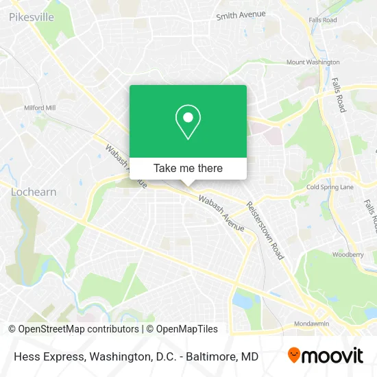
See Hess Express, Baltimore, on the map
Public Transit to Hess Express in Baltimore
Wondering how to get to Hess Express in Baltimore? Moovit helps you find the best way to get to Hess Express with step-by-step directions from the nearest public transit station.
Moovit provides free maps and live directions to help you navigate through your city. View schedules, routes, timetables, and find out how long does it take to get to Hess Express in real time.
Looking for the nearest stop or station to Hess Express? Check out this list of stops closest to your destination: Reisterstown Rd & Belvedere Ave FS Sb; Belvedere Ave & Reisterstown Rd Eb; Belvedere Ave & Elderon Ave Nb; Garrison Blvd & Groveland Ave Sb; Dolfield Ave & Garrison Blvd Wb; West Cold Spring Metro; Woodberry.
Bus: 31, 80, 82, 83, 34, 28.Metro: METRO.
Want to see if there’s another route that gets you there at an earlier time? Moovit helps you find alternative routes or times. Get directions from and directions to Hess Express easily from the Moovit App or Website.
We make riding to Hess Express easy, which is why over 1.5 million users, including users in Baltimore, trust Moovit as the best app for public transit. You don’t need to download an individual bus app or train app, Moovit is your all-in-one transit app that helps you find the best bus time or train time available.
For information on prices of bus and metro, costs and ride fares to Hess Express, please check the Moovit app.
Use the app to navigate to popular places including to the airport, hospital, stadium, grocery store, mall, coffee shop, school, college, and university.
Hess Express Address: 5128 Reisterstown Rd street in Baltimore
- arlington water tower,
- Speedway,
- Champion Pizza & Fried Chicken,
- Belvedere intersection Reisterstown Rd,
- Reisterstown Rd (Reisterstown Rd & belvedere),
- W Belvedere Ave and Reisterstown,
- Pueblo Bank Trust Company,
- Obama 7 Mart,
- Michaelangelo's Pizza & Subs ,
- WESTERN UNION,
- Kennedy Fried Chicken,
- TJ General Improvements,
- Smith Custom Woodworks,
- B & B Stripping & Buff Floor,
- Upfront Contractors,
- Teco Enterprises,
- Teeth Tasticz,
- No 1 Carry Out,
- Drake Towing,
- Ty and Trelles Janitorial Services
Places Near Hess Express (Baltimore)
- Rock Creek Tennis Center, Washington,
- The Anthem, Washington,
- Capital One Arena, Washington,
- Sibley Memorial Hospital, Washington,
- M&T Bank Stadium, Baltimore,
- Pennsylvania Ave NW (3rd st and pennsylvania), Washington,
- National Theatre, Washington,
- Amazon Hq2, Arlington County,
- Westfield Montgomery Mall, Montgomery County,
- National Zoo, Washington,
- Georgetown, Washington,
- Basilica of the National Shrine, Washington,
- PG Mall, Prince George's County,
- Washington National Cathedral, Washington,
- Warner Theatre, Washington,
- National Museum of African American History and Culture, Washington,
- Washington DC VA Medical Center, Washington,
- Museum Of The Bible, Washington,
- Camden Yards, Baltimore,
- Marriott Marquis Washington, DC, Washington
How to get to popular places in Washington, D.C. - Baltimore, MD with public transit
Get around Baltimore by public transit!
Traveling around Baltimore has never been so easy. See step by step directions as you travel to any attraction, street or major public transit station. View bus and train schedules, arrival times, service alerts and detailed routes on a map, so you know exactly how to get to anywhere in Baltimore.
When traveling to any destination around Baltimore use Moovit's Live Directions with Get Off Notifications to know exactly where and how far to walk, how long to wait for your line, and how many stops are left. Moovit will alert you when it's time to get off — no need to constantly re-check whether yours is the next stop.
Wondering how to use public transit in Baltimore or how to pay for public transit in Baltimore? Moovit public transit app can help you navigate your way with public transit easily, and at minimum cost. It includes public transit fees, ticket prices, and costs. Looking for a map of Baltimore public transit lines? Moovit public transit app shows all public transit maps in Baltimore with all Bus, Train, Metro, Light Rail and Ferry routes and stops on an interactive map.
Washington, D.C. - Baltimore, MD has 5 transit type(s), including: Bus, Train, Metro, Light Rail and Ferry, operated by several transit agencies, including WMATA, Montgomery County Ride On, Fairfax Connector, TheBus, PRTC, DASH - Alexandria, Arlington Transit (ART), RTA of Central Maryland, MDOT MTA, MDOT MTA Light RailLink, MDOT MTA Commuter Bus, MDOT MTA Local Bus, FXBGO!, Virginia Railway Express (VRE) and MARC