How to get to Hi-Tech Wireless by bus?
Click on the bus route to see step by step directions with maps, line arrival times and updated time schedules.
From Festival Grounds at RFK Campus, Washington
72 minFrom 8th St SE A St, Washington
72 minFrom Toki Underground, Washington
57 minFrom The Catholic University of America (CUA), Washington
66 minFrom H Street Festival, Washington
57 minFrom Alamo Drafthouse, Washington
55 minFrom Fairfield Inn & Suites Washington, DC/New York Avenue, Washington
48 minFrom Iverson Mall, Prince George's County
49 minFrom Barnes & Noble, Washington
65 minFrom Basilica of the National Shrine, Washington
65 min
How to get to Hi-Tech Wireless by metro?
Click on the metro route to see step by step directions with maps, line arrival times and updated time schedules.
From Festival Grounds at RFK Campus, Washington
61 minFrom 8th St SE A St, Washington
61 minFrom Toki Underground, Washington
90 minFrom The Catholic University of America (CUA), Washington
80 minFrom H Street Festival, Washington
91 minFrom Alamo Drafthouse, Washington
79 minFrom Iverson Mall, Prince George's County
96 minFrom Barnes & Noble, Washington
79 minFrom Basilica of the National Shrine, Washington
82 min
Bus stops near Hi-Tech Wireless in Prince George's County
Metro stations near Hi-Tech Wireless in Prince George's County
Train station near Hi-Tech Wireless in Prince George's County
- New Carrollton Marc Nb, 63 min walk,VIEW
Bus lines to Hi-Tech Wireless in Prince George's County
What are the closest stations to Hi-Tech Wireless?
The closest stations to Hi-Tech Wireless are:
- Ml King Hwy + Belle Haven Dr is 102 yards away, 2 min walk.
- Ml King Jr Hwy+Belle Haven Dr is 102 yards away, 2 min walk.
- M.L.King Jr. Highway at King Shopping Center is 314 yards away, 4 min walk.
- Sheriff Road at Belle Haven Drive is 475 yards away, 6 min walk.
- Addison Road Metro Station is 1944 yards away, 23 min walk.
- Cheverly Metro Station is 3329 yards away, 39 min walk.
- New Carrollton Marc Nb is 5343 yards away, 63 min walk.
Which bus lines stop near Hi-Tech Wireless?
These bus lines stop near Hi-Tech Wireless: P43, P60.
Which metro lines stop near Hi-Tech Wireless?
These metro lines stop near Hi-Tech Wireless: ORANGE, SILVER.
What’s the nearest metro station to Hi-Tech Wireless in Prince George's County?
The nearest metro station to Hi-Tech Wireless in Prince George's County is Addison Road Metro Station. It’s a 23 min walk away.
What’s the nearest bus station to Hi-Tech Wireless in Prince George's County?
The nearest bus stations to Hi-Tech Wireless in Prince George's County are Ml King Hwy + Belle Haven Dr and Ml King Jr Hwy+Belle Haven Dr. The closest one is a 2 min walk away.
What time is the first metro to Hi-Tech Wireless in Prince George's County?
The BLUE is the first metro that goes to Hi-Tech Wireless in Prince George's County. It stops nearby at 4:57 AM.
What time is the last metro to Hi-Tech Wireless in Prince George's County?
The ORANGE is the last metro that goes to Hi-Tech Wireless in Prince George's County. It stops nearby at 12:33 AM.
What time is the first train to Hi-Tech Wireless in Prince George's County?
The MARC is the first train that goes to Hi-Tech Wireless in Prince George's County. It stops nearby at 5:52 AM.
What time is the last train to Hi-Tech Wireless in Prince George's County?
The MARC is the last train that goes to Hi-Tech Wireless in Prince George's County. It stops nearby at 10:17 PM.
What time is the first bus to Hi-Tech Wireless in Prince George's County?
The P60 is the first bus that goes to Hi-Tech Wireless in Prince George's County. It stops nearby at 5:08 AM.
What time is the last bus to Hi-Tech Wireless in Prince George's County?
The P60 is the last bus that goes to Hi-Tech Wireless in Prince George's County. It stops nearby at 2:10 AM.
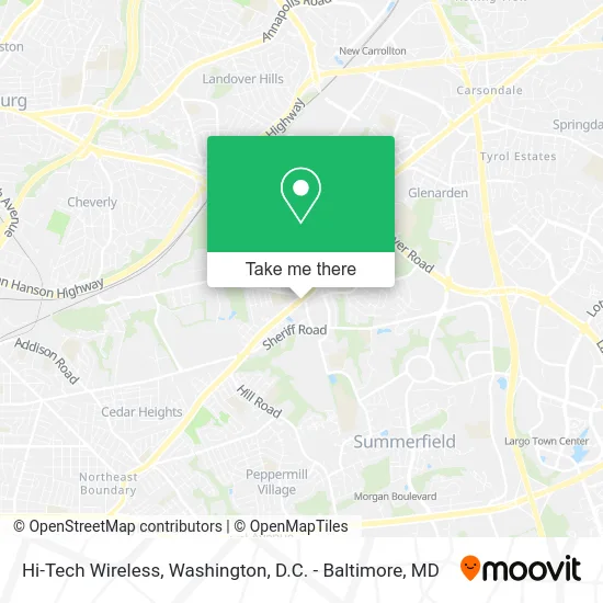
See Hi-Tech Wireless, Prince George's County, on the map
Public Transit to Hi-Tech Wireless in Prince George's County
Wondering how to get to Hi-Tech Wireless in Prince George's County? Moovit helps you find the best way to get to Hi-Tech Wireless with step-by-step directions from the nearest public transit station.
Moovit provides free maps and live directions to help you navigate through your city. View schedules, routes, timetables, and find out how long does it take to get to Hi-Tech Wireless in real time.
Looking for the nearest stop or station to Hi-Tech Wireless? Check out this list of stops closest to your destination: Ml King Hwy + Belle Haven Dr; Ml King Jr Hwy+Belle Haven Dr; M.L.King Jr. Highway at King Shopping Center; Sheriff Road at Belle Haven Drive; Addison Road Metro Station; Cheverly Metro Station; New Carrollton Marc Nb.
Bus: P43, P60, P44.Train: MARC.Metro: ORANGE, SILVER, BLUE.
Want to see if there’s another route that gets you there at an earlier time? Moovit helps you find alternative routes or times. Get directions from and directions to Hi-Tech Wireless easily from the Moovit App or Website.
We make riding to Hi-Tech Wireless easy, which is why over 1.5 million users, including users in Prince George's County, trust Moovit as the best app for public transit. You don’t need to download an individual bus app or train app, Moovit is your all-in-one transit app that helps you find the best bus time or train time available.
For information on prices of bus and metro, costs and ride fares to Hi-Tech Wireless, please check the Moovit app.
Use the app to navigate to popular places including to the airport, hospital, stadium, grocery store, mall, coffee shop, school, college, and university.
Hi-Tech Wireless Address: 7109 Martin Luther King Jr Hwy Hyattsville, MD 20785 street in Prince George's County
- Palmers liquor store,
- Palmer Park, Maryland,
- National Harmony Memorial Park,
- Kidz Factory,
- Sugar Ray Leonard Boxing Gym,
- B Square Electric,
- Braids That Speak,
- Kent Village Apartments,
- Fairmont Heights High School,
- Marvin F. Wilson Stadium,
- Kentland Volunteer Fire Department (Kentland Volunteer Fire Dept No 1),
- Kentland Community Center,
- 3104 75th Ave,
- National Gallery of Art,
- J.B. Jenkins Funeral Home,
- J B Jenkins Funeral Home (JB Jenkins Funeral Home),
- Ups,
- Prince George's Sports & Learning Complex-Aquatic Center,
- Peachtree Car Wash and Laundry (Peachtree Self-Service Car Wash),
- Prince George's Sports and Learning Complex
Places Near Hi-Tech Wireless (Prince George's County)
- Basilica of the National Shrine, Washington,
- Amazon Hq2, Arlington County,
- The Anthem, Washington,
- Sibley Memorial Hospital, Washington,
- Rock Creek Tennis Center, Washington,
- Westfield Montgomery Mall, Montgomery County,
- Marriott Marquis Washington, DC, Washington,
- PG Mall, Prince George's County,
- M&T Bank Stadium, Baltimore,
- Museum Of The Bible, Washington,
- Camden Yards, Baltimore,
- National Mall, Washington,
- Washington National Cathedral, Washington,
- Capital One Arena, Washington,
- Washington DC VA Medical Center, Washington,
- Pennsylvania Ave NW (3rd st and pennsylvania), Washington,
- Georgetown, Washington,
- Warner Theatre, Washington,
- National Zoo, Washington,
- National Museum of African American History and Culture, Washington
How to get to popular places in Washington, D.C. - Baltimore, MD with public transit
Get around Prince George's County by public transit!
Traveling around Prince George's County has never been so easy. See step by step directions as you travel to any attraction, street or major public transit station. View bus and train schedules, arrival times, service alerts and detailed routes on a map, so you know exactly how to get to anywhere in Prince George's County.
When traveling to any destination around Prince George's County use Moovit's Live Directions with Get Off Notifications to know exactly where and how far to walk, how long to wait for your line, and how many stops are left. Moovit will alert you when it's time to get off — no need to constantly re-check whether yours is the next stop.
Wondering how to use public transit in Prince George's County or how to pay for public transit in Prince George's County? Moovit public transit app can help you navigate your way with public transit easily, and at minimum cost. It includes public transit fees, ticket prices, and costs. Looking for a map of Prince George's County public transit lines? Moovit public transit app shows all public transit maps in Prince George's County with all Bus, Train, Metro, Light Rail and Ferry routes and stops on an interactive map.
Washington, D.C. - Baltimore, MD has 5 transit type(s), including: Bus, Train, Metro, Light Rail and Ferry, operated by several transit agencies, including WMATA, Montgomery County Ride On, Fairfax Connector, TheBus, PRTC, DASH - Alexandria, Arlington Transit (ART), RTA of Central Maryland, MDOT MTA, MDOT MTA Light RailLink, MDOT MTA Commuter Bus, MDOT MTA Local Bus, FXBGO!, Virginia Railway Express (VRE) and MARC