How to get to High Tech Icon by bus?
Click on the bus route to see step by step directions with maps, line arrival times and updated time schedules.
How to get to High Tech Icon by subway?
Click on the subway route to see step by step directions with maps, line arrival times and updated time schedules.
Bus stops near High Tech Icon in New York - New Jersey
Subway stations near High Tech Icon in New York - New Jersey
- Kings Hwy, 4 min walk,VIEW
Bus lines to High Tech Icon in New York - New Jersey
What are the closest stations to High Tech Icon?
The closest stations to High Tech Icon are:
- Kings Hwy/W 4 St is 82 yards away, 2 min walk.
- Kings Hwy/W 7 St is 249 yards away, 4 min walk.
- Kings Hwy is 267 yards away, 4 min walk.
- Stillwell Av/Highlawn Av is 981 yards away, 12 min walk.
Which bus lines stop near High Tech Icon?
These bus lines stop near High Tech Icon: B82, B82-SBS.
Which subway lines stop near High Tech Icon?
These subway lines stop near High Tech Icon: F, N.
What’s the nearest subway station to High Tech Icon in New York - New Jersey?
The nearest subway station to High Tech Icon in New York - New Jersey is Kings Hwy. It’s a 4 min walk away.
What’s the nearest bus station to High Tech Icon in New York - New Jersey?
The nearest bus station to High Tech Icon in New York - New Jersey is Kings Hwy/W 4 St. It’s a 2 min walk away.
What time is the first subway to High Tech Icon in New York - New Jersey?
The N is the first subway that goes to High Tech Icon in New York - New Jersey. It stops nearby at 3:01 AM.
What time is the last subway to High Tech Icon in New York - New Jersey?
The F is the last subway that goes to High Tech Icon in New York - New Jersey. It stops nearby at 4:37 AM.
What time is the first bus to High Tech Icon in New York - New Jersey?
The B82 is the first bus that goes to High Tech Icon in New York - New Jersey. It stops nearby at 3:00 AM.
What time is the last bus to High Tech Icon in New York - New Jersey?
The B82 is the last bus that goes to High Tech Icon in New York - New Jersey. It stops nearby at 3:04 AM.
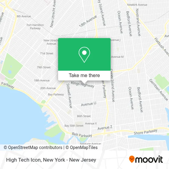
See High Tech Icon, New York - New Jersey, on the map
Public Transit to High Tech Icon in New York - New Jersey
Wondering how to get to High Tech Icon in New York - New Jersey? Moovit helps you find the best way to get to High Tech Icon with step-by-step directions from the nearest public transit station.
Moovit provides free maps and live directions to help you navigate through your city. View schedules, routes, timetables, and find out how long does it take to get to High Tech Icon in real time.
Looking for the nearest stop or station to High Tech Icon? Check out this list of stops closest to your destination: Kings Hwy/W 4 St; Kings Hwy/W 7 St; Kings Hwy; Stillwell Av/Highlawn Av.
Bus: B82, B82-SBS, B4.Subway: F, N, W, FX.
Want to see if there’s another route that gets you there at an earlier time? Moovit helps you find alternative routes or times. Get directions from and directions to High Tech Icon easily from the Moovit App or Website.
We make riding to High Tech Icon easy, which is why over 1.5 million users, including users in New York - New Jersey, trust Moovit as the best app for public transit. You don’t need to download an individual bus app or train app, Moovit is your all-in-one transit app that helps you find the best bus time or train time available.
For information on prices of subway, bus and train, costs and ride fares to High Tech Icon, please check the Moovit app.
Use the app to navigate to popular places including to the airport, hospital, stadium, grocery store, mall, coffee shop, school, college, and university.
High Tech Icon Address: 336 Kings Hwy street in New York - New Jersey
- CH Lucky 99,
- Uniformes David,
- Sav-A-Lot Realty,
- Century 21,
- Mainpctek Store,
- Kings Highway,
- Mainpc Group Usa,
- Kings Point Insurance Inc,
- Western Union - Cfsc Checks Cashed #14,
- Cfsc - Checks Cashed #14,
- Ecoatm,
- You Health,
- New Town Deli & Grill,
- Barbearia Wilson,
- Ahrc Nyc Kings Highway Day Services,
- Viacom Solutions Inc,
- Kings Cell Inc,
- Kings Piano World,
- Ups Access Point Location,
- Dunkin'
Places Near High Tech Icon (New York - New Jersey)
- Wall Street, Manhattan,
- 1 Police Plaza, Manhattan,
- 111 Centre New York City Supreme Court, Manhattan,
- 66 John Street, Manhattan,
- 376 Hudson Street, Manhattan,
- 3 Stone St, Manhattan,
- San Gennaro Feast, Manhattan,
- Pier 83, Manhattan,
- Rockefeller Center, Manhattan,
- Times Square, Manhattan,
- Bellevue Hospital, Manhattan,
- Chinatown, Manhattan,
- Queens Center Mall, Queens,
- 911 Memorial, Manhattan,
- Katz's Deli, Manhattan,
- qqqq, Manhattan,
- 26 Federal Plaza, Manhattan,
- Mountainside Hospital, Glen Ridge,
- SoHo, Manhattan,
- Hudson Yards, Manhattan
How to get to popular places in New York - New Jersey with public transit
Get around New York - New Jersey by public transit!
Traveling around New York - New Jersey has never been so easy. See step by step directions as you travel to any attraction, street or major public transit station. View bus and train schedules, arrival times, service alerts and detailed routes on a map, so you know exactly how to get to anywhere in New York - New Jersey.
When traveling to any destination around New York - New Jersey use Moovit's Live Directions with Get Off Notifications to know exactly where and how far to walk, how long to wait for your line, and how many stops are left. Moovit will alert you when it's time to get off — no need to constantly re-check whether yours is the next stop.
Wondering how to use public transit in New York - New Jersey or how to pay for public transit in New York - New Jersey? Moovit public transit app can help you navigate your way with public transit easily, and at minimum cost. It includes public transit fees, ticket prices, and costs. Looking for a map of New York - New Jersey public transit lines? Moovit public transit app shows all public transit maps in New York - New Jersey with all Bus, Train, Subway, Light Rail, Ferry and Cable Car routes and stops on an interactive map.
New York - New Jersey has 6 transit type(s), including: Bus, Train, Subway, Light Rail, Ferry and Cable Car, operated by several transit agencies, including MTA Subway, Metro-North Railroad, LIRR, PATH, MTA New York City Transit - Express routes, MTA Bus, NJ Transit, NYC Ferry, NICE bus, Bee-Line Bus, NJ Transit Rail, Norwalk Transit District, Hartford Line, River Valley Transit and HART