How to get to Highlights - 2 by bus?
Click on the bus route to see step by step directions with maps, line arrival times and updated time schedules.
From Northside Station, Miami
60 minFrom Mexican Consulate of Miami, Miami
43 minFrom Camillus House, Miami
63 minFrom Miami Escorts, Miami Beach
70 minFrom SW, Miami
40 minFrom Stephen P. Clark Center, Miami
42 minFrom Kendall, FL, Kendall-Palmetto Bay
89 minFrom Tri Rail Metrorail Transfer Station, Miami
56 minFrom Tropical Park, Miami
48 minFrom Century Medical Center, Miami
38 min
How to get to Highlights - 2 by train?
Click on the train route to see step by step directions with maps, line arrival times and updated time schedules.
From Northside Station, Miami
63 minFrom Mexican Consulate of Miami, Miami
49 minFrom Camillus House, Miami
69 minFrom SW, Miami
49 minFrom Stephen P. Clark Center, Miami
45 minFrom Kendall, FL, Kendall-Palmetto Bay
55 minFrom Tri Rail Metrorail Transfer Station, Miami
69 minFrom Century Medical Center, Miami
75 min
Bus stops near Highlights - 2 in Miami
Train station near Highlights - 2 in Miami
- Douglas Road, 41 min walk,VIEW
Bus lines to Highlights - 2 in Miami
What are the closest stations to Highlights - 2?
The closest stations to Highlights - 2 are:
- Ponce De Leon Blvd@majorca Av is 30 yards away, 1 min walk.
- Ponce De Leon Blvd@giralda Av is 272 yards away, 4 min walk.
- Ponce De Leon Bd@aragon Av is 338 yards away, 5 min walk.
- Aragon Av & Ponce De Leon Bd is 388 yards away, 5 min walk.
- Douglas Road is 3437 yards away, 41 min walk.
Which bus lines stop near Highlights - 2?
These bus lines stop near Highlights - 2: 42, CGABLE, MIACOR.
Which train lines stop near Highlights - 2?
These train lines stop near Highlights - 2: GREEN, ORANGE.
What’s the nearest bus station to Highlights - 2 in Miami?
The nearest bus station to Highlights - 2 in Miami is Ponce De Leon Blvd@majorca Av. It’s a 1 min walk away.
What time is the first train to Highlights - 2 in Miami?
The GREEN is the first train that goes to Highlights - 2 in Miami. It stops nearby at 5:09 AM.
What time is the last train to Highlights - 2 in Miami?
The GREEN is the last train that goes to Highlights - 2 in Miami. It stops nearby at 12:55 AM.
What time is the first bus to Highlights - 2 in Miami?
The 24 is the first bus that goes to Highlights - 2 in Miami. It stops nearby at 6:02 AM.
What time is the last bus to Highlights - 2 in Miami?
The 24 is the last bus that goes to Highlights - 2 in Miami. It stops nearby at 12:25 AM.
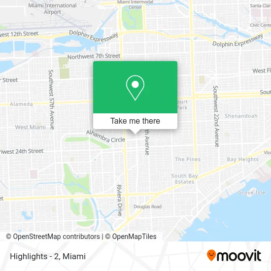
See Highlights - 2, Miami, on the map
Public Transit to Highlights - 2 in Miami
Wondering how to get to Highlights - 2 in Miami? Moovit helps you find the best way to get to Highlights - 2 with step-by-step directions from the nearest public transit station.
Moovit provides free maps and live directions to help you navigate through your city. View schedules, routes, timetables, and find out how long does it take to get to Highlights - 2 in real time.
Looking for the nearest stop or station to Highlights - 2? Check out this list of stops closest to your destination: Ponce De Leon Blvd@majorca Av; Ponce De Leon Blvd@giralda Av; Ponce De Leon Bd@aragon Av; Aragon Av & Ponce De Leon Bd; Douglas Road.
Bus: 42, CGABLE, MIACOR, CGABDT, 24.Train: GREEN, ORANGE.
Want to see if there’s another route that gets you there at an earlier time? Moovit helps you find alternative routes or times. Get directions from and directions to Highlights - 2 easily from the Moovit App or Website.
We make riding to Highlights - 2 easy, which is why over 1.5 million users, including users in Miami, trust Moovit as the best app for public transit. You don’t need to download an individual bus app or train app, Moovit is your all-in-one transit app that helps you find the best bus time or train time available.
For information on prices of bus and train, costs and ride fares to Highlights - 2, please check the Moovit app.
Use the app to navigate to popular places including to the airport, hospital, stadium, grocery store, mall, coffee shop, school, college, and university.
Highlights - 2 Address: 2100 Ponce de Leon Blvd Miami, FL 33134 street in Miami
- Cafe Bom Dia,
- Abogados W.,
- The Law Office of Diaz & Nunez Elorza,
- TRT Nearby,
- Ai Hair Transplant Miami,
- Advantage Investing,
- Lakonic Sun,
- Brow Babe,
- Arthur A Finkle & Associates,
- Massmutual Miami,
- Araguaney Coffee Bar,
- Solcema,
- Belmont Bank,
- Daniela Durazo - Therapy & Coaching,
- Privecarerx,
- Distrivalto USA,
- Realtor Association of Greater Miami,
- Patricia Gonzalez: First Horizon Mortgage,
- Segundo Muelle,
- Suntrust Plaza Garage
Places Near Highlights - 2 (Miami)
- Brickell City Centre, Miami,
- Sawgrass Mall, Miami,
- Dolphin Mall Bus, Miami,
- Sawgrass mall ( FL ), Miami Beach,
- Richard E. Gerstein Justice Building, Miami,
- Miami VA Hospital, Miami,
- Bayside Marketplace, Miami,
- Port of Miami Cruise Terminal, Miami,
- Marlins Park, Miami,
- Hard Rock Stadium, Miami Gardens,
- Dolphin Mall, Miami,
- Wynwood, Miami,
- Aventura Mall, Miami Beach,
- Miami Freedom Park, Miami,
- Little Havana, Miami,
- Miami-Dade County Courthouse, Miami,
- Keiser University Flagship Campus, West Palm Beach,
- Miami Design District, Miami,
- Zoo Miami, Miami,
- Aventura Mall, Miami
How to get to popular places in Miami with public transit
Get around Miami by public transit!
Traveling around Miami has never been so easy. See step by step directions as you travel to any attraction, street or major public transit station. View bus and train schedules, arrival times, service alerts and detailed routes on a map, so you know exactly how to get to anywhere in Miami.
When traveling to any destination around Miami use Moovit's Live Directions with Get Off Notifications to know exactly where and how far to walk, how long to wait for your line, and how many stops are left. Moovit will alert you when it's time to get off — no need to constantly re-check whether yours is the next stop.
Wondering how to use public transit in Miami or how to pay for public transit in Miami? Moovit public transit app can help you navigate your way with public transit easily, and at minimum cost. It includes public transit fees, ticket prices, and costs. Looking for a map of Miami public transit lines? Moovit public transit app shows all public transit maps in Miami with all Bus, Train, Light Rail and Ferry routes and stops on an interactive map.
Miami has 4 transit type(s), including: Bus, Train, Light Rail and Ferry, operated by several transit agencies, including Broward County Transit, Miami-Dade Transit, Metrorail, Palm Tran, Tri-Rail, Brightline, MARTY, City of Homestead Trolley, Key West Transit, Treasure Coast Connector, GoLine IRT, Amtrak, Greyhound-us, FlixBus-us and Aventura Express Shuttle Bus