Directions to Hillsborough, NC with public transportation
The following transit lines have routes that pass near Hillsborough, NC
 Bus: OCH, ODX, 420, OA, HC.
How to get to Hillsborough, NC by bus?
Click on the bus route to see step by step directions with maps, line arrival times and updated time schedules.
Bus stops near Hillsborough, NC
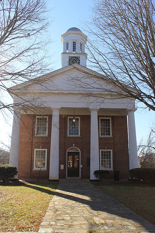
- Churton St at King St (Police Station), 2 min walk,
- Churton St at Margaret Ln (Orange County Courthouse), 3 min walk,
- W Margaret Ln at Orange County Library, 3 min walk,
Bus lines to Hillsborough, NC
- ODX, Route Odx To Efland Via Downtown Hillsborough,
- OCH, Cedar Grove - Hillsborough - Chapel Hill,
- 420, Manning Dr at Unc Hospitals,
- OA, Hillsborough And Efland,
- HC, Hillsborough,
- HC - BLUE LOOP, W Margaret Ln at Orange County Library,
- HC - ORANGE LOOP, Rainey St / Dnj Community Center,
What are the closest stations to Hillsborough, NC?
The closest stations to Hillsborough, NC are:
- Churton St at King St (Police Station) is 130 yards away, 2 min walk.
- Churton St at Margaret Ln (Orange County Courthouse) is 186 yards away, 3 min walk.
- W Margaret Ln at Orange County Library is 219 yards away, 3 min walk.
Which bus line stops near Hillsborough, NC?
OCH (Chapel Hill - Hillsborough - Cedar Grove)
What’s the nearest bus station to Hillsborough, NC?
The nearest bus station to Hillsborough, NC is Churton St at King St (Police Station). It’s a 2 min walk away.
What time is the first bus to Hillsborough, NC?
The 420 is the first bus that goes to Hillsborough, NC. It stops nearby at 6:03 AM.
What time is the last bus to Hillsborough, NC?
The 420 is the last bus that goes to Hillsborough, NC. It stops nearby at 7:50 PM.
See Hillsborough, NC on the map
Public Transportation to Hillsborough, NC
Wondering how to get to Hillsborough, NC? Moovit helps you find the best way to get to Hillsborough, NC with step-by-step directions from the nearest public transit station.
Moovit provides free maps and live directions to help you navigate through your city. View schedules, routes, timetables, and find out how long does it take to get to Hillsborough, NC in real time.
Looking for the nearest stop or station to Hillsborough, NC? Check out this list of stops closest to your destination: Churton St at King St (Police Station); Churton St at Margaret Ln (Orange County Courthouse); W Margaret Ln at Orange County Library.
Bus: OCH, ODX, 420, OA, HC, HC - BLUE LOOP, HC - ORANGE LOOP.
Want to see if there’s another route that gets you there at an earlier time? Moovit helps you find alternative routes or times. Get directions from and directions to Hillsborough, NC easily from the Moovit App or Website.
We make riding to Hillsborough, NC easy, which is why over 1.5 million users, including users in Hillsborough, trust Moovit as the best app for public transit. You don’t need to download an individual bus app or train app, Moovit is your all-in-one transit app that helps you find the best bus time or train time available.
For information on prices of bus, costs and ride fares to Hillsborough, NC, please check the Moovit app.
Use the app to navigate to popular places including to the airport, hospital, stadium, grocery store, mall, coffee shop, school, college, and university.
Location: Hillsborough, Raleigh
Popular routes to Hillsborough, NC
- From Cornwallis Rd at Industry Ln,
- From Raynor St at Hardee St (Wb),
- From Circuit Dr at Circuit Lot (Westbound),
- From Holloway St at Elizabeth St (Eb),
- From E Club Blvd at Cascadilla St,
- From Nc 54 at Blanchard Rd (Eb),
- From New Bern Ave at S Pettigrew St,
- From Old Chapel Hill Rd at Garrett Rd (Wb),
- From E Club Blvd at Glenbrook Dr (Sb),
- From W Club Blvd at Clarendon St
- Bradiggins Arts & Crafts,
- CBHPW Hillsborough Office,
- Cindy McIntyre Realtor,
- Linda Morris Real Estate,
- Jana Murdock-Doherty,
- Fisher Law Firm,
- Best Garage Door Repair,
- Pretrial Services,
- Orange-Chatham Alternative Sentencing,
- Butler Rick,
- Product Lines Ladies' Apparel,
- Hillsborough Artists Cooperative & the Skylight Gallery,
- Tonsorium,
- Ruby Bland, Broker/Realtor,
- Chapel Hill Wine Company,
- Vesta,
- Cook's Mill Whiskey,
- Linda's Personality Cuts,
- The Parlour on King Salon & Spa,
- Providence Smiles-Hillsborough
Places Near Hillsborough, NC
- Duke University Hospital, Durham,
- Fidelity Investments - Corporate Office,
- The Streets at Southpoint, Durham,
- Carolina del Norte, Raleigh,
- Duke HAFS (Hospital Addition For Surgery), Durham,
- Dorothea Dix Park, Raleigh,
- North Carolina State Fairgrounds,
- North Carolina State Fair,
- Walmart Supercenter, Durham,
- Unc Medical Center, Chapel Hill,
- State Fair,
- Kenan-Flagler Business School, Chapel Hill,
- C.E. Jordan High School, Durham,
- Walmart Supercenter, Chapel Hill,
- Durham VA Medical Center, Durham,
- Durham, NC, Durham,
- Carter-Finley Stadium,
- North Hills, Raleigh,
- NCSU McKimmon Center, Raleigh,
- Wake County Courthouse, Raleigh
How to get to popular places in Raleigh with public transit
Get around Hillsborough by public transit!
Traveling around Hillsborough has never been so easy. See step by step directions as you travel to any attraction, street or major public transit station. View bus and train schedules, arrival times, service alerts and detailed routes on a map, so you know exactly how to get to anywhere in Hillsborough.
When traveling to any destination around Hillsborough use Moovit's Live Directions with Get Off Notifications to know exactly where and how far to walk, how long to wait for your line, and how many stops are left. Moovit will alert you when it's time to get off — no need to constantly re-check whether yours is the next stop.
Wondering how to use public transit in Hillsborough or how to pay for public transit in Hillsborough? Moovit public transit app can help you navigate your way with public transit easily, and at minimum cost. It includes public transit fees, ticket prices, and costs. Looking for a map of Hillsborough public transit lines? Moovit public transit app shows all public transit maps in Hillsborough with all Bus and Train routes and stops on an interactive map.
Raleigh has 2 transit type(s), including: Bus and Train, operated by several transit agencies, including GoRaleigh, GoDurham, GoTriangle, Chapel Hill Transit, GoCary, NC State University Wolfline, Orange County Public Transportation, Duke Transit, Amtrak, Greyhound-us and FlixBus-us