Directions to Hip Hop Fish & Chicken (Baltimore) with public transportation
The following transit lines have routes that pass near Hip Hop Fish & Chicken
 Bus: 78, CITYLINK BLUE, 38, 77, 150.
How to get to Hip Hop Fish & Chicken by bus?
Click on the bus route to see step by step directions with maps, line arrival times and updated time schedules.
From Walmart Supercenter, Baltimore County
61 minFrom Randallstown, MD, Baltimore County
74 minFrom Port of Baltimore - Cruise Maryland Terminal, Baltimore
70 minFrom Johns Hopkins Mountcastle Auditorium, Baltimore
58 minFrom Lexington Market, Baltimore
32 minFrom Clarence M. Mitchell, Jr. Courthouse, Baltimore
39 minFrom The Johns Hopkins Hospital, Baltimore
49 minFrom Enoch Pratt Free Library - Central Library, Baltimore
34 minFrom Fells Point, Baltimore
55 minFrom M&T Bank Stadium, Baltimore
52 min
Bus stops near Hip Hop Fish & Chicken in Baltimore
Bus lines to Hip Hop Fish & Chicken in Baltimore
What are the closest stations to Hip Hop Fish & Chicken?
The closest stations to Hip Hop Fish & Chicken are:
- Edmondson Ave & Charing Cross Rd Wb is 303 yards away, 6 min walk.
- Baltimore National Pike & Greenwich Ave Eb is 337 yards away, 6 min walk.
Which bus lines stop near Hip Hop Fish & Chicken?
These bus lines stop near Hip Hop Fish & Chicken: 78, CITYLINK BLUE.
What’s the nearest bus station to Hip Hop Fish & Chicken in Baltimore?
The nearest bus stations to Hip Hop Fish & Chicken in Baltimore are Edmondson Ave & Charing Cross Rd Wb and Baltimore National Pike & Greenwich Ave Eb. The closest one is a 6 min walk away.
What time is the first bus to Hip Hop Fish & Chicken in Baltimore?
The CITYLINK BLUE is the first bus that goes to Hip Hop Fish & Chicken in Baltimore. It stops nearby at 3:40 AM.
What time is the last bus to Hip Hop Fish & Chicken in Baltimore?
The CITYLINK BLUE is the last bus that goes to Hip Hop Fish & Chicken in Baltimore. It stops nearby at 3:32 AM.
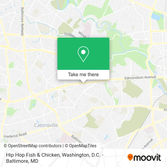
See Hip Hop Fish & Chicken, Baltimore, on the map
Public Transit to Hip Hop Fish & Chicken in Baltimore
Wondering how to get to Hip Hop Fish & Chicken in Baltimore? Moovit helps you find the best way to get to Hip Hop Fish & Chicken with step-by-step directions from the nearest public transit station.
Moovit provides free maps and live directions to help you navigate through your city. View schedules, routes, timetables, and find out how long does it take to get to Hip Hop Fish & Chicken in real time.
Looking for the nearest stop or station to Hip Hop Fish & Chicken? Check out this list of stops closest to your destination: Edmondson Ave & Charing Cross Rd Wb; Baltimore National Pike & Greenwich Ave Eb.
Bus: 78, CITYLINK BLUE, 38, 77, 150.
Want to see if there’s another route that gets you there at an earlier time? Moovit helps you find alternative routes or times. Get directions from and directions to Hip Hop Fish & Chicken easily from the Moovit App or Website.
We make riding to Hip Hop Fish & Chicken easy, which is why over 1.5 million users, including users in Baltimore, trust Moovit as the best app for public transit. You don’t need to download an individual bus app or train app, Moovit is your all-in-one transit app that helps you find the best bus time or train time available.
For information on prices of bus, light rail and metro, costs and ride fares to Hip Hop Fish & Chicken, please check the Moovit app.
Use the app to navigate to popular places including to the airport, hospital, stadium, grocery store, mall, coffee shop, school, college, and university.
Location: Baltimore, Washington, D.C. - Baltimore, MD
- Vaughn Greene Funeral Services,
- Abundant Towers II,
- Vaughn Greene Funeral Home,
- Ross Insurance Agency,
- Source One Auto,
- DMV REI United,
- Baltimore Pike Old Frederick Rd,
- Family Fall Feast,
- West Baltimore United Methodist Church,
- Robert L Haynes,
- West Baltimore UMC,
- United Methodist Church,
- Beauty Bomb Cutz,
- Ellen and Mary Home Improvement,
- CDC: Christian Deliverance Center,
- Soul Harvest,
- U Save Car Rental,
- Hip Hop Fish & Chicken - Route 40,
- Krishna Inc,
- Carroll Motor Fuels
Places Near Hip Hop Fish & Chicken (Baltimore)
- National Theatre, Washington,
- Sibley Memorial Hospital, Washington,
- Museum Of The Bible, Washington,
- Pennsylvania Ave NW (3rd st and pennsylvania), Washington,
- Basilica of the National Shrine, Washington,
- Georgetown, Washington,
- Westfield Montgomery Mall, Montgomery County,
- Washington National Cathedral, Washington,
- PG Mall, Prince George's County,
- National Museum of African American History and Culture, Washington,
- Marriott Marquis Washington, DC, Washington,
- M&T Bank Stadium, Baltimore,
- Capital One Arena, Washington,
- Camden Yards, Baltimore,
- Amazon Hq2, Arlington County,
- The Anthem, Washington,
- Rock Creek Tennis Center, Washington,
- National Zoo, Washington,
- Warner Theatre, Washington,
- Washington DC VA Medical Center, Washington
How to get to popular places in Washington, D.C. - Baltimore, MD with public transit
Get around Baltimore by public transit!
Traveling around Baltimore has never been so easy. See step by step directions as you travel to any attraction, street or major public transit station. View bus and train schedules, arrival times, service alerts and detailed routes on a map, so you know exactly how to get to anywhere in Baltimore.
When traveling to any destination around Baltimore use Moovit's Live Directions with Get Off Notifications to know exactly where and how far to walk, how long to wait for your line, and how many stops are left. Moovit will alert you when it's time to get off — no need to constantly re-check whether yours is the next stop.
Wondering how to use public transit in Baltimore or how to pay for public transit in Baltimore? Moovit public transit app can help you navigate your way with public transit easily, and at minimum cost. It includes public transit fees, ticket prices, and costs. Looking for a map of Baltimore public transit lines? Moovit public transit app shows all public transit maps in Baltimore with all Bus, Train, Metro, Light Rail and Ferry routes and stops on an interactive map.
Washington, D.C. - Baltimore, MD has 5 transit type(s), including: Bus, Train, Metro, Light Rail and Ferry, operated by several transit agencies, including WMATA, Montgomery County Ride On, Fairfax Connector, TheBus, PRTC, DASH - Alexandria, Arlington Transit (ART), RTA of Central Maryland, MDOT MTA, MDOT MTA Light RailLink, MDOT MTA Commuter Bus, MDOT MTA Local Bus, FXBGO!, Virginia Railway Express (VRE) and MARC