How to get to Hiper Usera by bus?
Click on the bus route to see step by step directions with maps, line arrival times and updated time schedules.
From Mapa, Área Metropolitana De Madrid Y Corredor Del Henares
51 minFrom C.C. Plaza Río 2, Madrid
51 minFrom Centro Comercial Tres Aguas (Tresaguas), Alcorcón
59 minFrom Aluche, Madrid
56 minFrom Parque Comercial Plaza Nueva, Leganés
46 minFrom Calle Juan Mieg 3, Madrid
40 minFrom DECATHLON Usera, Madrid
38 minFrom Poligono Industrial Prado Overa, Leganés
31 minFrom Tejidos Paredes, Fuenlabrada
56 minFrom Hospital Fundación Alcorcón., Área Metropolitana De Madrid Y Corredor Del Henares
66 min
How to get to Hiper Usera by train?
Click on the train route to see step by step directions with maps, line arrival times and updated time schedules.
From Mapa, Área Metropolitana De Madrid Y Corredor Del Henares
52 minFrom C.C. Plaza Río 2, Madrid
52 minFrom Centro Comercial Tres Aguas (Tresaguas), Alcorcón
71 minFrom Aluche, Madrid
61 minFrom Parque Comercial Plaza Nueva, Leganés
51 minFrom DECATHLON Usera, Madrid
35 minFrom Hospital Fundación Alcorcón., Área Metropolitana De Madrid Y Corredor Del Henares
68 min
How to get to Hiper Usera by metro?
Click on the metro route to see step by step directions with maps, line arrival times and updated time schedules.
From Mapa, Área Metropolitana De Madrid Y Corredor Del Henares
41 minFrom C.C. Plaza Río 2, Madrid
44 minFrom Centro Comercial Tres Aguas (Tresaguas), Alcorcón
51 minFrom Aluche, Madrid
71 minFrom Parque Comercial Plaza Nueva, Leganés
44 minFrom Calle Juan Mieg 3, Madrid
69 minFrom DECATHLON Usera, Madrid
52 minFrom Tejidos Paredes, Fuenlabrada
44 minFrom Hospital Fundación Alcorcón., Área Metropolitana De Madrid Y Corredor Del Henares
47 min
Bus stops near Hiper Usera in Getafe
Metro station near Hiper Usera in Getafe
- Getafe Central, 8 min walk,VIEW
Train station near Hiper Usera in Getafe
- Getafe - Centro, 8 min walk,VIEW
Bus lines to Hiper Usera in Getafe
- 441, P.º Juan José Rosón - Est. Arroyo Culebro,VIEW
- 1, Sector III - Ambulatorio,VIEW
- 4, Pol. Ind. Los Ángeles - Hospital - Perales del Río,VIEW
- 447, Madrid (Legazpi) - Getafe (Hospital),VIEW
- 448, Madrid (Legazpi) - Getafe (por Villaverde),VIEW
- 450, Getafe - Leganés - Alcorcón,VIEW
- 3B, Circular de Getafe B,VIEW
- N805, Madrid (Atocha) - Getafe (Los Molinos),VIEW
- N807, Madrid (Atocha) - Getafe - Humanes - Griñón,VIEW
- N801, Av. Juan Carlos I - Policía Local,VIEW
- 2, Ambulatorio,VIEW
- 444, Islas Canarias - Residencia,VIEW
- 455, Av. Libertad - Hospital De Getafe,VIEW
- 6, San Isidro - Hospital,VIEW
- 462, Av. Libertad - Hospital De Getafe,VIEW
- 7, Circular (Tecnogetafe),VIEW
What are the closest stations to Hiper Usera?
The closest stations to Hiper Usera are:
- Pza. Cuestas - Uned is 184 meters away, 3 min walk.
- Ferrocarril - Pintor Rosales is 276 meters away, 4 min walk.
- Av. Reyes Católicos - Faisán is 322 meters away, 5 min walk.
- Toledo - Ermita San Isidro is 385 meters away, 6 min walk.
- Ferrocarril - Est. Alonso De Mendoza is 390 meters away, 6 min walk.
- Getafe Central is 594 meters away, 8 min walk.
- Getafe - Centro is 594 meters away, 8 min walk.
Which bus lines stop near Hiper Usera?
These bus lines stop near Hiper Usera: 441, 444, 450.
Which train line stops near Hiper Usera?
C4 (Parla)
Which metro line stops near Hiper Usera?
M-12 (MetroSur Andén 2)
What’s the nearest metro station to Hiper Usera in Getafe?
The nearest metro station to Hiper Usera in Getafe is Getafe Central. It’s a 8 min walk away.
What’s the nearest train station to Hiper Usera in Getafe?
The nearest train station to Hiper Usera in Getafe is Getafe - Centro. It’s a 8 min walk away.
What’s the nearest bus station to Hiper Usera in Getafe?
The nearest bus station to Hiper Usera in Getafe is Pza. Cuestas - Uned. It’s a 3 min walk away.
What time is the first metro to Hiper Usera in Getafe?
The M-12 is the first metro that goes to Hiper Usera in Getafe. It stops nearby at 6:05 AM.
What time is the last metro to Hiper Usera in Getafe?
The M-12 is the last metro that goes to Hiper Usera in Getafe. It stops nearby at 2:07 AM.
What time is the first train to Hiper Usera in Getafe?
The C4 is the first train that goes to Hiper Usera in Getafe. It stops nearby at 5:12 AM.
What time is the last train to Hiper Usera in Getafe?
The C4 is the last train that goes to Hiper Usera in Getafe. It stops nearby at 12:13 AM.
What time is the first bus to Hiper Usera in Getafe?
The N805 is the first bus that goes to Hiper Usera in Getafe. It stops nearby at 3:03 AM.
What time is the last bus to Hiper Usera in Getafe?
The N805 is the last bus that goes to Hiper Usera in Getafe. It stops nearby at 3:03 AM.
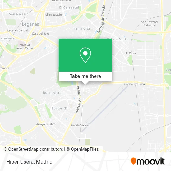
See Hiper Usera, Getafe, on the map
Public Transit to Hiper Usera in Getafe
Wondering how to get to Hiper Usera in Getafe? Moovit helps you find the best way to get to Hiper Usera with step-by-step directions from the nearest public transit station.
Moovit provides free maps and live directions to help you navigate through your city. View schedules, routes, timetables, and find out how long does it take to get to Hiper Usera in real time.
Looking for the nearest stop or station to Hiper Usera? Check out this list of stops closest to your destination: Pza. Cuestas - Uned; Ferrocarril - Pintor Rosales; Av. Reyes Católicos - Faisán; Toledo - Ermita San Isidro; Ferrocarril - Est. Alonso De Mendoza; Getafe Central; Getafe - Centro.
Bus: 441, 444, 450, 1, 4, 447, 448, N801, 2, 455.Train: C4, C4A, C4B.Metro: M-12.
Want to see if there’s another route that gets you there at an earlier time? Moovit helps you find alternative routes or times. Get directions from and directions to Hiper Usera easily from the Moovit App or Website.
We make riding to Hiper Usera easy, which is why over 1.5 million users, including users in Getafe, trust Moovit as the best app for public transit. You don’t need to download an individual bus app or train app, Moovit is your all-in-one transit app that helps you find the best bus time or train time available.
For information on prices of bus, metro and train, costs and ride fares to Hiper Usera, please check the Moovit app.
Use the app to navigate to popular places including to the airport, hospital, stadium, grocery store, mall, coffee shop, school, college, and university.
Hiper Usera Address: Calle Castilla, 7 28901 Getafe street in Getafe
- DyF,
- Calle Ferrocarril,
- Estanco La Casa de las Revistas,
- Frutas Milton,
- Bar Calificación,
- Peluquería Los Amigos,
- Ferreteria y Cerrajeria El Paso,
- Kebab Getafe,
- Alimentación Alma Lati,
- Salones Emperador,
- Amazon Counter-Alimentación Alma Latina,
- Döner Kebap el Patio Andaluz,
- Centro Odontológico,
- Asian Xperience,
- Alimentación Cervantes,
- Xueying Wang,
- Bagira Café-Bar,
- Sanchez Guillen Arquitectos,
- Guardia Civil - Cuartel De Getafe.,
- Bar "La Que Se Avecina"
Places Near Hiper Usera (Getafe)
- Rastro De Madrid, Área Metropolitana De Madrid Y Corredor Del Henares,
- Wizink Center, Madrid,
- Palacio De Vistalegre, Área Metropolitana De Madrid Y Corredor Del Henares,
- Plaza Mayor, Madrid,
- Sala La Riviera, Madrid,
- Hospital Clínico Universitario San Carlos, Madrid,
- Hospital Universitario Ramón y Cajal, Madrid,
- Plenilunio, Área Metropolitana De Madrid Y Corredor Del Henares,
- Centro Comercial Oasiz Madrid, Área Metropolitana De Madrid Y Corredor Del Henares,
- Mendez Alvaro, Madrid,
- Hospital Universitario La Paz, Madrid,
- Estadio Wanda Metropolitano, Área Metropolitana De Madrid Y Corredor Del Henares,
- Mercadillo de Majadahonda, Majadahonda,
- Calle de López de Hoyos 169, Madrid,
- Centro Comercial La Vaguada, Área Metropolitana De Madrid Y Corredor Del Henares,
- Centro Comercial La Gavia, Área Metropolitana De Madrid Y Corredor Del Henares,
- Estacion de Chamartin, Madrid,
- Tres Aguas, Alcorcón,
- Nassica, Área Metropolitana De Madrid Y Corredor Del Henares,
- Centro Comercial Islazul, Área Metropolitana De Madrid Y Corredor Del Henares
How to get to popular places in Madrid with public transit
Get around Getafe by public transit!
Traveling around Getafe has never been so easy. See step by step directions as you travel to any attraction, street or major public transit station. View bus and train schedules, arrival times, service alerts and detailed routes on a map, so you know exactly how to get to anywhere in Getafe.
When traveling to any destination around Getafe use Moovit's Live Directions with Get Off Notifications to know exactly where and how far to walk, how long to wait for your line, and how many stops are left. Moovit will alert you when it's time to get off — no need to constantly re-check whether yours is the next stop.
Wondering how to use public transit in Getafe or how to pay for public transit in Getafe? Moovit public transit app can help you navigate your way with public transit easily, and at minimum cost. It includes public transit fees, ticket prices, and costs. Looking for a map of Getafe public transit lines? Moovit public transit app shows all public transit maps in Getafe with all Bus, Train, Metro and Light Rail routes and stops on an interactive map.
Madrid has 4 transit type(s), including: Bus, Train, Metro and Light Rail, operated by several transit agencies, including Metro de Madrid, Metro Ligero, Tranvía de Parla, Renfe Cercanías - Servicios de Autobús especiales, Renfe Cercanias, Renfe Cercanías, EMT, Interurbanos, Urbanos de Alcalá de Henares, Urbanos de Alcobendas, Urbanos de Alcorcón, Urbanos de Algete, Urbanos de Aranjuez, Urbanos de Arganda del Rey and Urbanos de Arroyomolinos