Directions to Hobbitronics (Alexandria) with public transportation
The following transit lines have routes that pass near Hobbitronics
 Bus: 33, 36A, 36B, A11, A12.
- Train: MANASSAS LINE, PALMETTO.
- Metro: BLUE, YELLOW, METRO STATION CLOSURE SHUTTLE.
How to get to Hobbitronics by bus?
Click on the bus route to see step by step directions with maps, line arrival times and updated time schedules.
From Ross Dress for Less, Washington
132 minFrom DC Improv Comedy Club, Washington
62 minFrom Marriott-Washington DC Marquis (Marriott Marquis Washington, DC), Washington
75 minFrom Hampton Inn Washington-Downtown-Convention Center, Washington
80 minFrom United States Mint, Washington
75 minFrom Residence Inn-Washington DC, Washington
124 minFrom Festival Grounds at RFK Campus, Washington
155 minFrom Children's Hospital, Washington
110 minFrom McKinley Technology High School, Washington
146 minFrom Hechinger Mall, Washington
132 min
How to get to Hobbitronics by train?
Click on the train route to see step by step directions with maps, line arrival times and updated time schedules.
How to get to Hobbitronics by metro?
Click on the metro route to see step by step directions with maps, line arrival times and updated time schedules.
From Ross Dress for Less, Washington
80 minFrom DC Improv Comedy Club, Washington
52 minFrom Marriott-Washington DC Marquis (Marriott Marquis Washington, DC), Washington
52 minFrom Hampton Inn Washington-Downtown-Convention Center, Washington
50 minFrom United States Mint, Washington
47 minFrom Residence Inn-Washington DC, Washington
47 minFrom Festival Grounds at RFK Campus, Washington
72 minFrom Children's Hospital, Washington
61 minFrom McKinley Technology High School, Washington
65 minFrom Hechinger Mall, Washington
80 min
Bus stops near Hobbitronics in Alexandria
Metro stations near Hobbitronics in Alexandria
Bus lines to Hobbitronics in Alexandria
What are the closest stations to Hobbitronics?
The closest stations to Hobbitronics are:
- W Glebe Rd + Mt Vernon Av is 334 yards away, 4 min walk.
- Mount Vernon Ave & W Glebe Rd is 358 yards away, 5 min walk.
- Russell Rd + Mount Pl is 477 yards away, 6 min walk.
- Braddock Road Metro is 2031 yards away, 24 min walk.
- Crystal City is 3859 yards away, 46 min walk.
Which bus lines stop near Hobbitronics?
These bus lines stop near Hobbitronics: 33, 36A, 36B, A11, A12.
Which train lines stop near Hobbitronics?
These train lines stop near Hobbitronics: MANASSAS LINE, PALMETTO.
Which metro lines stop near Hobbitronics?
These metro lines stop near Hobbitronics: BLUE, YELLOW.
What’s the nearest metro station to Hobbitronics in Alexandria?
The nearest metro station to Hobbitronics in Alexandria is Braddock Road Metro. It’s a 24 min walk away.
What’s the nearest bus station to Hobbitronics in Alexandria?
The nearest bus station to Hobbitronics in Alexandria is W Glebe Rd + Mt Vernon Av. It’s a 4 min walk away.
What time is the first metro to Hobbitronics in Alexandria?
The YELLOW is the first metro that goes to Hobbitronics in Alexandria. It stops nearby at 5:06 AM.
What time is the last metro to Hobbitronics in Alexandria?
The YELLOW is the last metro that goes to Hobbitronics in Alexandria. It stops nearby at 12:33 AM.
What time is the first bus to Hobbitronics in Alexandria?
The A11 is the first bus that goes to Hobbitronics in Alexandria. It stops nearby at 4:50 AM.
What time is the last bus to Hobbitronics in Alexandria?
The A11 is the last bus that goes to Hobbitronics in Alexandria. It stops nearby at 1:48 AM.
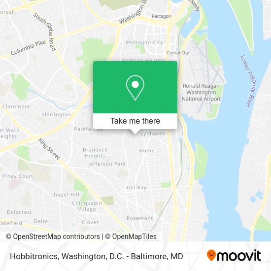
See Hobbitronics, Alexandria, on the map
Public Transit to Hobbitronics in Alexandria
Wondering how to get to Hobbitronics in Alexandria? Moovit helps you find the best way to get to Hobbitronics with step-by-step directions from the nearest public transit station.
Moovit provides free maps and live directions to help you navigate through your city. View schedules, routes, timetables, and find out how long does it take to get to Hobbitronics in real time.
Looking for the nearest stop or station to Hobbitronics? Check out this list of stops closest to your destination: W Glebe Rd + Mt Vernon Av; Mount Vernon Ave & W Glebe Rd; Russell Rd + Mount Pl; Braddock Road Metro; Crystal City.
Bus: 33, 36A, 36B, A11, A12, 103.Train: MANASSAS LINE, PALMETTO.Metro: BLUE, YELLOW, METRO STATION CLOSURE SHUTTLE.
Want to see if there’s another route that gets you there at an earlier time? Moovit helps you find alternative routes or times. Get directions from and directions to Hobbitronics easily from the Moovit App or Website.
We make riding to Hobbitronics easy, which is why over 1.5 million users, including users in Alexandria, trust Moovit as the best app for public transit. You don’t need to download an individual bus app or train app, Moovit is your all-in-one transit app that helps you find the best bus time or train time available.
For information on prices of bus, metro and train, costs and ride fares to Hobbitronics, please check the Moovit app.
Use the app to navigate to popular places including to the airport, hospital, stadium, grocery store, mall, coffee shop, school, college, and university.
Hobbitronics Address: 203 Burgess Ave Alexandria, VA 22305 street in Alexandria
- Alston's Southern Style Cuisine,
- M & J Construction,
- Streat Guitar,
- Dr. Jake Newsome,
- Reimers Design Studio,
- Credit Union 1,
- El Paisa Grocery,
- Alexandria Garage Door Service Repair,
- Mt Vernon Ave Glebe Rd,
- Tobacco Hut and Vape,
- Unbank Bitcoin ATM,
- District Biscuit Company,
- Delray Tower,
- Alexandria Locked Out of Business Locksmith,
- Mega Laundromat,
- Nap US,
- The Calvert,
- Delray Tower by Udr,
- Different Stages LLC Home Staging,
- Dollar Mas
Places Near Hobbitronics (Alexandria)
- Museum Of The Bible, Washington,
- Washington National Cathedral, Washington,
- Washington DC VA Medical Center, Washington,
- National Museum of African American History and Culture, Washington,
- The Anthem, Washington,
- Amazon Hq2, Arlington County,
- Marriott Marquis Washington, DC, Washington,
- Georgetown, Washington,
- Capital One Arena, Washington,
- Rock Creek Tennis Center, Washington,
- Westfield Montgomery Mall, Montgomery County,
- PG Mall, Prince George's County,
- M&T Bank Stadium, Baltimore,
- National Zoo, Washington,
- Sibley Memorial Hospital, Washington,
- National Theatre, Washington,
- Camden Yards, Baltimore,
- Pennsylvania Ave NW (3rd st and pennsylvania), Washington,
- Warner Theatre, Washington,
- Basilica of the National Shrine, Washington
How to get to popular places in Washington, D.C. - Baltimore, MD with public transit
Get around Alexandria by public transit!
Traveling around Alexandria has never been so easy. See step by step directions as you travel to any attraction, street or major public transit station. View bus and train schedules, arrival times, service alerts and detailed routes on a map, so you know exactly how to get to anywhere in Alexandria.
When traveling to any destination around Alexandria use Moovit's Live Directions with Get Off Notifications to know exactly where and how far to walk, how long to wait for your line, and how many stops are left. Moovit will alert you when it's time to get off — no need to constantly re-check whether yours is the next stop.
Wondering how to use public transit in Alexandria or how to pay for public transit in Alexandria? Moovit public transit app can help you navigate your way with public transit easily, and at minimum cost. It includes public transit fees, ticket prices, and costs. Looking for a map of Alexandria public transit lines? Moovit public transit app shows all public transit maps in Alexandria with all Bus, Train, Metro, Light Rail and Ferry routes and stops on an interactive map.
Washington, D.C. - Baltimore, MD has 5 transit type(s), including: Bus, Train, Metro, Light Rail and Ferry, operated by several transit agencies, including WMATA, Montgomery County Ride On, Fairfax Connector, TheBus, PRTC, DASH - Alexandria, Arlington Transit (ART), RTA of Central Maryland, MDOT MTA, MDOT MTA Light RailLink, MDOT MTA Commuter Bus, MDOT MTA Local Bus, FXBGO!, Virginia Railway Express (VRE) and MARC