How to get to Homestead Emergency Locksmith by bus?
Click on the bus route to see step by step directions with maps, line arrival times and updated time schedules.
From US 1@SW 248 St
39 minFrom Eureka Drive & U.S. 1
56 minFrom Cutler Bay, FL
92 minFrom Robert Morgan Educational Center
71 minFrom Baptist Health South Florida Homestead Hospital
26 minFrom Herbert Ammons Middle School
96 minFrom Baptist homestead hospital
46 minFrom SW 137th Ave / US-1
43 minFrom SW 184 St & US 1
57 minFrom Zoo Miami
109 min
Bus stops near Homestead Emergency Locksmith
Bus lines to Homestead Emergency Locksmith
What are the closest stations to Homestead Emergency Locksmith?
The closest stations to Homestead Emergency Locksmith are:
- Transitway & Sw 328 St is 70 yards away, 1 min walk.
- Sw 6 Av & Lucy St (Sw 8 St) is 366 yards away, 5 min walk.
- Nw 6 Av @ Lucy St (Sw 8 St) is 407 yards away, 5 min walk.
- Eastbound SW 4 St (West Of SW 2 Ave) is 514 yards away, 7 min walk.
- Sw 4th St @ Sw 2nd Ave is 531 yards away, 7 min walk.
Which bus lines stop near Homestead Emergency Locksmith?
These bus lines stop near Homestead Emergency Locksmith: 35, 602.
What’s the nearest bus station to Homestead Emergency Locksmith?
The nearest bus station to Homestead Emergency Locksmith is Transitway & Sw 328 St. It’s a 1 min walk away.
What time is the first bus to Homestead Emergency Locksmith?
The 602 is the first bus that goes to Homestead Emergency Locksmith. It stops nearby at 3:04 AM.
What time is the last bus to Homestead Emergency Locksmith?
The 602 is the last bus that goes to Homestead Emergency Locksmith. It stops nearby at 3:37 AM.
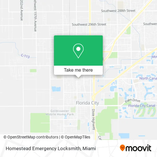
See Homestead Emergency Locksmith on the map
Public Transportation to Homestead Emergency Locksmith
Wondering how to get to Homestead Emergency Locksmith? Moovit helps you find the best way to get to Homestead Emergency Locksmith with step-by-step directions from the nearest public transit station.
Moovit provides free maps and live directions to help you navigate through your city. View schedules, routes, timetables, and find out how long does it take to get to Homestead Emergency Locksmith in real time.
Looking for the nearest stop or station to Homestead Emergency Locksmith? Check out this list of stops closest to your destination: Transitway & Sw 328 St; Sw 6 Av & Lucy St (Sw 8 St); Nw 6 Av @ Lucy St (Sw 8 St); Eastbound SW 4 St (West Of SW 2 Ave); Sw 4th St @ Sw 2nd Ave.
Bus: 35, 602, 301, DOWNTOWN, HOMEDT.
Want to see if there’s another route that gets you there at an earlier time? Moovit helps you find alternative routes or times. Get directions from and directions to Homestead Emergency Locksmith easily from the Moovit App or Website.
We make riding to Homestead Emergency Locksmith easy, which is why over 1.5 million users, including users in Homestead, trust Moovit as the best app for public transit. You don’t need to download an individual bus app or train app, Moovit is your all-in-one transit app that helps you find the best bus time or train time available.
For information on prices of bus, costs and ride fares to Homestead Emergency Locksmith, please check the Moovit app.
Use the app to navigate to popular places including to the airport, hospital, stadium, grocery store, mall, coffee shop, school, college, and university.
Homestead Emergency Locksmith Address: 505 SW 8th St Homestead, FL 33030 street in Homestead
- Rans Restaurant,
- M & T Food Store,
- County Government District 9,
- El Charrito Supermarket,
- Miami Dade Paramount Locksmith LTD,
- W Lucy St / Busway,
- SW 328th St / Busway,
- Diabetes Research Institute,
- Q Space Detox,
- Ar Equipment Services,
- 665 NW 14th St Parking,
- Lucky,
- Tatum Park,
- Lliny de la Nuez,
- Le Jardin Community Center,
- Michael Johnigean,
- Bayview Baptist Church,
- Holy Temple Pentecostal Church of South Dade Inc.,
- The New Jerusalem Church of God in Christ,
- Woody's BBQ
Places Near Homestead Emergency Locksmith
- Bayside Marketplace, Miami,
- Little Havana, Miami,
- Miami Freedom Park, Miami,
- Miami VA Hospital, Miami,
- Keiser University Flagship Campus, West Palm Beach,
- Dolphin Mall, Miami,
- Aventura Mall, Miami,
- Dolphin Mall Bus, Miami,
- Brickell City Centre, Miami,
- Port of Miami Cruise Terminal, Miami,
- Wynwood, Miami,
- Miami Design District, Miami,
- Marlins Park, Miami,
- Hard Rock Stadium, Miami Gardens,
- Richard E. Gerstein Justice Building, Miami,
- Miami-Dade County Courthouse, Miami,
- Aventura Mall, Miami Beach,
- Zoo Miami, Miami,
- Sawgrass Mall, Miami,
- Sawgrass mall ( FL ), Miami Beach
How to get to popular places in Miami with public transit
Get around Homestead by public transit!
Traveling around Homestead has never been so easy. See step by step directions as you travel to any attraction, street or major public transit station. View bus and train schedules, arrival times, service alerts and detailed routes on a map, so you know exactly how to get to anywhere in Homestead.
When traveling to any destination around Homestead use Moovit's Live Directions with Get Off Notifications to know exactly where and how far to walk, how long to wait for your line, and how many stops are left. Moovit will alert you when it's time to get off — no need to constantly re-check whether yours is the next stop.
Wondering how to use public transit in Homestead or how to pay for public transit in Homestead? Moovit public transit app can help you navigate your way with public transit easily, and at minimum cost. It includes public transit fees, ticket prices, and costs. Looking for a map of Homestead public transit lines? Moovit public transit app shows all public transit maps in Homestead with all Bus, Train, Light Rail and Ferry routes and stops on an interactive map.
Miami has 4 transit type(s), including: Bus, Train, Light Rail and Ferry, operated by several transit agencies, including Broward County Transit, Miami-Dade Transit, Metrorail, Palm Tran, Tri-Rail, Brightline, MARTY, City of Homestead Trolley, Key West Transit, Treasure Coast Connector, GoLine IRT, Amtrak, Greyhound-us, FlixBus-us and Aventura Express Shuttle Bus