How to get to Homestead Locksmith by bus?
Click on the bus route to see step by step directions with maps, line arrival times and updated time schedules.
From SW 184 St & US 1, Kendall-Palmetto Bay
33 minFrom Florida City, Homestead
37 minFrom Zoo Miami, Kendale Lakes-Tamiami
89 minFrom Orlando Florida, Homestead
36 minFrom Walmart (Walmart Florida City), Homestead
40 minFrom Eureka Drive & U.S. 1, Kendall-Palmetto Bay
32 minFrom Florida Keys Outlet Marketplace, Homestead
52 minFrom Cutler Bay, FL, Princeton-Goulds
72 minFrom SW 187th Ave / SW 344th St, Homestead
48 minFrom Robert Morgan Educational Center, Kendale Lakes-Tamiami
57 min
Bus stops near Homestead Locksmith in Princeton-Goulds
Bus lines to Homestead Locksmith in Princeton-Goulds
What are the closest stations to Homestead Locksmith?
The closest stations to Homestead Locksmith are:
- Us 1@sw 266 St is 214 yards away, 3 min walk.
- Transitway & Bauer Dr Station is 512 yards away, 7 min walk.
- Bauer Dr Station is 559 yards away, 7 min walk.
Which bus lines stop near Homestead Locksmith?
These bus lines stop near Homestead Locksmith: 601, 602, 70.
What’s the nearest bus station to Homestead Locksmith in Princeton-Goulds?
The nearest bus station to Homestead Locksmith in Princeton-Goulds is Us 1@sw 266 St. It’s a 3 min walk away.
What time is the first bus to Homestead Locksmith in Princeton-Goulds?
The 602 is the first bus that goes to Homestead Locksmith in Princeton-Goulds. It stops nearby at 3:18 AM.
What time is the last bus to Homestead Locksmith in Princeton-Goulds?
The 602 is the last bus that goes to Homestead Locksmith in Princeton-Goulds. It stops nearby at 3:16 AM.
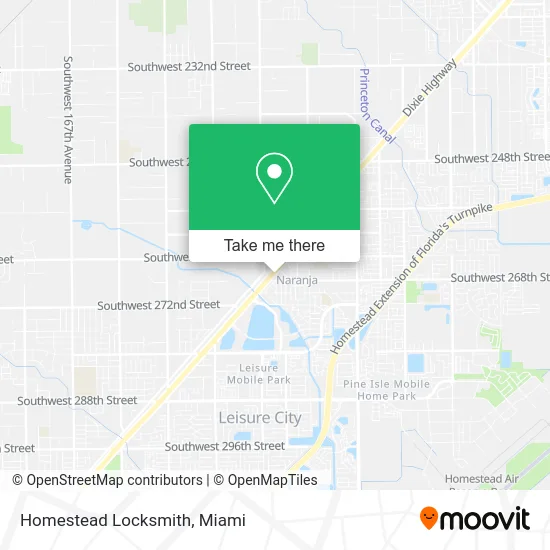
See Homestead Locksmith, Princeton-Goulds, on the map
Public Transit to Homestead Locksmith in Princeton-Goulds
Wondering how to get to Homestead Locksmith in Princeton-Goulds? Moovit helps you find the best way to get to Homestead Locksmith with step-by-step directions from the nearest public transit station.
Moovit provides free maps and live directions to help you navigate through your city. View schedules, routes, timetables, and find out how long does it take to get to Homestead Locksmith in real time.
Looking for the nearest stop or station to Homestead Locksmith? Check out this list of stops closest to your destination: Us 1@sw 266 St; Transitway & Bauer Dr Station; Bauer Dr Station.
Bus: 601, 602, 70, 35.
Want to see if there’s another route that gets you there at an earlier time? Moovit helps you find alternative routes or times. Get directions from and directions to Homestead Locksmith easily from the Moovit App or Website.
We make riding to Homestead Locksmith easy, which is why over 1.5 million users, including users in Princeton-Goulds, trust Moovit as the best app for public transit. You don’t need to download an individual bus app or train app, Moovit is your all-in-one transit app that helps you find the best bus time or train time available.
For information on prices of bus, costs and ride fares to Homestead Locksmith, please check the Moovit app.
Use the app to navigate to popular places including to the airport, hospital, stadium, grocery store, mall, coffee shop, school, college, and university.
Homestead Locksmith Address: 26655 S Dixie Hwy Homestead, FL 33032 street in Princeton-Goulds
- Dona Tania,
- Arepas Venegara,
- Chilly Willy AC Parts and Supply,
- Blink Charging,
- Family Paintball Center,
- Shear Elegance HR Designs by Ltrssia,
- Locksmith Commercial Lockout Miami,
- La Michoacana 100% Natural,
- Busway US 1 & 264 street,
- Truist,
- EVgo,
- Caribe Community Center,
- Krispy Krunchy Chicken,
- Taco Bell,
- SW 264th St / US-1,
- Cricket,
- Walmart,
- Keyme Locksmiths,
- Coinstar,
- Walmart Naranja Neighborhood Market
Places Near Homestead Locksmith (Princeton-Goulds)
- Aventura Mall, Miami Beach,
- Wynwood, Miami,
- Marlins Park, Miami,
- Sawgrass Mall, Miami,
- Sawgrass mall ( FL ), Miami Beach,
- Brickell City Centre, Miami,
- Dolphin Mall Bus, Miami,
- Hard Rock Stadium, Miami Gardens,
- Miami-Dade County Courthouse, Miami,
- Keiser University Flagship Campus, West Palm Beach,
- Bayside Marketplace, Miami,
- Miami VA Hospital, Miami,
- Miami Design District, Miami,
- Zoo Miami, Miami,
- Little Havana, Miami,
- Miami Freedom Park, Miami,
- Richard E. Gerstein Justice Building, Miami,
- Port of Miami Cruise Terminal, Miami,
- Aventura Mall, Miami,
- Dolphin Mall, Miami
How to get to popular places in Miami with public transit
Get around Princeton-Goulds by public transit!
Traveling around Princeton-Goulds has never been so easy. See step by step directions as you travel to any attraction, street or major public transit station. View bus and train schedules, arrival times, service alerts and detailed routes on a map, so you know exactly how to get to anywhere in Princeton-Goulds.
When traveling to any destination around Princeton-Goulds use Moovit's Live Directions with Get Off Notifications to know exactly where and how far to walk, how long to wait for your line, and how many stops are left. Moovit will alert you when it's time to get off — no need to constantly re-check whether yours is the next stop.
Wondering how to use public transit in Princeton-Goulds or how to pay for public transit in Princeton-Goulds? Moovit public transit app can help you navigate your way with public transit easily, and at minimum cost. It includes public transit fees, ticket prices, and costs. Looking for a map of Princeton-Goulds public transit lines? Moovit public transit app shows all public transit maps in Princeton-Goulds with all Bus, Train, Light Rail and Ferry routes and stops on an interactive map.
Miami has 4 transit type(s), including: Bus, Train, Light Rail and Ferry, operated by several transit agencies, including Broward County Transit, Miami-Dade Transit, Metrorail, Palm Tran, Tri-Rail, Brightline, MARTY, City of Homestead Trolley, Key West Transit, Treasure Coast Connector, GoLine IRT, Amtrak, Greyhound-us, FlixBus-us and Aventura Express Shuttle Bus