How to get to Homestead Square by bus?
Click on the bus route to see step by step directions with maps, line arrival times and updated time schedules.
From Absolute Law, Villas
48 minFrom Go Home Services, Cypress Lake
75 minFrom Winkler & Colonial, Fort Myers
45 minFrom Inspiration at South Pointe, Mcgregor
88 minFrom Car Lockout, Mcgregor
86 minFrom Massiel Alfonso-Folden, Cypress Lake
92 minFrom Mega Arcade, Cape Coral
55 minFrom Boombalattis Sandwich Company, Mcgregor
87 minFrom RE/MAX, Suncoast Estates
78 minFrom Family - US, North Fort Myers
18 min
Bus stops near Homestead Square in Fort Myers
Bus lines to Homestead Square in Fort Myers
What are the closest stations to Homestead Square?
The closest stations to Homestead Square are:
- Monroe St @ Second St is 177 yards away, 3 min walk.
- Rosa Parks Transportation Ctr W is 209 yards away, 3 min walk.
- Mlk Blvd @ Lee St is 220 yards away, 3 min walk.
- Fort Myers Bus Stop is 289 yards away, 4 min walk.
Which bus lines stop near Homestead Square?
These bus lines stop near Homestead Square: 10, 140, 70.
What’s the nearest bus station to Homestead Square in Fort Myers?
The nearest bus stations to Homestead Square in Fort Myers are Monroe St @ Second St, Rosa Parks Transportation Ctr W and Mlk Blvd @ Lee St. The closest one is a 3 min walk away.
What time is the first bus to Homestead Square in Fort Myers?
The 20 is the first bus that goes to Homestead Square in Fort Myers. It stops nearby at 5:00 AM.
What time is the last bus to Homestead Square in Fort Myers?
The 100 is the last bus that goes to Homestead Square in Fort Myers. It stops nearby at 10:06 PM.
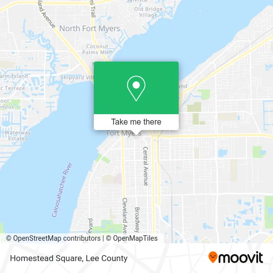
See Homestead Square, Fort Myers, on the map
Public Transit to Homestead Square in Fort Myers
Wondering how to get to Homestead Square in Fort Myers? Moovit helps you find the best way to get to Homestead Square with step-by-step directions from the nearest public transit station.
Moovit provides free maps and live directions to help you navigate through your city. View schedules, routes, timetables, and find out how long does it take to get to Homestead Square in real time.
Looking for the nearest stop or station to Homestead Square? Check out this list of stops closest to your destination: Monroe St @ Second St; Rosa Parks Transportation Ctr W; Mlk Blvd @ Lee St; Fort Myers Bus Stop.
Bus: 10, 140, 70, 15, 20, 100, FLIXBUS 2421.
Want to see if there’s another route that gets you there at an earlier time? Moovit helps you find alternative routes or times. Get directions from and directions to Homestead Square easily from the Moovit App or Website.
We make riding to Homestead Square easy, which is why over 1.5 million users, including users in Fort Myers, trust Moovit as the best app for public transit. You don’t need to download an individual bus app or train app, Moovit is your all-in-one transit app that helps you find the best bus time or train time available.
For information on prices of bus, costs and ride fares to Homestead Square, please check the Moovit app.
Use the app to navigate to popular places including to the airport, hospital, stadium, grocery store, mall, coffee shop, school, college, and university.
Homestead Square Address: Hendry St Fort Myers, FL 33901 street in Fort Myers
- Egs,
- Painting Perfectionists,
- Hilt Creative Music,
- C and C Painting,
- Prestige Mobile Notary and Courier Services,
- Consult the City,
- Butler Property Management,
- Mekasa Services,
- Prestige Digital Marketing,
- A&A Electric,
- Almeida's Fast Towing and Recovery,
- Gill Guide Services,
- Gulf Side Renovations Home Services,
- Champs Construction,
- Regalbuto Contractors,
- Keepin' Dirty,
- Mobile Mechanic Casmor,
- Diag Guy,
- Rosa Sisters Cleaning,
- Elegant Crane Services
Places Near Homestead Square (Fort Myers)
- Flixbus, Fort Myers,
- Walmart Supercenter, Fort Myers,
- Lehigh Acres, FL, Lehigh Acres,
- Bonita Beach, Bonita Springs,
- Edison Mall, Fort Myers,
- US-41, Fort Myers,
- I-75 & Colonial (Exit 136), Fort Myers,
- U.S.-41 / Colonial Blvd. Intersection, Fort Myers,
- Bonita Bay Private Beach Club, Bonita Springs,
- Seminole Casino Hotel Immokalee,
- All About U Naples Escorts, Pine Ridge,
- Rosa Parks Transportation Center, Fort Myers,
- Ft Myers Airport RSW,
- Amazon Warehouse Rsw5,
- Miromar Outlets, Estero,
- Matlacha Nude Beach, Matlacha Isles-Matlacha Shores,
- I-75 & MLK (Exit 138), Fort Myers,
- Pelican Landing Beach Shuttle, Bonita Springs,
- Bonita Springs, FL, Bonita Springs,
- Lee County Tax Collector, Cape Coral
How to get to popular places in Lee County with public transit
Get around Fort Myers by public transit!
Traveling around Fort Myers has never been so easy. See step by step directions as you travel to any attraction, street or major public transit station. View bus and train schedules, arrival times, service alerts and detailed routes on a map, so you know exactly how to get to anywhere in Fort Myers.
When traveling to any destination around Fort Myers use Moovit's Live Directions with Get Off Notifications to know exactly where and how far to walk, how long to wait for your line, and how many stops are left. Moovit will alert you when it's time to get off — no need to constantly re-check whether yours is the next stop.
Wondering how to use public transit in Fort Myers or how to pay for public transit in Fort Myers? Moovit public transit app can help you navigate your way with public transit easily, and at minimum cost. It includes public transit fees, ticket prices, and costs. Looking for a map of Fort Myers public transit lines? Moovit public transit app shows all public transit maps in Fort Myers with all bus routes and stops on an interactive map.
Lee County has 1 transit type(s), including: bus, operated by several transit agencies, including LeeTran, CAT and FlixBus-us