How to get to Homestretch by bus?
Click on the bus route to see step by step directions with maps, line arrival times and updated time schedules.
From Falls Church, VA, Falls Church
31 minFrom The Westin Arlington Gateway, Arlington County
49 minFrom Inova employee Shuttle, Fairfax County
43 minFrom King's Dominion, Fairfax County
49 minFrom Walmart, Arlington County
47 minFrom Defense Health Agency Headquarters, Fairfax County
69 minFrom Kaiser Permanente - Falls Church Medical Center, Falls Church
31 minFrom Fairfax County Courthouse, Fairfax County
56 minFrom Intelligence Community Campus—Bethesda, Montgomery County
109 minFrom Sibley Memorial Hospital, Washington
114 min
How to get to Homestretch by metro?
Click on the metro route to see step by step directions with maps, line arrival times and updated time schedules.
Bus stops near Homestretch in Fairfax County
- Greensboro Dr @ International Dr, 6 min walk,VIEW
- Greensboro Dr And International Dr, 6 min walk,VIEW
- Chain Bridge Rd And International Dr, 8 min walk,VIEW
- International Dr And Tysons Corner Ct, 8 min walk,VIEW
- International Dr @ Greensboro Dr, 9 min walk,VIEW
- Tysons Corner Metro Station Departures, 10 min walk,VIEW
- Tysons Corner Metro Bay B, 11 min walk,VIEW
Metro stations near Homestretch in Fairfax County
Bus lines to Homestretch in Fairfax County
- 402, 402 Franconia- Springfield,VIEW
- 401, 401 Tysons West Park,VIEW
- 721, 721 Mclean Metro - Chain Br Rd,VIEW
- A70, East To Potomac Yard,VIEW
- 462, 462 Dunn Loring - Navy Fcu,VIEW
- 467, 467 Dunn Loring,VIEW
- F20, East To King St-Old Town,VIEW
- 463, 463 Vienna Metro - Maple Ave,VIEW
- 494, 494 Tysons Metro,VIEW
- 495, 495 Burke Ctr,VIEW
- 660, 660 Centreville Park & Ride,VIEW
- 798, 798 Bethesda,VIEW
- 60, Tysons Metro Station,VIEW
- 423, 423 Park Run - West Park,VIEW
What are the closest stations to Homestretch?
The closest stations to Homestretch are:
- Greensboro Dr @ International Dr is 491 yards away, 6 min walk.
- Greensboro Dr And International Dr is 505 yards away, 6 min walk.
- Chain Bridge Rd And International Dr is 606 yards away, 8 min walk.
- International Dr And Tysons Corner Ct is 664 yards away, 8 min walk.
- International Dr @ Greensboro Dr is 728 yards away, 9 min walk.
- Tysons Corner Metro Station Departures is 771 yards away, 10 min walk.
- Tysons Corner Metro Bay B is 876 yards away, 11 min walk.
- Mclean is 1739 yards away, 21 min walk.
- West Falls Church-Vt is 4970 yards away, 58 min walk.
Which bus lines stop near Homestretch?
These bus lines stop near Homestretch: 401, 660, 798, A70, F20.
Which metro line stops near Homestretch?
SILVER (Ashburn)
What’s the nearest metro station to Homestretch in Fairfax County?
The nearest metro station to Homestretch in Fairfax County is Mclean. It’s a 21 min walk away.
What’s the nearest bus station to Homestretch in Fairfax County?
The nearest bus stations to Homestretch in Fairfax County are Greensboro Dr @ International Dr and Greensboro Dr And International Dr. The closest one is a 6 min walk away.
What time is the first metro to Homestretch in Fairfax County?
The SILVER is the first metro that goes to Homestretch in Fairfax County. It stops nearby at 5:07 AM.
What time is the last metro to Homestretch in Fairfax County?
The SILVER is the last metro that goes to Homestretch in Fairfax County. It stops nearby at 12:43 AM.
What time is the first bus to Homestretch in Fairfax County?
The 401 is the first bus that goes to Homestretch in Fairfax County. It stops nearby at 4:28 AM.
What time is the last bus to Homestretch in Fairfax County?
The F20 is the last bus that goes to Homestretch in Fairfax County. It stops nearby at 2:03 AM.
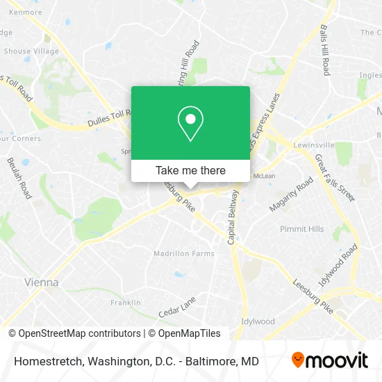
See Homestretch, Fairfax County, on the map
Public Transit to Homestretch in Fairfax County
Wondering how to get to Homestretch in Fairfax County? Moovit helps you find the best way to get to Homestretch with step-by-step directions from the nearest public transit station.
Moovit provides free maps and live directions to help you navigate through your city. View schedules, routes, timetables, and find out how long does it take to get to Homestretch in real time.
Looking for the nearest stop or station to Homestretch? Check out this list of stops closest to your destination: Greensboro Dr @ International Dr; Greensboro Dr And International Dr; Chain Bridge Rd And International Dr; International Dr And Tysons Corner Ct; International Dr @ Greensboro Dr; Tysons Corner Metro Station Departures; Tysons Corner Metro Bay B; Mclean; West Falls Church-Vt.
Bus: 401, 660, 798, A70, F20, 402, 721, 462, 467.Metro: SILVER, ORANGE.
Want to see if there’s another route that gets you there at an earlier time? Moovit helps you find alternative routes or times. Get directions from and directions to Homestretch easily from the Moovit App or Website.
We make riding to Homestretch easy, which is why over 1.5 million users, including users in Fairfax County, trust Moovit as the best app for public transit. You don’t need to download an individual bus app or train app, Moovit is your all-in-one transit app that helps you find the best bus time or train time available.
For information on prices of bus and metro, costs and ride fares to Homestretch, please check the Moovit app.
Use the app to navigate to popular places including to the airport, hospital, stadium, grocery store, mall, coffee shop, school, college, and university.
Homestretch Address: 1970 Chain Bridge Rd McLean, VA 22109 street in Fairfax County
- Uptown Cafe,
- Wolf Den Associates,
- 1980-1994 Chain Bridge Rd Parking,
- Courtyard by Marriott Tysons Mclean,
- East West - Tysons,
- DoubleTree by Hilton McLean Tysons,
- Onelife Fitness,
- Asap Firewatch,
- Dedicated Attorney,
- Avanco International,
- Capital Retail Group,
- Deloitte,
- Argos Cleaning Services,
- Boodleai,
- Ae Strategies McLean,
- Schwartz & Seifert Cpas,
- TRC Pinnacle Towers,
- Medical Professionals,
- 411.Info,
- Fluet
Places Near Homestretch (Fairfax County)
- Capital One Arena, Washington,
- M&T Bank Stadium, Baltimore,
- Washington DC VA Medical Center, Washington,
- National Zoo, Washington,
- Amazon Hq2, Arlington County,
- Basilica of the National Shrine, Washington,
- Westfield Montgomery Mall, Montgomery County,
- Washington National Cathedral, Washington,
- Georgetown, Washington,
- National Museum of African American History and Culture, Washington,
- Sibley Memorial Hospital, Washington,
- The Anthem, Washington,
- National Mall, Washington,
- Rock Creek Tennis Center, Washington,
- Warner Theatre, Washington,
- Marriott Marquis Washington, DC, Washington,
- PG Mall, Prince George's County,
- Camden Yards, Baltimore,
- Pennsylvania Ave NW (3rd st and pennsylvania), Washington,
- Museum Of The Bible, Washington
How to get to popular places in Washington, D.C. - Baltimore, MD with public transit
Get around Fairfax County by public transit!
Traveling around Fairfax County has never been so easy. See step by step directions as you travel to any attraction, street or major public transit station. View bus and train schedules, arrival times, service alerts and detailed routes on a map, so you know exactly how to get to anywhere in Fairfax County.
When traveling to any destination around Fairfax County use Moovit's Live Directions with Get Off Notifications to know exactly where and how far to walk, how long to wait for your line, and how many stops are left. Moovit will alert you when it's time to get off — no need to constantly re-check whether yours is the next stop.
Wondering how to use public transit in Fairfax County or how to pay for public transit in Fairfax County? Moovit public transit app can help you navigate your way with public transit easily, and at minimum cost. It includes public transit fees, ticket prices, and costs. Looking for a map of Fairfax County public transit lines? Moovit public transit app shows all public transit maps in Fairfax County with all Bus, Train, Metro, Light Rail and Ferry routes and stops on an interactive map.
Washington, D.C. - Baltimore, MD has 5 transit type(s), including: Bus, Train, Metro, Light Rail and Ferry, operated by several transit agencies, including WMATA, Montgomery County Ride On, Fairfax Connector, TheBus, PRTC, DASH - Alexandria, Arlington Transit (ART), RTA of Central Maryland, MDOT MTA, MDOT MTA Light RailLink, MDOT MTA Commuter Bus, MDOT MTA Local Bus, FXBGO!, Virginia Railway Express (VRE) and MARC