How to get to Horizone Graphics by bus?
Click on the bus route to see step by step directions with maps, line arrival times and updated time schedules.
How to get to Horizone Graphics by train?
Click on the train route to see step by step directions with maps, line arrival times and updated time schedules.
Bus stops near Horizone Graphics in Warsaw
Light Rail stations near Horizone Graphics in Warsaw
- Salwator, 7 min walk,VIEW
Bus lines to Horizone Graphics in Warsaw
- 100, Kopiec Kościuszki,VIEW
- 109, Bielany,VIEW
- 209, Os. Podwawelskie - Mników Skały,VIEW
- 229, Os. Podwawelskie - Kamień Szkoła,VIEW
- 269, Os. Podwawelskie - Czułówek Kapliczka,VIEW
- 239, Salwator,VIEW
- 249, Czułówek Kapliczka,VIEW
- 259, Czernichów Rynek Przez: Ściejowice Remiza,VIEW
- 279, Dąbrowa Szlachecka Krzemiennik,VIEW
- 310, Będkowice Pętla,VIEW
- 152, Czyżyny Dworzec - Cmentarz Olszanica,VIEW
- 102, Krowodrza Górka P+R - Bielany,VIEW
- 134, Cracovia Stadion - ZOO,VIEW
- 192, Dworzec Główny Wschód - Olszanica Bory,VIEW
- 706, Cichy Kącik - Filharmonia,VIEW
- 902, Linia nocna | Dworzec Główny Wschód - Kraków Airport,VIEW
- 307, Michałowice P+R,VIEW
- 124, Os. Podwawelskie - TAURON Arena Kraków Wieczysta,VIEW
- 144, Rżąka - Prądnik Biały,VIEW
- 164, Piaski Nowe - Bronowice Małe,VIEW
What are the closest stations to Horizone Graphics?
The closest stations to Horizone Graphics are:
- Plac Na Stawach is 241 meters away, 4 min walk.
- Salwator is 400 meters away, 6 min walk.
- Cracovia Błonia is 604 meters away, 8 min walk.
- Cracovia Stadion is 647 meters away, 9 min walk.
- Jubilat is 812 meters away, 11 min walk.
- Rynek Dębnicki is 1005 meters away, 14 min walk.
Which bus lines stop near Horizone Graphics?
These bus lines stop near Horizone Graphics: 194, 304.
Which train lines stop near Horizone Graphics?
These train lines stop near Horizone Graphics: EIP 1304, EIP 8300, KMŁ, TLK 53104.
Which light rail lines stop near Horizone Graphics?
These light rail lines stop near Horizone Graphics: 1, 13.
What’s the nearest light rail station to Horizone Graphics in Warsaw?
The nearest light rail station to Horizone Graphics in Warsaw is Salwator. It’s a 7 min walk away.
What’s the nearest bus station to Horizone Graphics in Warsaw?
The nearest bus station to Horizone Graphics in Warsaw is Plac Na Stawach. It’s a 4 min walk away.
What time is the first light rail to Horizone Graphics in Warsaw?
The 1 is the first light rail that goes to Horizone Graphics in Warsaw. It stops nearby at 4:35 AM.
What time is the last light rail to Horizone Graphics in Warsaw?
The 13 is the last light rail that goes to Horizone Graphics in Warsaw. It stops nearby at 11:35 PM.
What time is the first bus to Horizone Graphics in Warsaw?
The 229 is the first bus that goes to Horizone Graphics in Warsaw. It stops nearby at 3:00 AM.
What time is the last bus to Horizone Graphics in Warsaw?
The 608 is the last bus that goes to Horizone Graphics in Warsaw. It stops nearby at 3:12 AM.
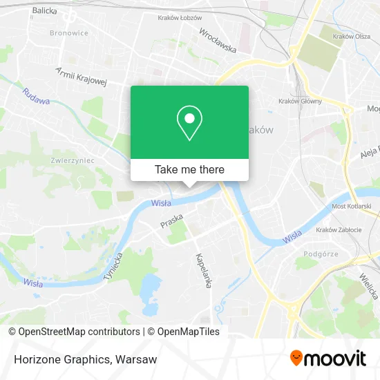
See Horizone Graphics, Warsaw, on the map
Public Transit to Horizone Graphics in Warsaw
Wondering how to get to Horizone Graphics in Warsaw? Moovit helps you find the best way to get to Horizone Graphics with step-by-step directions from the nearest public transit station.
Moovit provides free maps and live directions to help you navigate through your city. View schedules, routes, timetables, and find out how long does it take to get to Horizone Graphics in real time.
Looking for the nearest stop or station to Horizone Graphics? Check out this list of stops closest to your destination: Plac Na Stawach; Salwator; Cracovia Błonia; Cracovia Stadion; Jubilat; Rynek Dębnicki.
Bus: 194, 304, 100, 109, 209, 229, 269, 239, 249, 259, 279, 310, 152, 102, 134, 192, 706, 307, 124, 144, 164, 169, 173.Train: EIP 1304, EIP 8300, KMŁ, TLK 53104.Light Rail: 1, 13.
Want to see if there’s another route that gets you there at an earlier time? Moovit helps you find alternative routes or times. Get directions from and directions to Horizone Graphics easily from the Moovit App or Website.
We make riding to Horizone Graphics easy, which is why over 1.5 million users, including users in Warsaw, trust Moovit as the best app for public transit. You don’t need to download an individual bus app or train app, Moovit is your all-in-one transit app that helps you find the best bus time or train time available.
For information on prices of train, bus and light rail, costs and ride fares to Horizone Graphics, please check the Moovit app.
Use the app to navigate to popular places including to the airport, hospital, stadium, grocery store, mall, coffee shop, school, college, and university.
Horizone Graphics Address: ulica Tadeusza Kościuszki 45, 30-114 Kraków street in Warsaw
- Administracja Nieruchomości,
- Dudek Piotr. Zakład Jubilersko-Grawerski,
- Tadeusza Kościuszki Apartment,
- Masterhair,
- Intertech S C Pawel Malarz Arkadiusz Wegiel,
- Michał Bar Firma Usługowo-Handlowa System,
- Likelink S C A Wlodarczyk J Krol,
- Biuroservice,
- Expander - Integrator It,
- Mocnerowery.pl,
- Singular Polska sp. z o.o. Kraków,
- Związek Pracodawców Usług Rozwojowych i Szkoleniowych Lewiatan,
- Małopolski Związek Pracodawców,
- Dom dla Ciebie s.c. Biuro Projektów,
- Biuroserwis,
- Rotaract Klub Kraków-Wawel,
- M Invest sp. z o.o. Sp.K,
- Koas Sp z o O w Organizacji,
- Kancelaria Radcow Prawnych Sp C Maria Sienko,
- Jan Borowiec
Places Near Horizone Graphics (Warsaw)
- Wołoska, Warsaw,
- Szpital Spartanska, Warsaw,
- Wołoska-Szpital 01, Warsaw,
- Domaniewska, Warsaw,
- Szpital Czerniakowski, Warsaw,
- Banacha - Szpital Kliniczny, Warsaw,
- Szpital Bielański, Warsaw,
- PGE Narodowy, Warsaw,
- Stare Miasto, Warsaw,
- Szaserów - Szpital, Warsaw,
- Torwar, Warsaw,
- Sejm Rp, Warsaw,
- Galeria Mokotów, Warsaw,
- Instytut Kardiologii w Aninie, Warsaw,
- Cmentarz Bródnowski, Warsaw,
- CH Arkadia, Warsaw,
- Szpital Orłowskiego, Warsaw,
- Centralny Szpital Kliniczny MSWiA ul. Wołoska, Warsaw,
- Galeria Północna, Warsaw,
- Postępu, Warsaw
How to get to popular places in Warsaw with public transit
Get around Warsaw by public transit!
Traveling around Warsaw has never been so easy. See step by step directions as you travel to any attraction, street or major public transit station. View bus and train schedules, arrival times, service alerts and detailed routes on a map, so you know exactly how to get to anywhere in Warsaw.
When traveling to any destination around Warsaw use Moovit's Live Directions with Get Off Notifications to know exactly where and how far to walk, how long to wait for your line, and how many stops are left. Moovit will alert you when it's time to get off — no need to constantly re-check whether yours is the next stop.
Wondering how to use public transit in Warsaw or how to pay for public transit in Warsaw? Moovit public transit app can help you navigate your way with public transit easily, and at minimum cost. It includes public transit fees, ticket prices, and costs. Looking for a map of Warsaw public transit lines? Moovit public transit app shows all public transit maps in Warsaw with all Bus, Train, Metro, Light Rail, Ferry and Cable Car routes and stops on an interactive map.
Warsaw has 6 transit type(s), including: Bus, Train, Metro, Light Rail, Ferry and Cable Car, operated by several transit agencies, including Warszawski Transport Publiczny, Warszawska Kolej Dojazdowa, Koleje Mazowieckie, ZTP Kraków, Miasto Piastów, Miasto Ząbki, Koleje Małopolskie, Komunikacja Miejska Łomianki, Gmina Pruszków, MPK Wrocław, MZDiK Radom, UM w Grodzisku Mazowieckim, UM w Nowym Dworze Mazowieckim, UM Płońsk and Koleje Dolnośląskie