Directions to Hot Shade (Worcester County) with public transportation
The following transit lines have routes that pass near Hot Shade
 Bus: CHBB.
How to get to Hot Shade by bus?
Click on the bus route to see step by step directions with maps, line arrival times and updated time schedules.
Bus stop near Hot Shade in Worcester County
- S117- Coastal Hwy at Newport Bay Drive (117th), 1 min walk,VIEW
Bus lines to Hot Shade in Worcester County
- CHBB, ,VIEW
What are the closest stations to Hot Shade?
The closest stations to Hot Shade are:
- S117- Coastal Hwy at Newport Bay Drive (117th) is 52 yards away, 1 min walk.
Which bus line stops near Hot Shade?
CHBB
What’s the nearest bus station to Hot Shade in Worcester County?
The nearest bus station to Hot Shade in Worcester County is S117- Coastal Hwy at Newport Bay Drive (117th). It’s a 1 min walk away.
What time is the first bus to Hot Shade in Worcester County?
The CHBB is the first bus that goes to Hot Shade in Worcester County. It stops nearby at 6:06 AM.
What time is the last bus to Hot Shade in Worcester County?
The CHBB is the last bus that goes to Hot Shade in Worcester County. It stops nearby at 2:33 AM.
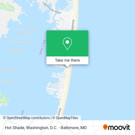
See Hot Shade, Worcester County, on the map
Public Transit to Hot Shade in Worcester County
Wondering how to get to Hot Shade in Worcester County? Moovit helps you find the best way to get to Hot Shade with step-by-step directions from the nearest public transit station.
Moovit provides free maps and live directions to help you navigate through your city. View schedules, routes, timetables, and find out how long does it take to get to Hot Shade in real time.
Looking for the nearest stop or station to Hot Shade? Check out this list of stops closest to your destination: S117- Coastal Hwy at Newport Bay Drive (117th).
Bus: CHBB.
Want to see if there’s another route that gets you there at an earlier time? Moovit helps you find alternative routes or times. Get directions from and directions to Hot Shade easily from the Moovit App or Website.
We make riding to Hot Shade easy, which is why over 1.5 million users, including users in Worcester County, trust Moovit as the best app for public transit. You don’t need to download an individual bus app or train app, Moovit is your all-in-one transit app that helps you find the best bus time or train time available.
For information on prices of bus, costs and ride fares to Hot Shade, please check the Moovit app.
Use the app to navigate to popular places including to the airport, hospital, stadium, grocery store, mall, coffee shop, school, college, and university.
Hot Shade Address: 11513 Coastal Hwy Ocean City, MD 21842 street in Worcester County
- Oyster Bay Shoppes,
- Original Green,
- Jankovic Paul Advertising Agency,
- Tony's Pizza - Ocean City,
- Topgun Water Sports,
- Playa Bowls,
- Flavors of Italy Bistro,
- Fountainhead 702 by Redawning,
- Coastal Delmarva Business Network,
- Beach Real Estate Sales,
- Marco's Pizza,
- RE/MAX,
- Ocean City Hotels,
- Carousel 601,
- Trophies Jet Ski Rentals LLC,
- Beach Therapy - Oc, MD Vacation Rental,
- Fox White Marlin Theatre,
- USPS Collection Box - Blue Box,
- The Patio Bar & Grill,
- Senor Cigar's
Places Near Hot Shade (Worcester County)
- M&T Bank Stadium, Baltimore,
- National Mall, Washington,
- PG Mall, Prince George's County,
- National Museum of African American History and Culture, Washington,
- Sibley Memorial Hospital, Washington,
- National Zoo, Washington,
- Rock Creek Tennis Center, Washington,
- Washington DC VA Medical Center, Washington,
- Basilica of the National Shrine, Washington,
- Camden Yards, Baltimore,
- Marriott Marquis Washington, DC, Washington,
- Capital One Arena, Washington,
- The Anthem, Washington,
- Westfield Montgomery Mall, Montgomery County,
- Washington National Cathedral, Washington,
- Pennsylvania Ave NW (3rd st and pennsylvania), Washington,
- Warner Theatre, Washington,
- Georgetown, Washington,
- Museum Of The Bible, Washington,
- Amazon Hq2, Arlington County
How to get to popular places in Washington, D.C. - Baltimore, MD with public transit
Get around Worcester County by public transit!
Traveling around Worcester County has never been so easy. See step by step directions as you travel to any attraction, street or major public transit station. View bus and train schedules, arrival times, service alerts and detailed routes on a map, so you know exactly how to get to anywhere in Worcester County.
When traveling to any destination around Worcester County use Moovit's Live Directions with Get Off Notifications to know exactly where and how far to walk, how long to wait for your line, and how many stops are left. Moovit will alert you when it's time to get off — no need to constantly re-check whether yours is the next stop.
Wondering how to use public transit in Worcester County or how to pay for public transit in Worcester County? Moovit public transit app can help you navigate your way with public transit easily, and at minimum cost. It includes public transit fees, ticket prices, and costs. Looking for a map of Worcester County public transit lines? Moovit public transit app shows all public transit maps in Worcester County with all Bus, Train, Metro, Light Rail and Ferry routes and stops on an interactive map.
Washington, D.C. - Baltimore, MD has 5 transit type(s), including: Bus, Train, Metro, Light Rail and Ferry, operated by several transit agencies, including WMATA, Montgomery County Ride On, Fairfax Connector, TheBus, PRTC, DASH - Alexandria, Arlington Transit (ART), RTA of Central Maryland, MDOT MTA, MDOT MTA Light RailLink, MDOT MTA Commuter Bus, MDOT MTA Local Bus, FXBGO!, Virginia Railway Express (VRE) and MARC