Directions to Houdain with public transportation
The following transit lines have routes that pass near Houdain
How to get to Houdain by bus?
Click on the bus route to see step by step directions with maps, line arrival times and updated time schedules.
Bus stations near Houdain
- Petite Place, 2 min walk,
- Grand Champ, 3 min walk,
- Marronniers, 3 min walk,
- Mairie, 4 min walk,
- Poste, 4 min walk,
- College Prevert, 8 min walk,
Bus lines to Houdain
- 62, Haut D'Estree,
- 70, Provinces - Quai G,
- 1845, College Saint-François,
- 2411, Resistance,
- B2, Marne,
- 16, Libération,
- 34, Poste,
- 64, Abreuvoir,
- 2531, Mairie,
- 2700, Jean Jaures,
- 2701, Lycee Carnot,
- 2702, Souchez,
What are the closest stations to Houdain?
The closest stations to Houdain are:
- Petite Place is 94 meters away, 2 min walk.
- Grand Champ is 179 meters away, 3 min walk.
- Marronniers is 180 meters away, 3 min walk.
- Mairie is 245 meters away, 4 min walk.
- Poste is 284 meters away, 4 min walk.
- College Prevert is 563 meters away, 8 min walk.
Which bus lines stop near Houdain?
These bus lines stop near Houdain: 32, 34, B2.
What’s the nearest bus stop to Houdain?
The nearest bus stop to Houdain is Petite Place. It’s a 2 min walk away.
What time is the first bus to Houdain?
The 34 is the first bus that goes to Houdain. It stops nearby at 7:02 AM.
What time is the last bus to Houdain?
The B2 is the last bus that goes to Houdain. It stops nearby at 8:36 PM.
See Houdain on the map
Public Transportation to Houdain
Wondering how to get to Houdain, France? Moovit helps you find the best way to get to Houdain with step-by-step directions from the nearest public transit station.
Moovit provides free maps and live directions to help you navigate through your city. View schedules, routes, timetables, and find out how long does it take to get to Houdain in real time.
Looking for the nearest stop or station to Houdain? Check out this list of stops closest to your destination: Petite Place; Grand Champ; Marronniers; Mairie; Poste; College Prevert.
Bus: 32, 34, B2, 62, 70, 1845, 2411, 16, 64, 2531, 2700, 2701, 2702.
Want to see if there’s another route that gets you there at an earlier time? Moovit helps you find alternative routes or times. Get directions from and directions to Houdain easily from the Moovit App or Website.
We make riding to Houdain easy, which is why over 1.5 million users, including users in Lens, trust Moovit as the best app for public transit. You don’t need to download an individual bus app or train app, Moovit is your all-in-one transit app that helps you find the best bus time or train time available.
For information on prices of bus and train, costs and ride fares to Houdain, please check the Moovit app.
Use the app to navigate to popular places including to the airport, hospital, stadium, grocery store, mall, coffee shop, school, college, and university.
Location: Lens
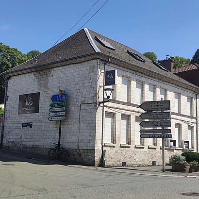
Houdain (French pronunciation: [udɛ̃]) is a commune in the Pas-de-Calais department in the Hauts-de-France region of France.Wiki
Popular routes to Houdain
Popular routes from Houdain
Attractions near Houdain
Place de la Somme,Chez Ma'm,Phigae,Le Voyageur,Cité De La Victoire,Croqalcool,Belle Bougie B,Georges Rybarc,Talia's Kids and Family,Katarzynski Patrick,Caron Freddy,Collège Jacques-Prévert,Winterstein Christian,Szymczewski Perrine,Adele la Fee,Les Fées Terroir,La Machine a C,Cité 35 Des Arbres,Cimetière Du Mont,Courquin HenriHow to get to popular attractions in Lens with public transit
KFC Hénin-Beaumont, Hénin-Beaumont,Mémorial Canadien de Vimy, Givenchy-En-Gohelle,Carrefour Liévin, Liévin,Bois De Carieul, Souchez,Salle Henri Lestoquoy, Camphin-En-Carembault,Résidence Du Village, Mazingarbe,Louvre Lens Vallée,Marche aux Affaires, Sallaumines,Résidence les Charmes, Hénin-Beaumont,Annay-sous-Lens, Annay,Marais d'Estevelles, Pont-À-Vendin,Aire D'Accueil Des Gens Du Voyage, Vermelles,I.U.T. de Béthune, Béthune,Centre De Psychothérapie Les Marronniers, Bully-Les-Mines,Collège Paul Verlaine, Béthune,Auchan, Noyelles-Godault,Espace François Mitterrand, Hénin-Beaumont,P.F. Bridoux, Annezin,Rue du 8 Mai, Haisnes,Auto Ecole Bégard Jeannine, CourrièresGet around Lens by public transit!
Traveling around Lens has never been so easy. See step by step directions as you travel to any attraction, street or major public transit station. View bus and train schedules, arrival times, service alerts and detailed routes on a map, so you know exactly how to get to anywhere in Lens.
When traveling to any destination around Lens use Moovit's Live Directions with Get Off Notifications to know exactly where and how far to walk, how long to wait for your line, and how many stops are left. Moovit will alert you when it's time to get off — no need to constantly re-check whether yours is the next stop.
Wondering how to use public transit in Lens or how to pay for public transit in Lens? Moovit public transit app can help you navigate your way with public transit easily, and at minimum cost. It includes public transit fees, ticket prices, and costs. Looking for a map of Lens public transit lines? Moovit public transit app shows all public transit maps in Lens with all Bus and Train routes and stops on an interactive map.
Lens has 2 transit type(s), including: Bus and Train, operated by several transit agencies, including Tadao, Tadao | Lignes Principales, Tadao | Navettes (Marchés / Centre-ville), Tadao | Lignes Bulles (BHNS), SNCF