Directions to Hsecurity (Tatuquara) with public transportation
The following transit lines have routes that pass near Hsecurity
How to get to Hsecurity by bus?
Click on the bus route to see step by step directions with maps, line arrival times and updated time schedules.
From Rua Omilio Monteiro Soares, Fanny
37 minFrom BR-116, km 125 s/n, Fazenda Rio Grande
39 minFrom BARIGUI CURITIBA, Portão
30 minFrom Rua Senador Accioly Filho, Cic
49 minFrom Terminal Central de Araucária, Araucária
67 minFrom Estação Tubo Santa Bernadethe, Fanny
29 minFrom Avenida Presidente Kennedy, Portão
43 minFrom Bairro Costeira, Araucária
58 minFrom UPA 24h - Unidade de Pronto Atendimento Boqueirão, Boqueirão
62 minFrom Rua Doutor Bley Zornig, Boqueirão
59 min
Bus stops near Hsecurity in Tatuquara
Bus lines to Hsecurity in Tatuquara
- 617 JARDIM LUDOVICA, JARDIM LUDOVICA,VIEW
- 646 POMPÉIA / JANAÍNA, POMPÉIA / JANAÍNA,VIEW
- 655 JARDIM DA ORDEM, JARDIM DA ORDEM,VIEW
- 681 DALAGASSA, DALAGASSA,VIEW
- 679 MAD. TATUQUARA, Terminal Pinheirinho ↺ Tatuquara (Circular),VIEW
- 690 VILA JULIANA, Vila Juliana → Terminal Pinheirinho,VIEW
- 680 RURBANA, Terminal Pinheirinho → Terminal Tatuquara,VIEW
- 684 RIO BONITO, Terminal Pinheirinho → Rio Bonito (via Ludovica),VIEW
- 708 TATUQUARA / SÍTIO CERCADO, Terminal Sítio Cercado → Terminal Tatuquara,VIEW
- X37 SANTA RITA / PINHEIRINHO (SEMI-DIRETO), SANTA RITA / PINHEIRINHO (SEMI-DIRETO),VIEW
- 600 TEQUALY / QUARTEL GENERAL, TEQUALY / QUARTEL GENERAL,VIEW
- 864 TEQUALY , TEQUALY,VIEW
What are the closest stations to Hsecurity?
The closest stations to Hsecurity are:
- R. Antônio Sarote, 235 is 208 meters away, 3 min walk.
- R. Antônio Sarote, 218 is 208 meters away, 3 min walk.
- R. João Batista Bettega Júnior, 380 is 299 meters away, 5 min walk.
- Rua Roberto Ozório de Almeida 15 is 535 meters away, 8 min walk.
Which bus lines stop near Hsecurity?
These bus lines stop near Hsecurity: 617 JARDIM LUDOVICA, 646 POMPÉIA / JANAÍNA, 655 JARDIM DA ORDEM, 708 TATUQUARA / SÍTIO CERCADO, 772 TUPY / JULIANA.
What’s the nearest bus station to Hsecurity in Tatuquara?
The nearest bus stations to Hsecurity in Tatuquara are R. Antônio Sarote, 235 and R. Antônio Sarote, 218. The closest one is a 3 min walk away.
What time is the first bus to Hsecurity in Tatuquara?
The 679 MAD. TATUQUARA is the first bus that goes to Hsecurity in Tatuquara. It stops nearby at 3:51 AM.
What time is the last bus to Hsecurity in Tatuquara?
The 679 MAD. TATUQUARA is the last bus that goes to Hsecurity in Tatuquara. It stops nearby at 2:17 AM.
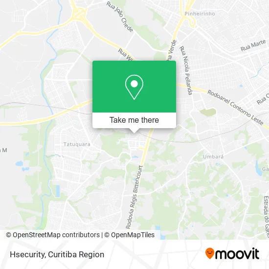
See Hsecurity, Tatuquara, on the map
Public Transit to Hsecurity in Tatuquara
Wondering how to get to Hsecurity in Tatuquara? Moovit helps you find the best way to get to Hsecurity with step-by-step directions from the nearest public transit station.
Moovit provides free maps and live directions to help you navigate through your city. View schedules, routes, timetables, and find out how long does it take to get to Hsecurity in real time.
Looking for the nearest stop or station to Hsecurity? Check out this list of stops closest to your destination: R. Antônio Sarote; R. Antônio Sarote; R. João Batista Bettega Júnior; Rua Roberto Ozório de Almeida 15.
Bus: 617 JARDIM LUDOVICA, 646 POMPÉIA / JANAÍNA, 655 JARDIM DA ORDEM, 708 TATUQUARA / SÍTIO CERCADO, 772 TUPY / JULIANA, 679 MAD. TATUQUARA, 690 VILA JULIANA, 681 DALAGASSA, 680 RURBANA, 684 RIO BONITO, X37 SANTA RITA / PINHEIRINHO (SEMI-DIRETO), 600 TEQUALY / QUARTEL GENERAL, 864 TEQUALY .
Want to see if there’s another route that gets you there at an earlier time? Moovit helps you find alternative routes or times. Get directions from and directions to Hsecurity easily from the Moovit App or Website.
We make riding to Hsecurity easy, which is why over 1.5 million users, including users in Tatuquara, trust Moovit as the best app for public transit. You don’t need to download an individual bus app or train app, Moovit is your all-in-one transit app that helps you find the best bus time or train time available.
For information on prices of bus, costs and ride fares to Hsecurity, please check the Moovit app.
Use the app to navigate to popular places including to the airport, hospital, stadium, grocery store, mall, coffee shop, school, college, and university.
Hsecurity Address: Rua João Sarot, 335 Tatuquara Curitiba-PR 81480-130 street in Tatuquara
- Rua João Sarot,
- Denelu Transportes,
- Mercado São Lourenço,
- Rua Antônio Sarote 81,
- Karolina Ferreira Ltda,
- Cris Burguer Lanches,
- Josemir Soares,
- Help Dri Limpezas,
- Antonio Carlos Vireira Junior,
- Jo Marmitex,
- Paróquia Santana,
- Gtdistribuidora,
- Josi Tupperware,
- Dentvida Pompeia,
- Dumom Cabeleireiro,
- Dm Repair Acessorios Para Celular Ltda,
- Leo Costura,
- Rua João Batista Bettega Júnior 414,
- Cãmbio Verde - Cachimba,
- Jardim Supermercado
Places Near Hsecurity (Tatuquara)
- Hospital Angelina Caron, Campina Grande Do Sul,
- Rua General Mário Tourinho, Campina Do Siqueira,
- Hospital Madalena Sofia, Bairro Alto,
- Pontifícia Universidade Católica do Paraná (PUCPR), Prado Velho,
- Shopping Estação, Rebouças,
- Rua Martim Afonso 558, Mercês,
- Shopping Palladium, Portão,
- Hospital Nossa Senhora Das Graças, Mercês,
- Hospital de Clínicas (HC - UFPR), Centro,
- Jardim Botânico de Curitiba PR, Centro,
- Hospital Da Cruz Vermelha, Batel,
- Campo Largo, Campo,
- Jockey Plaza Shopping Center, Tarumã,
- Hospital do Rocio, Campo,
- Hhhhh, Fazendinha,
- Arena Da Baixada - Curitiba,
- Park Shopping Barigüi, Mossunguê,
- Parque Barigui, Mercês,
- Hospital Universitário Evangélico de Curitiba, Bigorrilho,
- Hospital Erasto Gaertner, Jardim Das Américas
How to get to popular places in Curitiba Region with public transit
Get around Tatuquara by public transit!
Traveling around Tatuquara has never been so easy. See step by step directions as you travel to any attraction, street or major public transit station. View bus and train schedules, arrival times, service alerts and detailed routes on a map, so you know exactly how to get to anywhere in Tatuquara.
When traveling to any destination around Tatuquara use Moovit's Live Directions with Get Off Notifications to know exactly where and how far to walk, how long to wait for your line, and how many stops are left. Moovit will alert you when it's time to get off — no need to constantly re-check whether yours is the next stop.
Wondering how to use public transit in Tatuquara or how to pay for public transit in Tatuquara? Moovit public transit app can help you navigate your way with public transit easily, and at minimum cost. It includes public transit fees, ticket prices, and costs. Looking for a map of Tatuquara public transit lines? Moovit public transit app shows all public transit maps in Tatuquara with all Bus and Cable Car routes and stops on an interactive map.
Curitiba Region has 2 transit type(s), including: Bus and Cable Car, operated by several transit agencies, including Sistema Integrado de Mobilidade (URBS), Sistema Integrado de Mobilidade (AMEP), URBS (Cartões bancários e Dinheiro), URBS (Cartões bancários / Cartão URBS), AMEP (Cartões bancários / Cartão MetroCard), AMEP (Cartões bancários / Cartão MetroCard / Dinheiro), Viação Colombo (Dinheiro), TRIAR (Cartão TRIAR / Dinheiro), Empresa Curitiba Cerro Azul (Dinheiro), Expresso Nossa Senhora da Penha (Dinheiro), Empresa Campo Alto Tijucas (Dinheiro), Auto Viação São José (Cartão VEM / Dinheiro), BRT S/A (Cartão VEM / Dinheiro), TransPiedade (Cartão Cidadão / Dinheiro) and Oceânica Sul (Cartão Transporte / Dinheiro)