How to get to Huber Group by bus?
Click on the bus route to see step by step directions with maps, line arrival times and updated time schedules.
From Esenler Dörtyol Meydanı, Esenler
85 minFrom Atışalanı, Esenler
50 minFrom Esenler Otogarı Metro, Esenler
83 minFrom ESENLER, Sultangazi
84 minFrom İstanbul, Güngören
101 minFrom Bakırköy Prof. Dr. Mazhar Osman Ruh Sağ. Ve Sinir Hast. Eğt. Ve Araş. Hastanesi, Bahçelievler
66 minFrom Starcity AVM, Bahçelievler
68 minFrom İstanbul Florya Sahil, Bakirköy
87 minFrom Şehit Piyade Uzman Çavuş Ahmet Öztürk Kışlası, Arnavutkoy
100 min
How to get to Huber Group by metro?
Click on the metro route to see step by step directions with maps, line arrival times and updated time schedules.
Bus stops near Huber Group in Basaksehir
Metro station near Huber Group in Basaksehir
- Ziya Gökalp Mahallesi, 8 min walk,VIEW
Dolmus & Minibus stations near Huber Group in Basaksehir
Bus lines to Huber Group in Basaksehir
- A31, Şirinevler,VIEW
- A35, Aymakoop,VIEW
- A46, Başakşehir,VIEW
- A47, Kayaşehir,VIEW
- MK19, Ayazma Siteleri-Arenapark / Ring,VIEW
- 78ZB, Fenertepe Peronlar-Zeytinburnu,VIEW
- 78Ş, Aşık Veysel Caddesi-Fenertepe Peronlar,VIEW
- 79Ş, Dolapdere Sanayi Sitesi-İgtot,VIEW
- 98, Bakırköy-Fenertepe Peronlar,VIEW
- 98KM, Fenertepe Peronlar-Fenertepe Yolu,VIEW
- 143, İstoç-Mehmet Akif İnan İmam Hatip Ortaokulu,VIEW
- 76O, Cihangir Mahallesi-Otogar,VIEW
- 31Y, A Kapısı-Yenikapı Etkinlik Alanı,VIEW
What are the closest stations to Huber Group?
The closest stations to Huber Group are:
- Keresteciler Sitesi - İkitelli Garajı Yönü is 435 meters away, 6 min walk.
- Elektrik Kurumu - Bakırköy-Başakşehir Yönü is 499 meters away, 7 min walk.
- Ziya Gökalp Mahallesi is 603 meters away, 8 min walk.
- Emlak Konut Ayazma İlkokulu - Ziya Gökalp Metro Yönü is 801 meters away, 11 min walk.
- Tem Yolu is 864 meters away, 12 min walk.
- Süleyman Demirel Bulvarı - B.Şehir-Masko Yönü is 1636 meters away, 21 min walk.
Which bus lines stop near Huber Group?
These bus lines stop near Huber Group: 141M, 146T, 76O, 98, 98H.
Which metro line stops near Huber Group?
M9 (Ataköy > Olimpiyat)
Which Dolmus & Minibus lines stop near Huber Group?
These Dolmus & Minibus lines stop near Huber Group: A35, A46.
What’s the nearest metro station to Huber Group in Basaksehir?
The nearest metro station to Huber Group in Basaksehir is Ziya Gökalp Mahallesi. It’s a 8 min walk away.
What’s the nearest bus station to Huber Group in Basaksehir?
The nearest bus station to Huber Group in Basaksehir is Keresteciler Sitesi - İkitelli Garajı Yönü. It’s a 6 min walk away.
What’s the nearest Dolmus & Minibus station to Huber Group in Basaksehir?
The nearest Dolmus & Minibus station to Huber Group in Basaksehir is Tem Yolu. It’s a 12 min walk away.
What time is the first metro to Huber Group in Basaksehir?
The M9 is the first metro that goes to Huber Group in Basaksehir. It stops nearby at 6:02 AM.
What time is the last metro to Huber Group in Basaksehir?
The M9 is the last metro that goes to Huber Group in Basaksehir. It stops nearby at 12:24 AM.
What time is the first bus to Huber Group in Basaksehir?
The 98 is the first bus that goes to Huber Group in Basaksehir. It stops nearby at 6:14 AM.
What time is the last bus to Huber Group in Basaksehir?
The 98 is the last bus that goes to Huber Group in Basaksehir. It stops nearby at 1:16 AM.
What time is the first Dolmus & Minibus to Huber Group in Basaksehir?
The A35 is the first Dolmus & Minibus that goes to Huber Group in Basaksehir. It stops nearby at 5:20 AM.
What time is the last Dolmus & Minibus to Huber Group in Basaksehir?
The A46 is the last Dolmus & Minibus that goes to Huber Group in Basaksehir. It stops nearby at 1:25 AM.
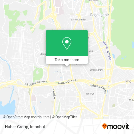
See Huber Group, Basaksehir, on the map
Public Transit to Huber Group in Basaksehir
Wondering how to get to Huber Group in Basaksehir? Moovit helps you find the best way to get to Huber Group with step-by-step directions from the nearest public transit station.
Moovit provides free maps and live directions to help you navigate through your city. View schedules, routes, timetables, and find out how long does it take to get to Huber Group in real time.
Looking for the nearest stop or station to Huber Group? Check out this list of stops closest to your destination: Keresteciler Sitesi - İkitelli Garajı Yönü; Elektrik Kurumu - Bakırköy-Başakşehir Yönü; Ziya Gökalp Mahallesi; Emlak Konut Ayazma İlkokulu - Ziya Gökalp Metro Yönü; Tem Yolu; Süleyman Demirel Bulvarı - B.Şehir-Masko Yönü.
Bus: 141M, 146T, 76O, 98, 98H, A31, A35, A46, A47, MK19, 31Y.Metro: M9.Dolmus & Minibus: A35, A46, A47, A48, A215, 78B, 146M.
Want to see if there’s another route that gets you there at an earlier time? Moovit helps you find alternative routes or times. Get directions from and directions to Huber Group easily from the Moovit App or Website.
We make riding to Huber Group easy, which is why over 1.5 million users, including users in Basaksehir, trust Moovit as the best app for public transit. You don’t need to download an individual bus app or train app, Moovit is your all-in-one transit app that helps you find the best bus time or train time available.
For information on prices of metro, bus, Dolmus & Minibus and Metrobus, costs and ride fares to Huber Group, please check the Moovit app.
Use the app to navigate to popular places including to the airport, hospital, stadium, grocery store, mall, coffee shop, school, college, and university.
Huber Group Address: Keresteciler Sanayi Sitesi, 34490 İkitelli OSB, Başakşehir street in Basaksehir
- Dekor Kapak,
- Duşlar Ebatlama,
- Metin Kaplama Orman Ürünleri,
- Yener Çelik Laboratuvar ve Büro Mobilyaları,
- Soyçinar Ticaret & Duroband Limited Şti.,
- Serkan Kuaför,
- Akbaş Mobilya Aksesuarları,
- Alkan Vernik,
- Karıncalar Insaat,
- Deck Dünyası,
- Burawall Duvar Kağıtları,
- Ziya Gökalp Mahallesi,
- Keresteciler Sanayi Sitesi, Cami Pasajı 35,
- Starwood Yapi Market,
- Argestar Mobilya ve Dekorasyon Aksesuarları,
- Enfes Köfte,
- Keresteciler Sanayi Sitesi,
- Adokapı-Karıncalar,
- Kanatlar Parke,
- İkitelli Keresteciler Sitesi
Places Near Huber Group (Basaksehir)
- Tersane İstanbul, Beyoğlu,
- İstanbul,
- Karaköy Genelevi, Karaköy, Beyoğlu,
- METROPOL IsTaNBuL, Ataşehir,
- Topkule Kışlası 47.Komando Tugay Komutanlığı, Esenler,
- İstinye Park, Sariyer,
- 41 Burda AVM, Kocaeli Merkezi,
- 2 Nolu Minibüss, Beylikduzu,
- Başakşehir Çam Ve Sakura Şehir Hastanesi, Basaksehir,
- Hilltown AVM, Maltepe,
- Mehmet Emin Tokadî Hz. Türbesi, Fatih,
- VİALAND AVM, Eyüp,
- Gebze Koop Durağı, Gebze,
- Beylikdüzü - 4 Nolu Minibüs Hattı, Beylikduzu,
- Hz. Yuşa Tepesi, Beykoz,
- Mall Of İstanbul, Basaksehir,
- Bakırköy Sosyete Pazarı, Bakirköy,
- Şehit Prof. Dr. İlhan Varank Eğitim Ve Araştırma Hastanesi, Sancaktepe,
- Gebze-Harem Minibüs Hattı, Gebze,
- 212 AVM, Bagcilar
How to get to popular places in Istanbul with public transit
Get around Basaksehir by public transit!
Traveling around Basaksehir has never been so easy. See step by step directions as you travel to any attraction, street or major public transit station. View bus and train schedules, arrival times, service alerts and detailed routes on a map, so you know exactly how to get to anywhere in Basaksehir.
When traveling to any destination around Basaksehir use Moovit's Live Directions with Get Off Notifications to know exactly where and how far to walk, how long to wait for your line, and how many stops are left. Moovit will alert you when it's time to get off — no need to constantly re-check whether yours is the next stop.
Wondering how to use public transit in Basaksehir or how to pay for public transit in Basaksehir? Moovit public transit app can help you navigate your way with public transit easily, and at minimum cost. It includes public transit fees, ticket prices, and costs. Looking for a map of Basaksehir public transit lines? Moovit public transit app shows all public transit maps in Basaksehir with all Bus, Train, Metro, Tram, Ferry, Metrobus and Dolmus & Minibus routes and stops on an interactive map.
Istanbul has 7 transit type(s), including: Bus, Train, Metro, Tram, Ferry, Metrobus and Dolmus & Minibus, operated by several transit agencies, including Marmaray, Metro İstanbul, Metrobüs, UAB, İETT, İETT ÇIFT KATLI HATLAR, İETT BÖLGESEL HATLAR, TCDD, Şehir Hatları, Dentur Avrasya, Beyden, Turyol, Mavi Marmara, Havaist and Prenstur
