Directions to Humble & Wallop (Baltimore) with public transportation
The following transit lines have routes that pass near Humble & Wallop
 Bus: 21, 94, CITYLINK GOLD, 22.
- Train: NORTHEAST REGIONAL.
- Metro: METRO.
How to get to Humble & Wallop by bus?
Click on the bus route to see step by step directions with maps, line arrival times and updated time schedules.
From Nick's Fish House, Baltimore
51 minFrom Ravens Walk @ M&T Bank Stadium, Baltimore
41 minFrom University Of Maryland Baltimore (Umbc), Baltimore County
83 minFrom Inner Harbor, Baltimore
31 minFrom I-695 @ Exit 18 (Liberty Rd/MD 26), Baltimore County
58 minFrom Bwi2 Employee Shuttles, Baltimore
51 minFrom Johns Hopkins Medicine at Green Spring Station, Baltimore County
33 minFrom Walmart, Baltimore County
75 minFrom Patterson Park, Baltimore
44 minFrom B&O Railroad Museum, Baltimore
33 min
How to get to Humble & Wallop by train?
Click on the train route to see step by step directions with maps, line arrival times and updated time schedules.
How to get to Humble & Wallop by metro?
Click on the metro route to see step by step directions with maps, line arrival times and updated time schedules.
Bus stops near Humble & Wallop in Baltimore
Light Rail stations near Humble & Wallop in Baltimore
- Woodberry, 29 min walk,VIEW
Metro station near Humble & Wallop in Baltimore
- Mondawmin Metro, 58 min walk,VIEW
Bus lines to Humble & Wallop in Baltimore
What are the closest stations to Humble & Wallop?
The closest stations to Humble & Wallop are:
- 36th St & Falls Rd Wb is 105 yards away, 2 min walk.
- 36th St & Roland Ave Wb is 107 yards away, 2 min walk.
- Due 36th & Poole is 393 yards away, 5 min walk.
- Woodberry is 2402 yards away, 29 min walk.
- Mondawmin Metro is 4910 yards away, 58 min walk.
Which bus lines stop near Humble & Wallop?
These bus lines stop near Humble & Wallop: 21, 94.
Which train line stops near Humble & Wallop?
NORTHEAST REGIONAL (Springfield)
Which metro line stops near Humble & Wallop?
METRO (Towards Owing Mills)
What’s the nearest light rail station to Humble & Wallop in Baltimore?
The nearest light rail station to Humble & Wallop in Baltimore is Woodberry. It’s a 29 min walk away.
What’s the nearest bus station to Humble & Wallop in Baltimore?
The nearest bus stations to Humble & Wallop in Baltimore are 36th St & Falls Rd Wb and 36th St & Roland Ave Wb. The closest one is a 2 min walk away.
What time is the first light rail to Humble & Wallop in Baltimore?
The LIGHT RAILLINK is the first light rail that goes to Humble & Wallop in Baltimore. It stops nearby at 3:42 AM.
What time is the last light rail to Humble & Wallop in Baltimore?
The LIGHT RAILLINK is the last light rail that goes to Humble & Wallop in Baltimore. It stops nearby at 1:30 AM.
What time is the first metro to Humble & Wallop in Baltimore?
The METRO is the first metro that goes to Humble & Wallop in Baltimore. It stops nearby at 5:01 AM.
What time is the last metro to Humble & Wallop in Baltimore?
The METRO is the last metro that goes to Humble & Wallop in Baltimore. It stops nearby at 12:16 AM.
What time is the first bus to Humble & Wallop in Baltimore?
The 94 is the first bus that goes to Humble & Wallop in Baltimore. It stops nearby at 3:58 AM.
What time is the last bus to Humble & Wallop in Baltimore?
The 94 is the last bus that goes to Humble & Wallop in Baltimore. It stops nearby at 2:47 AM.
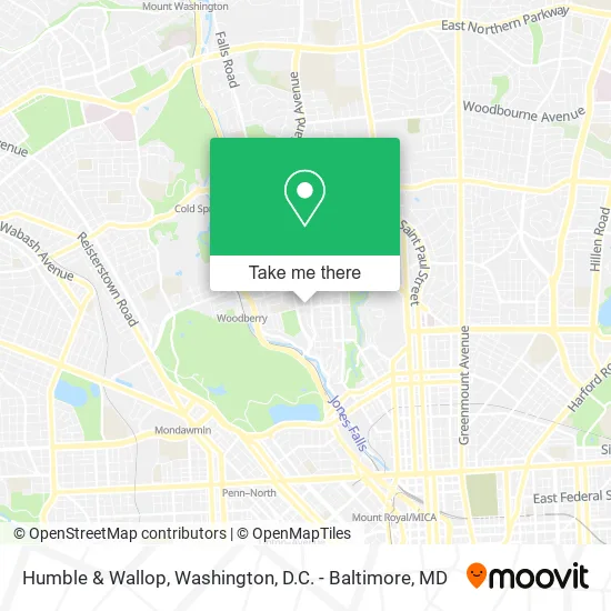
See Humble & Wallop, Baltimore, on the map
Public Transit to Humble & Wallop in Baltimore
Wondering how to get to Humble & Wallop in Baltimore? Moovit helps you find the best way to get to Humble & Wallop with step-by-step directions from the nearest public transit station.
Moovit provides free maps and live directions to help you navigate through your city. View schedules, routes, timetables, and find out how long does it take to get to Humble & Wallop in real time.
Looking for the nearest stop or station to Humble & Wallop? Check out this list of stops closest to your destination: 36th St & Falls Rd Wb; 36th St & Roland Ave Wb; Due 36th & Poole; Woodberry; Mondawmin Metro.
Bus: 21, 94, CITYLINK GOLD, 22.Train: NORTHEAST REGIONAL.Metro: METRO.
Want to see if there’s another route that gets you there at an earlier time? Moovit helps you find alternative routes or times. Get directions from and directions to Humble & Wallop easily from the Moovit App or Website.
We make riding to Humble & Wallop easy, which is why over 1.5 million users, including users in Baltimore, trust Moovit as the best app for public transit. You don’t need to download an individual bus app or train app, Moovit is your all-in-one transit app that helps you find the best bus time or train time available.
For information on prices of bus, train, light rail and metro, costs and ride fares to Humble & Wallop, please check the Moovit app.
Use the app to navigate to popular places including to the airport, hospital, stadium, grocery store, mall, coffee shop, school, college, and university.
Humble & Wallop Address: 1014 W 36th St Baltimore, MD 21211 street in Baltimore
- Orange Moon SSS,
- Educators Financial Group,
- Orinoco Construction,
- Therataxis,
- Kanevale Management,
- Bizzybee Mobile Phlebotomy Company,
- Bob Marousek,
- Jovial Properties,
- City Chic Real Estate,
- Arctic Realm,
- Intouch CPR Certification Classes Baltimore,
- Creative Think Tank,
- Elision Solutions,
- Theec,
- Ainsley,
- Therapy for Black Women,
- PDRC International Inc.,
- Boots in Baltimore,
- Dragonfly Digital Marketing,
- Maryland Port Administration Railroad Access Security
Places Near Humble & Wallop (Baltimore)
- National Mall, Washington,
- Camden Yards, Baltimore,
- Washington DC VA Medical Center, Washington,
- Capital One Arena, Washington,
- Georgetown, Washington,
- Sibley Memorial Hospital, Washington,
- Basilica of the National Shrine, Washington,
- Rock Creek Tennis Center, Washington,
- National Zoo, Washington,
- PG Mall, Prince George's County,
- The Anthem, Washington,
- Pennsylvania Ave NW (3rd st and pennsylvania), Washington,
- Museum Of The Bible, Washington,
- National Museum of African American History and Culture, Washington,
- Warner Theatre, Washington,
- Westfield Montgomery Mall, Montgomery County,
- Marriott Marquis Washington, DC, Washington,
- M&T Bank Stadium, Baltimore,
- Washington National Cathedral, Washington,
- Amazon Hq2, Arlington County
How to get to popular places in Washington, D.C. - Baltimore, MD with public transit
Get around Baltimore by public transit!
Traveling around Baltimore has never been so easy. See step by step directions as you travel to any attraction, street or major public transit station. View bus and train schedules, arrival times, service alerts and detailed routes on a map, so you know exactly how to get to anywhere in Baltimore.
When traveling to any destination around Baltimore use Moovit's Live Directions with Get Off Notifications to know exactly where and how far to walk, how long to wait for your line, and how many stops are left. Moovit will alert you when it's time to get off — no need to constantly re-check whether yours is the next stop.
Wondering how to use public transit in Baltimore or how to pay for public transit in Baltimore? Moovit public transit app can help you navigate your way with public transit easily, and at minimum cost. It includes public transit fees, ticket prices, and costs. Looking for a map of Baltimore public transit lines? Moovit public transit app shows all public transit maps in Baltimore with all Bus, Train, Metro, Light Rail and Ferry routes and stops on an interactive map.
Washington, D.C. - Baltimore, MD has 5 transit type(s), including: Bus, Train, Metro, Light Rail and Ferry, operated by several transit agencies, including WMATA, Montgomery County Ride On, Fairfax Connector, TheBus, PRTC, DASH - Alexandria, Arlington Transit (ART), RTA of Central Maryland, MDOT MTA, MDOT MTA Light RailLink, MDOT MTA Commuter Bus, MDOT MTA Local Bus, FXBGO!, Virginia Railway Express (VRE) and MARC