Directions to Hunt & Chase Trading (Tazewell County) with public transportation
The following transit lines have routes that pass near Hunt & Chase Trading
Bus stops near Hunt & Chase Trading in Tazewell County
Bus lines to Hunt & Chase Trading in Tazewell County
- Weimer Remodeling & Tile,
- Chicory Cottage Design,
- L&M Building and Remodeling,
- Pixies Salon,
- Lena's Beauty Shop,
- Logan Street School,
- Schools,
- Champion Dent Craft,
- Bedford Well Drilling,
- St Mary's Episcopal Church,
- Veterans Memorial,
- Bluestone Interiors,
- Town Park,
- Jen Raley Photography,
- Wvva Net,
- Bluefield,
- Oakwood Scientific Laboratory,
- New Graham Pharmacy,
- Frank Blankenship Properties & Electrical,
- Bluefield Virginia Rescue Squad
Places Near Hunt & Chase Trading (Tazewell County)
- Pennsylvania Ave NW (3rd st and pennsylvania), Washington,
- Rock Creek Tennis Center, Washington,
- Museum Of The Bible, Washington,
- PG Mall, Prince George's County,
- Amazon Hq2, Arlington County,
- Capital One Arena, Washington,
- Camden Yards, Baltimore,
- M&T Bank Stadium, Baltimore,
- National Zoo, Washington,
- Basilica of the National Shrine, Washington,
- Westfield Montgomery Mall, Montgomery County,
- Sibley Memorial Hospital, Washington,
- Warner Theatre, Washington,
- Marriott Marquis Washington, DC, Washington,
- National Mall, Washington,
- Washington DC VA Medical Center, Washington,
- National Museum of African American History and Culture, Washington,
- Washington National Cathedral, Washington,
- The Anthem, Washington,
- Georgetown, Washington
How to get to popular places in Washington, D.C. - Baltimore, MD with public transit
What are the closest stations to Hunt & Chase Trading?
The closest stations to Hunt & Chase Trading are:
- 427 Virginia Ave at Treasury Office is 829 yards away, 10 min walk.
- Bluefield-Underpass Near Crescentview Apts is 1429 yards away, 17 min walk.
- 3 Gurney St at Bluefield Transit is 1532 yards away, 18 min walk.
Which bus line stops near Hunt & Chase Trading?
GREYHOUND US0140 (Detroit Bus Station)
What’s the nearest bus station to Hunt & Chase Trading in Tazewell County?
The nearest bus station to Hunt & Chase Trading in Tazewell County is 427 Virginia Ave at Treasury Office. It’s a 10 min walk away.
What time is the first bus to Hunt & Chase Trading in Tazewell County?
The SWVCC EAGLE EXPRESS TAZEWELL COUNTY is the first bus that goes to Hunt & Chase Trading in Tazewell County. It stops nearby at 6:00 AM.
What time is the last bus to Hunt & Chase Trading in Tazewell County?
The SWVCC EAGLE EXPRESS TAZEWELL COUNTY is the last bus that goes to Hunt & Chase Trading in Tazewell County. It stops nearby at 6:15 PM.
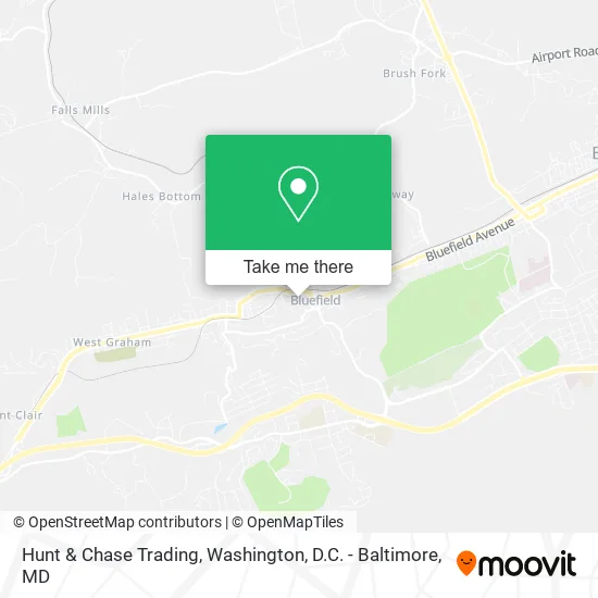
See Hunt & Chase Trading, Tazewell County, on the map
Public Transit to Hunt & Chase Trading in Tazewell County
Wondering how to get to Hunt & Chase Trading in Tazewell County? Moovit helps you find the best way to get to Hunt & Chase Trading with step-by-step directions from the nearest public transit station.
Moovit provides free maps and live directions to help you navigate through your city. View schedules, routes, timetables, and find out how long does it take to get to Hunt & Chase Trading in real time.
Looking for the nearest stop or station to Hunt & Chase Trading? Check out this list of stops closest to your destination: 427 Virginia Ave at Treasury Office; Bluefield-Underpass Near Crescentview Apts; 3 Gurney St at Bluefield Transit.
Bus: GREYHOUND US0140, GOLD, MAIN, SWVCC EAGLE EXPRESS TAZEWELL COUNTY, POCAHONTAS.
Want to see if there’s another route that gets you there at an earlier time? Moovit helps you find alternative routes or times. Get directions from and directions to Hunt & Chase Trading easily from the Moovit App or Website.
We make riding to Hunt & Chase Trading easy, which is why over 1.5 million users, including users in Tazewell County, trust Moovit as the best app for public transit. You don’t need to download an individual bus app or train app, Moovit is your all-in-one transit app that helps you find the best bus time or train time available.
For information on prices of bus and train, costs and ride fares to Hunt & Chase Trading, please check the Moovit app.
Use the app to navigate to popular places including to the airport, hospital, stadium, grocery store, mall, coffee shop, school, college, and university.
Hunt & Chase Trading Address: Franklin St Bluefield, VA 24605 street in Tazewell County
Get around Tazewell County by public transit!
Traveling around Tazewell County has never been so easy. See step by step directions as you travel to any attraction, street or major public transit station. View bus and train schedules, arrival times, service alerts and detailed routes on a map, so you know exactly how to get to anywhere in Tazewell County.
When traveling to any destination around Tazewell County use Moovit's Live Directions with Get Off Notifications to know exactly where and how far to walk, how long to wait for your line, and how many stops are left. Moovit will alert you when it's time to get off — no need to constantly re-check whether yours is the next stop.
Wondering how to use public transit in Tazewell County or how to pay for public transit in Tazewell County? Moovit public transit app can help you navigate your way with public transit easily, and at minimum cost. It includes public transit fees, ticket prices, and costs. Looking for a map of Tazewell County public transit lines? Moovit public transit app shows all public transit maps in Tazewell County with all Bus, Train, Metro, Light Rail and Ferry routes and stops on an interactive map.
Washington, D.C. - Baltimore, MD has 5 transit type(s), including: Bus, Train, Metro, Light Rail and Ferry, operated by several transit agencies, including WMATA, Montgomery County Ride On, Fairfax Connector, TheBus, PRTC, DASH - Alexandria, Arlington Transit (ART), RTA of Central Maryland, MDOT MTA, MDOT MTA Light RailLink, MDOT MTA Commuter Bus, MDOT MTA Local Bus, FXBGO!, Virginia Railway Express (VRE) and MARC