How to get to Hunter Locators by bus?
Click on the bus route to see step by step directions with maps, line arrival times and updated time schedules.
From Fort Wayne VA Medical Center, Fort Wayne
108 minFrom Living Faith Chapel, Fort Wayne
58 minFrom 1900 N Clinton Parking, Fort Wayne
68 minFrom Mary A Price, Fort Wayne
65 minFrom Kristen Varian Psyd, Fort Wayne
85 minFrom Integrity Physical Therapy, Fort Wayne
38 minFrom Ra Drywall Services, Fort Wayne
82 minFrom Sidra Mukhtar MD, Fort Wayne
72 minFrom St Joe Place, Fort Wayne
94 minFrom Chimney 1, Fort Wayne
72 min
Bus stop near Hunter Locators in Fort Wayne
- Dupont And Coldwater Rd. (Nb), 3 min walk,VIEW
Bus lines to Hunter Locators in Fort Wayne
- 21, Prmc Entrance 1,VIEW
What are the closest stations to Hunter Locators?
The closest stations to Hunter Locators are:
- Dupont And Coldwater Rd. (Nb) is 236 yards away, 3 min walk.
Which bus lines stop near Hunter Locators?
These bus lines stop near Hunter Locators: 15PM, 21GC.
What’s the nearest bus station to Hunter Locators in Fort Wayne?
The nearest bus station to Hunter Locators in Fort Wayne is Dupont And Coldwater Rd. (Nb). It’s a 3 min walk away.
What time is the first bus to Hunter Locators in Fort Wayne?
The 21GC is the first bus that goes to Hunter Locators in Fort Wayne. It stops nearby at 6:45 AM.
What time is the last bus to Hunter Locators in Fort Wayne?
The 21GC is the last bus that goes to Hunter Locators in Fort Wayne. It stops nearby at 8:00 PM.
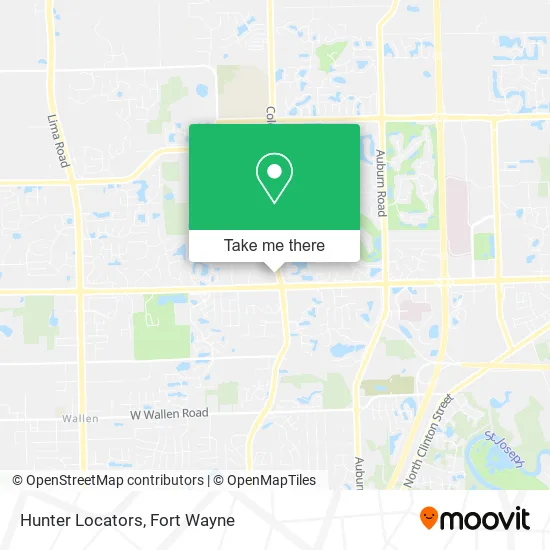
See Hunter Locators, Fort Wayne, on the map
Public Transit to Hunter Locators in Fort Wayne
Wondering how to get to Hunter Locators in Fort Wayne? Moovit helps you find the best way to get to Hunter Locators with step-by-step directions from the nearest public transit station.
Moovit provides free maps and live directions to help you navigate through your city. View schedules, routes, timetables, and find out how long does it take to get to Hunter Locators in real time.
Looking for the nearest stop or station to Hunter Locators? Check out this list of stops closest to your destination: Dupont And Coldwater Rd. (Nb).
Bus: 15PM, 21GC, 21.
Want to see if there’s another route that gets you there at an earlier time? Moovit helps you find alternative routes or times. Get directions from and directions to Hunter Locators easily from the Moovit App or Website.
We make riding to Hunter Locators easy, which is why over 1.5 million users, including users in Fort Wayne, trust Moovit as the best app for public transit. You don’t need to download an individual bus app or train app, Moovit is your all-in-one transit app that helps you find the best bus time or train time available.
For information on prices of bus, costs and ride fares to Hunter Locators, please check the Moovit app.
Get to Hunter Locators with public transit and pay for the ride in the Moovit app. In addition to all info you may need for your trip to Hunter Locators, including live directions, real-time arrivals and fare prices, you can also buy public transit passes for your rides. No need for cash or paper tickets to get to Hunter Locators - everything you need is accessible in the app with a click of the button.
Use the app to navigate to popular places including to the airport, hospital, stadium, grocery store, mall, coffee shop, school, college, and university.
Hunter Locators Address: 619 E Dupont Rd Fort Wayne, IN 46825 street in Fort Wayne
- Personnel Profilers,
- AAA Electric,
- Lasater Institute,
- E Dupont Rd,
- Coinstar - Bitcoin ATM,
- Kroger's at Dupont Village, 601 E. Dupont Rd.,
- Larry King, 1st Source Mortgage, NMLSR#,
- Connor,
- Integrity Insurance & Financial Services,
- Aging and Disabled Home Health,
- Your Hometown Mortgage Lender,
- Salkeld Family Dental,
- Rivers Relaxation,
- Berner & Company,
- Electric Heat Treatment Management Company,
- Village Chiropractic,
- Mainstream Mortgage,
- Coldwater Rd. Office,
- Social Accounts Sprite,
- Just Sue Graphic Design
Places Near Hunter Locators (Fort Wayne)
- Parkview North Hospital,
- Fort Wayne International Airport (FWA) (Fort Wayne International Airport), Fort Wayne,
- Citilink Bus 10 (New Haven), Fort Wayne,
- Fort Wayne International Airport, Fort Wayne,
- Parkview Hospital Parking Garage, Fort Wayne,
- Dupont Hospital, Fort Wayne,
- Sweetwater Sound, Fort Wayne,
- Parkview Randallia Infusion Center, Fort Wayne,
- South Side Baseball - Derbyshire Field,
- Lima Rd / W Coliseum Blvd, Fort Wayne,
- german Roasted Nuts Stand (Glenbrook Mall), Fort Wayne,
- Trine University, Fort Wayne,
- Walmart Supercenter, Fort Wayne,
- Parkview Regional Medical Center,
- North Side High School, Fort Wayne,
- Aunt Gena's Sweet Corn,
- Lutheran Hospital, Fort Wayne,
- Jefferson Pointe, Fort Wayne,
- Illinois Road & Hadley Road Intersection, Fort Wayne,
- Lutheran Ministries Media, Fort Wayne
How to get to popular places in Fort Wayne with public transit
Get around Fort Wayne by public transit!
Traveling around Fort Wayne has never been so easy. See step by step directions as you travel to any attraction, street or major public transit station. View bus and train schedules, arrival times, service alerts and detailed routes on a map, so you know exactly how to get to anywhere in Fort Wayne.
When traveling to any destination around Fort Wayne use Moovit's Live Directions with Get Off Notifications to know exactly where and how far to walk, how long to wait for your line, and how many stops are left. Moovit will alert you when it's time to get off — no need to constantly re-check whether yours is the next stop.
Wondering how to use public transit in Fort Wayne or how to pay for public transit in Fort Wayne? Moovit public transit app can help you navigate your way with public transit easily, and at minimum cost. It includes public transit fees, ticket prices, and costs. Looking for a map of Fort Wayne public transit lines? Moovit public transit app shows all public transit maps in Fort Wayne with all bus routes and stops on an interactive map.
Fort Wayne has 1 transit type(s), including: bus, operated by several transit agencies, including Citilink