Directions to Hunters Point (Washington) with public transportation
The following transit lines have routes that pass near Hunters Point
 Bus: 43, 598.
- Train: MANASSAS LINE, FREDERICKSBURG LINE.
- Metro: BLUE, YELLOW.
How to get to Hunters Point by bus?
Click on the bus route to see step by step directions with maps, line arrival times and updated time schedules.
From Rayburn House Staff Fitness Center, Washington
105 minFrom Kreeger Museum, Washington
124 minFrom White House, Washington
91 minFrom National Zoo, Washington
109 minFrom Kimpton Hotel Monaco Washington DC, Washington
98 minFrom Tony & Joe's Seafood Place, Washington
78 minFrom A League of Her Own, Washington
104 minFrom St. Albans School, Washington
88 min
How to get to Hunters Point by train?
Click on the train route to see step by step directions with maps, line arrival times and updated time schedules.
How to get to Hunters Point by metro?
Click on the metro route to see step by step directions with maps, line arrival times and updated time schedules.
From Rayburn House Staff Fitness Center, Washington
69 minFrom White House, Washington
64 minFrom National Zoo, Washington
76 minFrom Kimpton Hotel Monaco Washington DC, Washington
56 minFrom Tony & Joe's Seafood Place, Washington
67 minFrom A League of Her Own, Washington
77 minFrom St. Albans School, Washington
89 min
Metro station near Hunters Point in Washington
- Potomac Yard, 24 min walk,VIEW
Train station near Hunters Point in Washington
- Crystal City, 40 min walk,VIEW
What are the closest stations to Hunters Point?
The closest stations to Hunters Point are:
- Potomac Yard is 1934 yards away, 24 min walk.
- Crystal City is 3346 yards away, 40 min walk.
Which bus lines stop near Hunters Point?
These bus lines stop near Hunters Point: 43, 598.
Which train line stops near Hunters Point?
MANASSAS LINE (Broad Run)
Which metro lines stop near Hunters Point?
These metro lines stop near Hunters Point: BLUE, YELLOW.
What’s the nearest metro station to Hunters Point in Washington?
The nearest metro station to Hunters Point in Washington is Potomac Yard. It’s a 24 min walk away.
What time is the first metro to Hunters Point in Washington?
The YELLOW is the first metro that goes to Hunters Point in Washington. It stops nearby at 5:08 AM.
What time is the last metro to Hunters Point in Washington?
The BLUE is the last metro that goes to Hunters Point in Washington. It stops nearby at 12:29 AM.
What time is the first train to Hunters Point in Washington?
The MANASSAS LINE is the first train that goes to Hunters Point in Washington. It stops nearby at 6:04 AM.
What time is the last train to Hunters Point in Washington?
The MANASSAS LINE is the last train that goes to Hunters Point in Washington. It stops nearby at 7:15 PM.
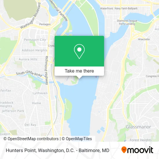
See Hunters Point, Washington, on the map
Public Transit to Hunters Point in Washington
Wondering how to get to Hunters Point in Washington? Moovit helps you find the best way to get to Hunters Point with step-by-step directions from the nearest public transit station.
Moovit provides free maps and live directions to help you navigate through your city. View schedules, routes, timetables, and find out how long does it take to get to Hunters Point in real time.
Looking for the nearest stop or station to Hunters Point? Check out this list of stops closest to your destination: Potomac Yard; Crystal City.
Bus: 43, 598.Train: MANASSAS LINE, FREDERICKSBURG LINE.Metro: BLUE, YELLOW.
Want to see if there’s another route that gets you there at an earlier time? Moovit helps you find alternative routes or times. Get directions from and directions to Hunters Point easily from the Moovit App or Website.
We make riding to Hunters Point easy, which is why over 1.5 million users, including users in Washington, trust Moovit as the best app for public transit. You don’t need to download an individual bus app or train app, Moovit is your all-in-one transit app that helps you find the best bus time or train time available.
For information on prices of bus, metro and train, costs and ride fares to Hunters Point, please check the Moovit app.
Use the app to navigate to popular places including to the airport, hospital, stadium, grocery store, mall, coffee shop, school, college, and university.
Location: Washington, Washington, D.C. - Baltimore, MD
- Southwest Airlines @ DCA,
- Mwaa Fire Station 301,
- Official Frontier Airlines Terminal-DCA,
- National Hall / Reagan National Airport (DCA),
- Capital Cove Marina,
- Daingerfield Island Sailing Club,
- Thompson Boat Center,
- Catboat Pizza Bar,
- DCA TSA Known Crewmember,
- Washington Sailing Marina,
- U.S. Coast Guard - Air Station Washington, Dc,
- Try Clean Maid,
- Mount Vernon Trail,
- Army & Air Force Exchange Service,
- Ronald Reagan Washington National Airport (Dca),
- Dca - Ronald Reagan National Airport,
- Terminal A - Ronald Reagan Washington National Airport,
- 9:30 Club Backstage Balcony,
- Legal Sea Foods (Legal Sea Food Reagan National Airport),
- DCA Peet's Coffee
Places Near Hunters Point (Washington)
- Warner Theatre, Washington,
- Rock Creek Tennis Center, Washington,
- M&T Bank Stadium, Baltimore,
- Camden Yards, Baltimore,
- Marriott Marquis Washington, DC, Washington,
- Museum Of The Bible, Washington,
- Capital One Arena, Washington,
- Amazon Hq2, Arlington County,
- The Anthem, Washington,
- Washington National Cathedral, Washington,
- Sibley Memorial Hospital, Washington,
- National Zoo, Washington,
- PG Mall, Prince George's County,
- Washington DC VA Medical Center, Washington,
- Basilica of the National Shrine, Washington,
- National Museum of African American History and Culture, Washington,
- Westfield Montgomery Mall, Montgomery County,
- Georgetown, Washington,
- National Theatre, Washington,
- Pennsylvania Ave NW (3rd st and pennsylvania), Washington
How to get to popular places in Washington, D.C. - Baltimore, MD with public transit
Get around Washington by public transit!
Traveling around Washington has never been so easy. See step by step directions as you travel to any attraction, street or major public transit station. View bus and train schedules, arrival times, service alerts and detailed routes on a map, so you know exactly how to get to anywhere in Washington.
When traveling to any destination around Washington use Moovit's Live Directions with Get Off Notifications to know exactly where and how far to walk, how long to wait for your line, and how many stops are left. Moovit will alert you when it's time to get off — no need to constantly re-check whether yours is the next stop.
Wondering how to use public transit in Washington or how to pay for public transit in Washington? Moovit public transit app can help you navigate your way with public transit easily, and at minimum cost. It includes public transit fees, ticket prices, and costs. Looking for a map of Washington public transit lines? Moovit public transit app shows all public transit maps in Washington with all Bus, Train, Metro, Light Rail and Ferry routes and stops on an interactive map.
Washington, D.C. - Baltimore, MD has 5 transit type(s), including: Bus, Train, Metro, Light Rail and Ferry, operated by several transit agencies, including WMATA, Montgomery County Ride On, Fairfax Connector, TheBus, PRTC, DASH - Alexandria, Arlington Transit (ART), RTA of Central Maryland, MDOT MTA, MDOT MTA Light RailLink, MDOT MTA Commuter Bus, MDOT MTA Local Bus, FXBGO!, Virginia Railway Express (VRE) and MARC