Directions to Hunters Point Ave (Queens) with public transportation
The following transit lines have routes that pass near Hunters Point Ave
 Bus: B32, Q32, Q44-SBS, Q60, Q67.
- Train: LONG BEACH BRANCH, MONTAUK BRANCH, PORT JEFFERSON BRANCH, PORT WASHINGTON BRANCH, OYSTER BAY BRANCH.
- Subway: 2, 7, 7X, E, G.
How to get to Hunters Point Ave by bus?
Click on the bus route to see step by step directions with maps, line arrival times and updated time schedules.
From Battery Park City, Manhattan
74 minFrom Louis Armstrong Stadium, Queens
76 minFrom 80-02 Kew Gardens Rd., Queens
69 minFrom John Street, Manhattan
74 minFrom Wall Street, Manhattan
75 minFrom 50Th Street, Manhattan
56 minFrom Hampton Jitney - Queens Airport Connection Westbound, Queens
69 minFrom New World Mall, Queens
66 minFrom OZONE PARK, Queens
70 minFrom Liberty State Park, Jersey City
178 min
How to get to Hunters Point Ave by train?
Click on the train route to see step by step directions with maps, line arrival times and updated time schedules.
How to get to Hunters Point Ave by subway?
Click on the subway route to see step by step directions with maps, line arrival times and updated time schedules.
From Battery Park City, Manhattan
37 minFrom Louis Armstrong Stadium, Queens
34 minFrom 80-02 Kew Gardens Rd., Queens
32 minFrom John Street, Manhattan
29 minFrom Wall Street, Manhattan
30 minFrom 50Th Street, Manhattan
26 minFrom Hampton Jitney - Queens Airport Connection Westbound, Queens
58 minFrom New World Mall, Queens
33 minFrom OZONE PARK, Queens
67 min
Train station near Hunters Point Ave in Queens
- Hunterspoint Avenue, 1 min walk,VIEW
Bus stops near Hunters Point Ave in Queens
Subway stations near Hunters Point Ave in Queens
Bus lines to Hunters Point Ave in Queens
What are the closest stations to Hunters Point Ave?
The closest stations to Hunters Point Ave are:
- Hunterspoint Avenue is 54 yards away, 1 min walk.
- 49 Av/25 St is 144 yards away, 2 min walk.
- Hunters Point Av is 188 yards away, 3 min walk.
- 21 St is 539 yards away, 7 min walk.
- Jackson Av/47 Rd is 545 yards away, 7 min walk.
- 11 St/48 Av is 593 yards away, 8 min walk.
- Jackson Av/11 St is 603 yards away, 8 min walk.
- Court Sq is 906 yards away, 11 min walk.
Which bus lines stop near Hunters Point Ave?
These bus lines stop near Hunters Point Ave: B32, Q32, Q44-SBS, Q60, Q67.
Which train lines stop near Hunters Point Ave?
These train lines stop near Hunters Point Ave: LONG BEACH BRANCH, MONTAUK BRANCH, PORT JEFFERSON BRANCH, PORT WASHINGTON BRANCH.
Which subway lines stop near Hunters Point Ave?
These subway lines stop near Hunters Point Ave: 2, 7, 7X, E.
What’s the nearest subway station to Hunters Point Ave in Queens?
The nearest subway station to Hunters Point Ave in Queens is Hunters Point Av. It’s a 3 min walk away.
What’s the nearest train station to Hunters Point Ave in Queens?
The nearest train station to Hunters Point Ave in Queens is Hunterspoint Avenue. It’s a 1 min walk away.
What’s the nearest bus station to Hunters Point Ave in Queens?
The nearest bus station to Hunters Point Ave in Queens is 49 Av/25 St. It’s a 2 min walk away.
What time is the first subway to Hunters Point Ave in Queens?
The 7 is the first subway that goes to Hunters Point Ave in Queens. It stops nearby at 3:01 AM.
What time is the last subway to Hunters Point Ave in Queens?
The E is the last subway that goes to Hunters Point Ave in Queens. It stops nearby at 3:24 AM.
What time is the first train to Hunters Point Ave in Queens?
The PORT JEFFERSON BRANCH is the first train that goes to Hunters Point Ave in Queens. It stops nearby at 6:32 AM.
What time is the last train to Hunters Point Ave in Queens?
The OYSTER BAY BRANCH is the last train that goes to Hunters Point Ave in Queens. It stops nearby at 6:53 PM.
What time is the first bus to Hunters Point Ave in Queens?
The Q101 is the first bus that goes to Hunters Point Ave in Queens. It stops nearby at 3:05 AM.
What time is the last bus to Hunters Point Ave in Queens?
The B62 is the last bus that goes to Hunters Point Ave in Queens. It stops nearby at 3:20 AM.
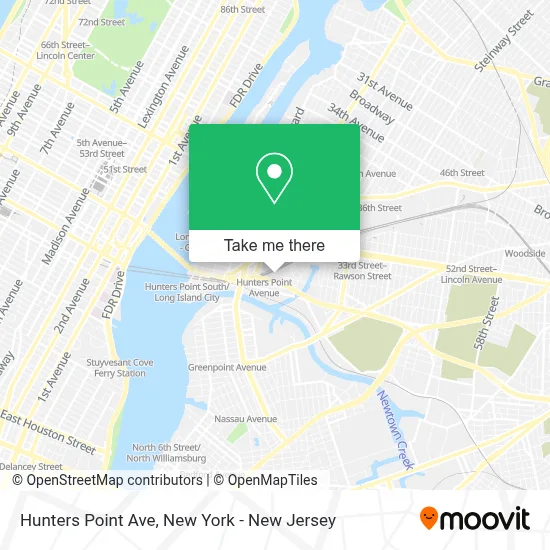
See Hunters Point Ave, Queens, on the map
Public Transit to Hunters Point Ave in Queens
Wondering how to get to Hunters Point Ave in Queens? Moovit helps you find the best way to get to Hunters Point Ave with step-by-step directions from the nearest public transit station.
Moovit provides free maps and live directions to help you navigate through your city. View schedules, routes, timetables, and find out how long does it take to get to Hunters Point Ave in real time.
Looking for the nearest stop or station to Hunters Point Ave? Check out this list of stops closest to your destination: Hunterspoint Avenue; 49 Av/25 St; Hunters Point Av; 21 St; Jackson Av/47 Rd; 11 St/48 Av; Jackson Av/11 St; Court Sq.
Bus: B32, Q32, Q44-SBS, Q60, Q67, Q101.Train: LONG BEACH BRANCH, MONTAUK BRANCH, PORT JEFFERSON BRANCH, PORT WASHINGTON BRANCH, OYSTER BAY BRANCH.Subway: 2, 7, 7X, E, G, F, FX.
Want to see if there’s another route that gets you there at an earlier time? Moovit helps you find alternative routes or times. Get directions from and directions to Hunters Point Ave easily from the Moovit App or Website.
We make riding to Hunters Point Ave easy, which is why over 1.5 million users, including users in Queens, trust Moovit as the best app for public transit. You don’t need to download an individual bus app or train app, Moovit is your all-in-one transit app that helps you find the best bus time or train time available.
For information on prices of subway, bus, train and light rail, costs and ride fares to Hunters Point Ave, please check the Moovit app.
Use the app to navigate to popular places including to the airport, hospital, stadium, grocery store, mall, coffee shop, school, college, and university.
Hunters Point Ave Address: Long Island City, NY 11101 street in Queens
- 2302 49th Ave,
- Nycha,
- LIRR-Hunterspoint Ave,
- 23-02 49th Avenue,
- Nyc Housing Authority,
- P4 at Skillman,
- LIRR Arch Street Facility,
- LIRR - Hunterspoint Ave Station,
- City Of Dreams,
- Town and Gardens,
- P4@Skillman School,
- 50-23 23rd St,
- 25th St 49th Ave,
- Linco Printing Inc,
- Metro Group Inc.,
- Dougherty Gallery at Crescent Grill,
- 23 Space,
- Arch Street Shop Long Island Rail Road,
- Lw Construction,
- Sushi Catering
Places Near Hunters Point Ave (Queens)
- Mountainside Hospital, Glen Ridge,
- Times Square, Manhattan,
- Hudson Yards, Manhattan,
- Pier 83, Manhattan,
- 3 Stone St, Manhattan,
- 66 John Street, Manhattan,
- qqqq, Manhattan,
- Wall Street, Manhattan,
- Katz's Deli, Manhattan,
- Bellevue Hospital, Manhattan,
- San Gennaro Feast, Manhattan,
- 911 Memorial, Manhattan,
- 26 Federal Plaza, Manhattan,
- 1 Police Plaza, Manhattan,
- Chinatown, Manhattan,
- SoHo, Manhattan,
- 111 Centre New York City Supreme Court, Manhattan,
- 376 Hudson Street, Manhattan,
- Queens Center Mall, Queens,
- Rockefeller Center, Manhattan
How to get to popular places in New York - New Jersey with public transit
Get around Queens by public transit!
Traveling around Queens has never been so easy. See step by step directions as you travel to any attraction, street or major public transit station. View bus and train schedules, arrival times, service alerts and detailed routes on a map, so you know exactly how to get to anywhere in Queens.
When traveling to any destination around Queens use Moovit's Live Directions with Get Off Notifications to know exactly where and how far to walk, how long to wait for your line, and how many stops are left. Moovit will alert you when it's time to get off — no need to constantly re-check whether yours is the next stop.
Wondering how to use public transit in Queens or how to pay for public transit in Queens? Moovit public transit app can help you navigate your way with public transit easily, and at minimum cost. It includes public transit fees, ticket prices, and costs. Looking for a map of Queens public transit lines? Moovit public transit app shows all public transit maps in Queens with all Bus, Train, Subway, Light Rail, Ferry and Cable Car routes and stops on an interactive map.
New York - New Jersey has 6 transit type(s), including: Bus, Train, Subway, Light Rail, Ferry and Cable Car, operated by several transit agencies, including MTA Subway, Metro-North Railroad, LIRR, PATH, MTA New York City Transit - Express routes, MTA Bus, NJ Transit, NYC Ferry, NICE bus, Bee-Line Bus, NJ Transit Rail, Norwalk Transit District, Hartford Line, River Valley Transit and HART