How to get to Huntersville Pool by bus?
Click on the bus route to see step by step directions with maps, line arrival times and updated time schedules.
How to get to Huntersville Pool by train?
Click on the train route to see step by step directions with maps, line arrival times and updated time schedules.
Bus stops near Huntersville Pool in Norfolk
Light Rail stations near Huntersville Pool in Norfolk
- Monticello, 25 min walk,VIEW
Train station near Huntersville Pool in Norfolk
- Norfolk Station, 63 min walk,VIEW
Bus lines to Huntersville Pool in Norfolk
What are the closest stations to Huntersville Pool?
The closest stations to Huntersville Pool are:
- Church & Goff is 282 yards away, 4 min walk.
- Tidewater & Goff is 293 yards away, 4 min walk.
- Princess Anne & Chapel is 305 yards away, 5 min walk.
- Virginia Beach & Chapel is 649 yards away, 9 min walk.
- Monticello is 2040 yards away, 25 min walk.
- Norfolk Station is 5431 yards away, 63 min walk.
Which bus lines stop near Huntersville Pool?
These bus lines stop near Huntersville Pool: 004, 023, 961.
Which train line stops near Huntersville Pool?
NORTHEAST REGIONAL (Norfolk)
What’s the nearest light rail station to Huntersville Pool in Norfolk?
The nearest light rail station to Huntersville Pool in Norfolk is Monticello. It’s a 25 min walk away.
What’s the nearest bus station to Huntersville Pool in Norfolk?
The nearest bus stations to Huntersville Pool in Norfolk are Church & Goff and Tidewater & Goff. The closest one is a 4 min walk away.
What time is the first light rail to Huntersville Pool in Norfolk?
The 800 is the first light rail that goes to Huntersville Pool in Norfolk. It stops nearby at 5:29 AM.
What time is the last light rail to Huntersville Pool in Norfolk?
The 800 is the last light rail that goes to Huntersville Pool in Norfolk. It stops nearby at 11:45 PM.
What time is the first train to Huntersville Pool in Norfolk?
The NORTHEAST REGIONAL is the first train that goes to Huntersville Pool in Norfolk. It stops nearby at 8:59 AM.
What time is the last train to Huntersville Pool in Norfolk?
The NORTHEAST REGIONAL is the last train that goes to Huntersville Pool in Norfolk. It stops nearby at 10:43 PM.
What time is the first bus to Huntersville Pool in Norfolk?
The 023 is the first bus that goes to Huntersville Pool in Norfolk. It stops nearby at 5:14 AM.
What time is the last bus to Huntersville Pool in Norfolk?
The 020 is the last bus that goes to Huntersville Pool in Norfolk. It stops nearby at 1:07 AM.
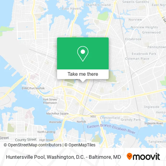
See Huntersville Pool, Norfolk, on the map
Public Transit to Huntersville Pool in Norfolk
Wondering how to get to Huntersville Pool in Norfolk? Moovit helps you find the best way to get to Huntersville Pool with step-by-step directions from the nearest public transit station.
Moovit provides free maps and live directions to help you navigate through your city. View schedules, routes, timetables, and find out how long does it take to get to Huntersville Pool in real time.
Looking for the nearest stop or station to Huntersville Pool? Check out this list of stops closest to your destination: Church & Goff; Tidewater & Goff; Princess Anne & Chapel; Virginia Beach & Chapel; Monticello; Norfolk Station.
Bus: 004, 023, 961, 008, 020.Train: NORTHEAST REGIONAL.
Want to see if there’s another route that gets you there at an earlier time? Moovit helps you find alternative routes or times. Get directions from and directions to Huntersville Pool easily from the Moovit App or Website.
We make riding to Huntersville Pool easy, which is why over 1.5 million users, including users in Norfolk, trust Moovit as the best app for public transit. You don’t need to download an individual bus app or train app, Moovit is your all-in-one transit app that helps you find the best bus time or train time available.
For information on prices of bus and train, costs and ride fares to Huntersville Pool, please check the Moovit app.
Use the app to navigate to popular places including to the airport, hospital, stadium, grocery store, mall, coffee shop, school, college, and university.
Huntersville Pool Address: 830 Goff St Norfolk, VA 23504 street in Norfolk
- Urban League of Hampton Roads,
- Huntersville Neighborhood Services,
- Wic State Agency,
- Huntersville Community Center,
- Norfolk City Health Department,
- Lamb Enterprises,
- Goff & Okeefe,
- Goff St Building 825,
- Green Top Lawn,
- Union United Church of Christ,
- Bruce Braids & Styling,
- Goff & Midrise,
- Mason Memorial Church of God in Christ,
- Mason Memorial Church Of God,
- Fenwick Adult Education Service,
- Child of God,
- Huntersville Park,
- Wesley Union African Methodist Episcopal Zion Church,
- United House Of Prayer,
- Boys and Girls
Places Near Huntersville Pool (Norfolk)
- Camden Yards, Baltimore,
- The Anthem, Washington,
- Capital One Arena, Washington,
- National Museum of African American History and Culture, Washington,
- National Zoo, Washington,
- Washington DC VA Medical Center, Washington,
- National Mall, Washington,
- Basilica of the National Shrine, Washington,
- Museum Of The Bible, Washington,
- Pennsylvania Ave NW (3rd st and pennsylvania), Washington,
- Warner Theatre, Washington,
- Westfield Montgomery Mall, Montgomery County,
- Rock Creek Tennis Center, Washington,
- Marriott Marquis Washington, DC, Washington,
- Washington National Cathedral, Washington,
- Georgetown, Washington,
- PG Mall, Prince George's County,
- Sibley Memorial Hospital, Washington,
- Amazon Hq2, Arlington County,
- M&T Bank Stadium, Baltimore
How to get to popular places in Washington, D.C. - Baltimore, MD with public transit
Get around Norfolk by public transit!
Traveling around Norfolk has never been so easy. See step by step directions as you travel to any attraction, street or major public transit station. View bus and train schedules, arrival times, service alerts and detailed routes on a map, so you know exactly how to get to anywhere in Norfolk.
When traveling to any destination around Norfolk use Moovit's Live Directions with Get Off Notifications to know exactly where and how far to walk, how long to wait for your line, and how many stops are left. Moovit will alert you when it's time to get off — no need to constantly re-check whether yours is the next stop.
Wondering how to use public transit in Norfolk or how to pay for public transit in Norfolk? Moovit public transit app can help you navigate your way with public transit easily, and at minimum cost. It includes public transit fees, ticket prices, and costs. Looking for a map of Norfolk public transit lines? Moovit public transit app shows all public transit maps in Norfolk with all Bus, Train, Metro, Light Rail and Ferry routes and stops on an interactive map.
Washington, D.C. - Baltimore, MD has 5 transit type(s), including: Bus, Train, Metro, Light Rail and Ferry, operated by several transit agencies, including WMATA, Montgomery County Ride On, Fairfax Connector, TheBus, PRTC, DASH - Alexandria, Arlington Transit (ART), RTA of Central Maryland, MDOT MTA, MDOT MTA Light RailLink, MDOT MTA Commuter Bus, MDOT MTA Local Bus, FXBGO!, Virginia Railway Express (VRE) and MARC