Huntington / Centennial stop - Friday schedule
| Line | Direction | Time |
|---|---|---|
| 187 | East: Azusa | 5:24 AM |
| 179 | Arcadia Station | 5:54 AM |
| 187 | East: Azusa | 5:56 AM |
| 187 | East: Azusa | 6:28 AM |
| 187 | East: Azusa | 6:51 AM |
| 179 | Arcadia Station | 6:54 AM |
| 187 | East: Azusa | 7:08 AM |
| 179 | Arcadia Station | 7:23 AM |
| 187 | East: Azusa | 7:27 AM |
| 187 | East: Azusa | 7:44 AM |
| 179 | Arcadia Station | 7:53 AM |
| 187 | East: Azusa | 7:59 AM |
| 187 | East: Azusa | 8:14 AM |
| 179 | Arcadia Station | 8:25 AM |
| 187 | East: Azusa | 8:31 AM |
| 187 | East: Azusa | 8:46 AM |
| 179 | Arcadia Station | 8:56 AM |
| 187 | East: Azusa | 9:01 AM |
| 187 | East: Azusa | 9:16 AM |
| 179 | Arcadia Station | 9:27 AM |
| 187 | East: Azusa | 9:31 AM |
| 187 | East: Azusa | 9:46 AM |
| 179 | Arcadia Station | 9:57 AM |
| 187 | East: Azusa | 10:01 AM |
| 187 | East: Azusa | 10:18 AM |
Directions to Huntington / Centennial stop (Arcadia) with public transit
The following transit lines have routes that pass near Huntington / Centennial
 Bus: 179, 187, GREEN ROUTE, 287, BLUE ROUTE.
- Subway: A LINE.
How to get to Huntington / Centennial stop by bus?
Click on the bus route to see step by step directions with maps, line arrival times and updated time schedules.
How to get to Huntington / Centennial stop by subway?
Click on the subway route to see step by step directions with maps, line arrival times and updated time schedules.
Bus stops near Huntington / Centennial stop in Arcadia
- Huntington D @ E of Holly Ave (Community Center), 3 min walk,
- Huntington Dr and Santa Anita Medical Pl, 7 min walk,
- Huntington / Methodist Hospital, 7 min walk,
- Santa Anita / Bonita, 15 min walk,
- Santa Anita & Diamond NB, 18 min walk,
Subway stations near Huntington / Centennial station in Arcadia
- Arcadia, 28 min walk,
Bus lines to Huntington / Centennial stop in Arcadia
- GREEN ROUTE, Metro Rail Station (Gold Line),
- 187, East: Azusa,
- 179, Huntington - Monterey,
- 287, El Monte Station,
- BLUE ROUTE, Metro Rail Station South,
What are the closest stations to Huntington / Centennial?
The closest stations to Huntington / Centennial are:
- Huntington D @ E of Holly Ave (Community Center) is 219 yards away, 3 min walk.
- Huntington Dr and Santa Anita Medical Pl is 530 yards away, 7 min walk.
- Huntington / Methodist Hospital is 534 yards away, 7 min walk.
- Santa Anita / Bonita is 1235 yards away, 15 min walk.
- Santa Anita & Diamond NB is 1531 yards away, 18 min walk.
- Arcadia is 2325 yards away, 28 min walk.
Which bus lines stop near Huntington / Centennial?
These bus lines stop near Huntington / Centennial: 179, 187.
Which subway line stops near Huntington / Centennial?
A LINE (Pomona Station)
What’s the nearest subway station to Huntington / Centennial in Arcadia?
The nearest subway station to Huntington / Centennial in Arcadia is Arcadia. It’s a 28 min walk away.
What’s the nearest bus station to Huntington / Centennial in Arcadia?
The nearest bus station to Huntington / Centennial in Arcadia is Huntington D @ E of Holly Ave (Community Center). It’s a 3 min walk away.
What time is the first subway to Huntington / Centennial in Arcadia?
The A LINE is the first subway that goes to Huntington / Centennial in Arcadia. It stops nearby at 3:34 AM.
What time is the last subway to Huntington / Centennial in Arcadia?
The A LINE is the last subway that goes to Huntington / Centennial in Arcadia. It stops nearby at 1:31 AM.
What time is the first bus to Huntington / Centennial in Arcadia?
The 187 is the first bus that goes to Huntington / Centennial in Arcadia. It stops nearby at 4:26 AM.
What time is the last bus to Huntington / Centennial in Arcadia?
The 179 is the last bus that goes to Huntington / Centennial in Arcadia. It stops nearby at 12:19 AM.
Huntington / Centennial station
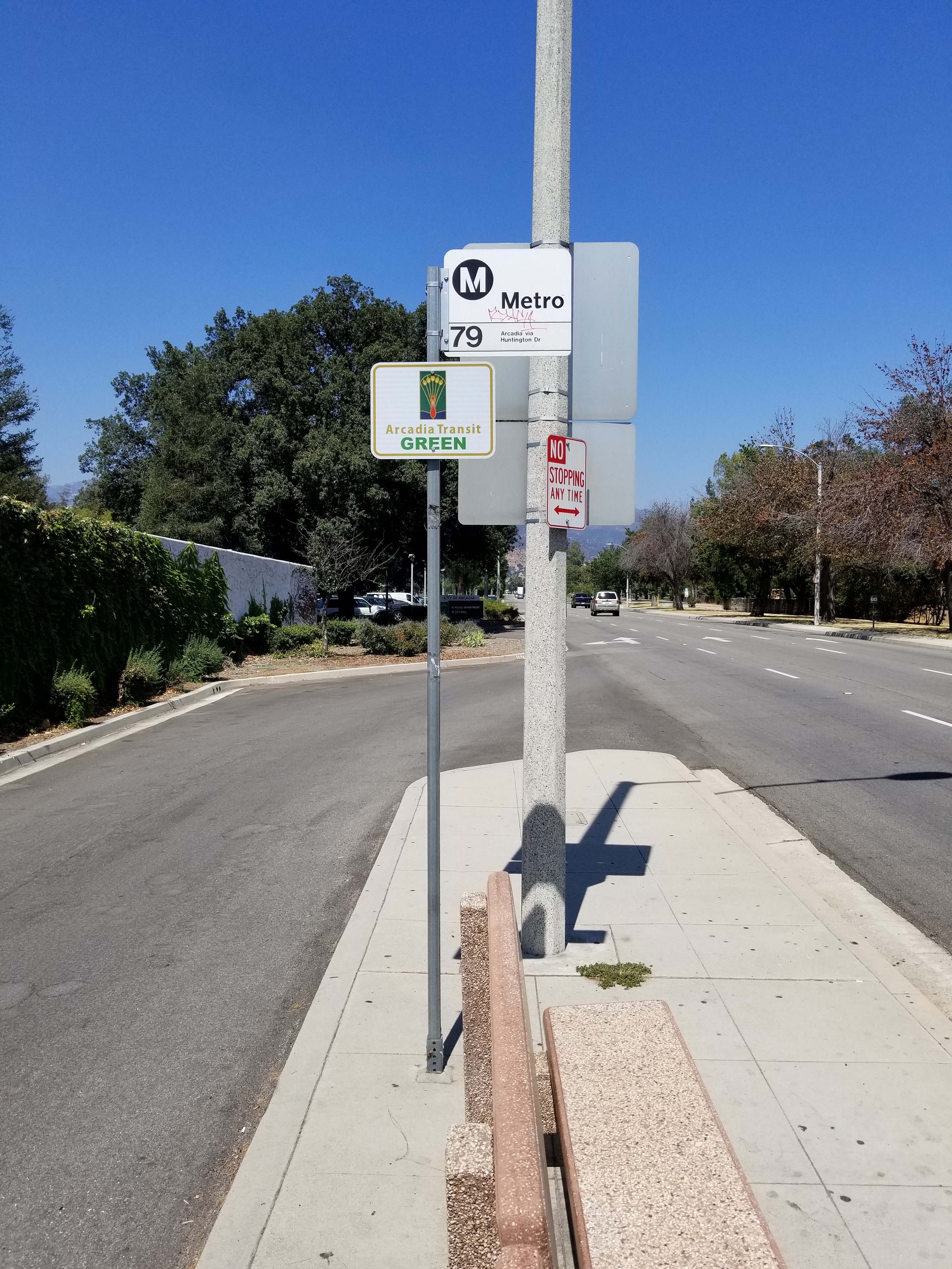 Taken by Anonymous
See Huntington / Centennial stop, Arcadia, on the map
Public transit to Huntington / Centennial stop (ID: 7708) in Arcadia
Looking for directions to Huntington / Centennial in Arcadia, United States?
Download the Moovit App to find the current schedule and step-by-step directions for Bus or Subway routes that pass through Huntington / Centennial.
Looking for the nearest stops closest to Huntington / Centennial ? Check out this list of closest stops to your destination: Huntington D @ E of Holly Ave (Community Center); Huntington Dr and Santa Anita Medical Pl; Huntington / Methodist Hospital; Santa Anita / Bonita; Santa Anita & Diamond NB; Arcadia.
Bus: 179, 187, GREEN ROUTE, 287, BLUE ROUTE.Subway: A LINE.
We make riding on public transit to Huntington / Centennial easy, which is why over 1.5 million users, including users in Arcadia trust Moovit as the best app for public transit.
Use the app to navigate to popular places including to the airport, hospital, stadium, grocery store, mall, coffee shop, school, college, and university.
Huntington / Centennial stop’s code is 7708
The first line to this stop is 187, at 5:24 AM, and the last line is 179 at 12:17 AM.
This stop serves Metro and Foothill Transit’s lines
- Huntington D @ E of Holly Ave (Community Center),
- Huntington Dr and Santa Anita Medical Pl,
- Huntington / Methodist Hospital,
- Santa Anita / Bonita,
- Santa Anita & Diamond NB
Bus stops near Huntington / Centennial stop
- Arcadia
Subway station near Huntington / Centennial station
- MLK Jr. & Budlong Ave.,
- Vineland / Chandler,
- Sierra Hwy & Vasquez Canyon Rd,
- Florence / Seville,
- Sherman Way / Laurel Canyon,
- 120th / Martin Luther King Hospital,
- 6th St & Bonnie Brae St (Eastbound),
- Highland Park Station,
- Fairfax Ave & Beverly Blvd (Southbound),
- Sunset / Vin Scully - Dodger Stadium,
- El Monte Busway Layover,
- Outlets at San Clemente,
- Zelzah / San Jose,
- Vernon & Kansas Ave.,
- Mona Blvd & Santa Ana Blvd (Southbound),
- Temescal Canyon / Pacific Coast Highway,
- Wilshire & Cloverdale,
- 92nd St & Compton Ave (Westbound),
- Slauson & Crenshaw Blvd.,
- Arlington / 48th
Popular public transit stations in Arcadia
Get around Arcadia by public transit!
Traveling around Arcadia has never been so easy. See step by step directions as you travel to any attraction, street or major public transit station. View bus and train schedules, arrival times, service alerts and detailed routes on a map, so you know exactly how to get to anywhere in Arcadia.
When traveling to any destination around Arcadia use Moovit's Live Directions with Get Off Notifications to know exactly where and how far to walk, how long to wait for your line, and how many stops are left. Moovit will alert you when it's time to get off — no need to constantly re-check whether yours is the next stop.
Wondering how to use public transit in Arcadia or how to pay for public transit in Arcadia? Moovit public transit app can help you navigate your way with public transit easily, and at minimum cost. It includes public transit fees, ticket prices, and costs. Looking for a map of Arcadia public transit lines? Moovit public transit app shows all public transit maps in Arcadia with all Bus, Train, Subway, Ferry and Funicular routes and stops on an interactive map.
Los Angeles has 5 transit type(s), including: Bus, Train, Subway, Ferry and Funicular, operated by several transit agencies, including Metro, Alhambra Community Transit, Arcadia Transit, ART, Artesia Transit, AVTA, Baldwin Park Transit, Beach Cities Transit, Beaumont Transit, Bell Gardens Town Trolley, Bellflower Bus, Big Blue Bus, Burbank Bus, Calabasas Trolley and Camarillo Area Transit