How to get to Hyatt Regency by bus?
Click on the bus route to see step by step directions with maps, line arrival times and updated time schedules.
From Washington Yu Ying Public Charter School, Washington
78 minFrom Logan Circle, Washington
73 minFrom Glover Park Hotel Georgetown, Washington
37 minFrom Wheaton High School, Montgomery County
45 minFrom George Washington University Hospital, Washington
58 minFrom Foggy Bottom-GWU Metro Station, Washington
57 minFrom Foggy Bottom, Washington
58 minFrom George Washington University, Washington
58 minFrom The Phillips Collection, Washington
58 minFrom George H.W. Bush Center For Intelligence (CIA Headquarters), Fairfax County
512 min
How to get to Hyatt Regency by metro?
Click on the metro route to see step by step directions with maps, line arrival times and updated time schedules.
From Washington Yu Ying Public Charter School, Washington
53 minFrom Logan Circle, Washington
46 minFrom Wheaton High School, Montgomery County
71 minFrom George Washington University Hospital, Washington
31 minFrom Foggy Bottom-GWU Metro Station, Washington
30 minFrom Foggy Bottom, Washington
31 minFrom George Washington University, Washington
31 minFrom The Phillips Collection, Washington
23 min
Bus stops near Hyatt Regency in Montgomery County
Bus lines to Hyatt Regency in Montgomery County
- 29, 29-Bethesda-GlenEcho-FriendshpHghts,VIEW
- 30, 30-Bethesda-Medical Center,VIEW
- 32, 32-Bethesda-Naval Ship R&D Center,VIEW
- 34, 34-Bethesda-Wheaton,VIEW
- 47, 47-Rockville-Mont. Mall-Bethesda,VIEW
- M22, North To Olney,VIEW
- M70, West To Montgomery Mall,VIEW
- D96, South To Potomac Park,VIEW
- 36, Bethesda Loop,VIEW
- 70, Germantown Milestone Via Medical Center,VIEW
- RED, Noma-Gallaudet U,VIEW
- 798, 798 Bethesda,VIEW
- FLIXBUS 2601, NYC - Washington DC,VIEW
- FLIXBUS 2605, NYC - Richmond,VIEW
What are the closest stations to Hyatt Regency?
The closest stations to Hyatt Regency are:
- Bethesda Station is 49 yards away, 1 min walk.
- Bethesda+Bay B is 62 yards away, 2 min walk.
- Montgomery Ln+East Ln is 96 yards away, 2 min walk.
- Bethesda Station & Bay H is 97 yards away, 2 min walk.
- Bethesda Metro Station is 103 yards away, 2 min walk.
- Montgomery Ln @ East Ln is 105 yards away, 2 min walk.
- Bethesda is 353 yards away, 5 min walk.
Which bus lines stop near Hyatt Regency?
These bus lines stop near Hyatt Regency: 798, D96, M22, M70.
Which metro line stops near Hyatt Regency?
RED (Shady Grove)
What’s the nearest bus station to Hyatt Regency in Montgomery County?
The nearest bus station to Hyatt Regency in Montgomery County is Bethesda Station. It’s a 1 min walk away.
What time is the first metro to Hyatt Regency in Montgomery County?
The RED is the first metro that goes to Hyatt Regency in Montgomery County. It stops nearby at 5:16 AM.
What time is the last metro to Hyatt Regency in Montgomery County?
The RED is the last metro that goes to Hyatt Regency in Montgomery County. It stops nearby at 12:25 AM.
What time is the first bus to Hyatt Regency in Montgomery County?
The M70 is the first bus that goes to Hyatt Regency in Montgomery County. It stops nearby at 4:53 AM.
What time is the last bus to Hyatt Regency in Montgomery County?
The M70 is the last bus that goes to Hyatt Regency in Montgomery County. It stops nearby at 2:18 AM.
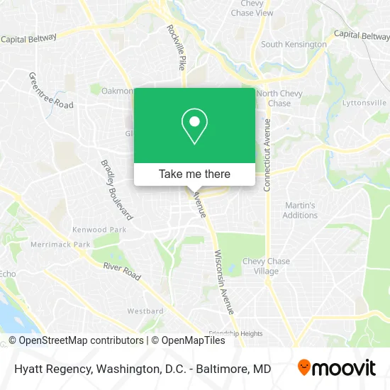
See Hyatt Regency, Montgomery County, on the map
Public Transit to Hyatt Regency in Montgomery County
Wondering how to get to Hyatt Regency in Montgomery County? Moovit helps you find the best way to get to Hyatt Regency with step-by-step directions from the nearest public transit station.
Moovit provides free maps and live directions to help you navigate through your city. View schedules, routes, timetables, and find out how long does it take to get to Hyatt Regency in real time.
Looking for the nearest stop or station to Hyatt Regency? Check out this list of stops closest to your destination: Bethesda Station ; Bethesda+Bay B; Montgomery Ln+East Ln; Bethesda Station & Bay H; Bethesda Metro Station; Montgomery Ln @ East Ln; Bethesda.
Bus: 798, D96, M22, M70, 29, 30, 32, 34, 47, 36, 70, RED.Metro: RED.
Want to see if there’s another route that gets you there at an earlier time? Moovit helps you find alternative routes or times. Get directions from and directions to Hyatt Regency easily from the Moovit App or Website.
We make riding to Hyatt Regency easy, which is why over 1.5 million users, including users in Montgomery County, trust Moovit as the best app for public transit. You don’t need to download an individual bus app or train app, Moovit is your all-in-one transit app that helps you find the best bus time or train time available.
For information on prices of metro and bus, costs and ride fares to Hyatt Regency, please check the Moovit app.
Use the app to navigate to popular places including to the airport, hospital, stadium, grocery store, mall, coffee shop, school, college, and university.
Hyatt Regency Address: East Lane street in Montgomery County
- Ultimate Performance Personal Trainers - Bethesda,
- Woodmont Triangle,
- Global Medical Reit,
- Adam Deal,
- Atlantic Group,
- Pancreas Foundation,
- Hyatt Regency Bethesda near Washington, DC,
- Bethesda Bus Station,
- Bus Stop J2 & J4 to Silver Spring,
- Wisconsin Avenue Metro Tunnel,
- Lot 522 - Francis G. Newlands Bldg,
- CCIIO,
- 355 & Montgomery Ln,
- Shipshape It,
- EVgo,
- Lloyd Iden - Morgan Stanley,
- Peter Beukema Realtor Bethesda MD Real Estate,
- Digital Axis,
- Downtown Bethesda,
- Northwest Biotherapeutics
Places Near Hyatt Regency (Montgomery County)
- Washington DC VA Medical Center, Washington,
- National Mall, Washington,
- Westfield Montgomery Mall, Montgomery County,
- Basilica of the National Shrine, Washington,
- Warner Theatre, Washington,
- The Anthem, Washington,
- Sibley Memorial Hospital, Washington,
- Capital One Arena, Washington,
- PG Mall, Prince George's County,
- Camden Yards, Baltimore,
- Pennsylvania Ave NW (3rd st and pennsylvania), Washington,
- Washington National Cathedral, Washington,
- Amazon Hq2, Arlington County,
- M&T Bank Stadium, Baltimore,
- National Zoo, Washington,
- National Museum of African American History and Culture, Washington,
- Rock Creek Tennis Center, Washington,
- Marriott Marquis Washington, DC, Washington,
- Museum Of The Bible, Washington,
- Georgetown, Washington
How to get to popular places in Washington, D.C. - Baltimore, MD with public transit
Get around Montgomery County by public transit!
Traveling around Montgomery County has never been so easy. See step by step directions as you travel to any attraction, street or major public transit station. View bus and train schedules, arrival times, service alerts and detailed routes on a map, so you know exactly how to get to anywhere in Montgomery County.
When traveling to any destination around Montgomery County use Moovit's Live Directions with Get Off Notifications to know exactly where and how far to walk, how long to wait for your line, and how many stops are left. Moovit will alert you when it's time to get off — no need to constantly re-check whether yours is the next stop.
Wondering how to use public transit in Montgomery County or how to pay for public transit in Montgomery County? Moovit public transit app can help you navigate your way with public transit easily, and at minimum cost. It includes public transit fees, ticket prices, and costs. Looking for a map of Montgomery County public transit lines? Moovit public transit app shows all public transit maps in Montgomery County with all Bus, Train, Metro, Light Rail and Ferry routes and stops on an interactive map.
Washington, D.C. - Baltimore, MD has 5 transit type(s), including: Bus, Train, Metro, Light Rail and Ferry, operated by several transit agencies, including WMATA, Montgomery County Ride On, Fairfax Connector, TheBus, PRTC, DASH - Alexandria, Arlington Transit (ART), RTA of Central Maryland, MDOT MTA, MDOT MTA Light RailLink, MDOT MTA Commuter Bus, MDOT MTA Local Bus, FXBGO!, Virginia Railway Express (VRE) and MARC