See Hyde Street Pier, San Francisco, CA 94133, North Beach, Sf, on the map
Directions to Hyde Street Pier, San Francisco, CA 94133 (North Beach, Sf) with public transportation
The following transit lines have routes that pass near Hyde Street Pier, San Francisco, CA 94133
 Bus:
Bus: - BART:
- Light Rail:
- Cable Car:
How to get to Hyde Street Pier, San Francisco, CA 94133 by bus?
Click on the bus route to see step by step directions with maps, line arrival times and updated time schedules.
How to get to Hyde Street Pier, San Francisco, CA 94133 by BART?
Click on the BART route to see step by step directions with maps, line arrival times and updated time schedules.
Bus stations near Hyde Street Pier, San Francisco, CA 94133 in North Beach, Sf
- Bay St & Midway St,7 min walk,
Cable Car stations near Hyde Street Pier, San Francisco, CA 94133 in North Beach, Sf
- Taylor St & Bay St,9 min walk,
Bus lines to Hyde Street Pier, San Francisco, CA 94133 in North Beach, Sf
- 8,Bayshore,
- 8BX,Bayshore B Express,
What are the closest stations to Hyde Street Pier, San Francisco, CA 94133?
The closest stations to Hyde Street Pier, San Francisco, CA 94133 are:
- Bay St & Midway St is 538 yards away, 7 min walk.
- Taylor St & Bay St is 679 yards away, 9 min walk.
Which bus lines stop near Hyde Street Pier, San Francisco, CA 94133?
These bus lines stop near Hyde Street Pier, San Francisco, CA 94133: 47, 8BX.
Which BART lines stop near Hyde Street Pier, San Francisco, CA 94133?
These BART lines stop near Hyde Street Pier, San Francisco, CA 94133: GREEN, RED, YELLOW.
Which light rail line stops near Hyde Street Pier, San Francisco, CA 94133?
F
What’s the nearest bus stop to Hyde Street Pier, San Francisco, CA 94133 in North Beach, Sf?
The nearest bus stop to Hyde Street Pier, San Francisco, CA 94133 in North Beach, Sf is Bay St & Midway St. It’s a 7 min walk away.
What’s the nearest cable car station to Hyde Street Pier, San Francisco, CA 94133 in North Beach, Sf?
The nearest cable car station to Hyde Street Pier, San Francisco, CA 94133 in North Beach, Sf is Taylor St & Bay St. It’s a 9 min walk away.
See Hyde Street Pier, San Francisco, CA 94133, North Beach, Sf, on the map
Public Transit to Hyde Street Pier, San Francisco, CA 94133 in North Beach, Sf
Wondering how to get to Hyde Street Pier, San Francisco, CA 94133 in North Beach, Sf, United States? Moovit helps you find the best way to get to Hyde Street Pier, San Francisco, CA 94133 with step-by-step directions from the nearest public transit station.
Moovit provides free maps and live directions to help you navigate through your city. View schedules, routes, timetables, and find out how long does it take to get to Hyde Street Pier, San Francisco, CA 94133 in real time.
Looking for the nearest stop or station to Hyde Street Pier, San Francisco, CA 94133? Check out this list of stops closest to your destination: Bay St & Midway St; Taylor St & Bay St.
Bus:BART:Light Rail:Cable Car:
Want to see if there’s another route that gets you there at an earlier time? Moovit helps you find alternative routes or times. Get directions from and directions to Hyde Street Pier, San Francisco, CA 94133 easily from the Moovit App or Website.
We make riding to Hyde Street Pier, San Francisco, CA 94133 easy, which is why over 1.5 million users, including users in North Beach, Sf, trust Moovit as the best app for public transit. You don’t need to download an individual bus app or train app, Moovit is your all-in-one transit app that helps you find the best bus time or train time available.
For information on prices of bus, BART and light rail, costs and ride fares to Hyde Street Pier, San Francisco, CA 94133, please check the Moovit app.
Use the app to navigate to popular places including to the airport, hospital, stadium, grocery store, mall, coffee shop, school, college, and university.
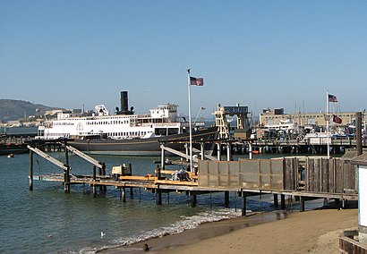
Hyde Street Pier, San Francisco, CA 94133 Address: San Francisco, CA 94133 street in North Beach, Sf
Attractions near Hyde Street Pier, San Francisco, CA 94133
Powell St / Fishermans Wharf,Powell Street,Powell Street & Jefferson Street,Powell Street & The Embarcadero,Daejung Enterprise Inc,Zentact,Wharf Fest - Chowder Competition,41 Embarcadero North Street,Grayline Pier 41 Booth,Crystal Geyser Water Co.,North Point,I Heart SF,Blazing Saddles Bike Rentals,Sandalwood,Luggage World,Pier 41 Marine Terminal,Art Galary,Digital Camera,Vallejo - San Francisco Pier 41,Golden Bay Tour CompanyHow to get to popular attractions in North Beach, Sf with public transit
Usf, Inner Richmond, Sf,Googleplex,City of Pleasanton, Pleasanton,Googleplex - Crittenden Campus,San Francisco-Oakland Bay Bridge, Treasure Island, Sf,Campbell, CA, Campbell,Boudin Bakery Café SFO, Sfo,Regal Cinemas Hacienda Crossings 21 & IMAX, Dublin,McCarthy Ranch, Milpitas,Lawrence Livermore National Laboratory, Livermore,Renaissance ClubSport Walnut Creek Hotel, Contra Costa Centre,Costco Wholesale, Santa Clara,Old Navy Inc Headquarters, Soma, Sf,Costco Wholesale, San Jose,Charles M. Schulz - Sonoma County Airport (STS),Travis Air Force Base, Fairfield,City of Pinole, Pinole,I-680 / US-101 / I-280 Interchange, San Jose,Mountain View, CA,Lombard Street, Russian Hill, SfGet around North Beach, Sf by public transit!
Traveling around North Beach, Sf has never been so easy. See step by step directions as you travel to any attraction, street or major public transit station. View bus and train schedules, arrival times, service alerts and detailed routes on a map, so you know exactly how to get to anywhere in North Beach, Sf.
When traveling to any destination around North Beach, Sf use Moovit's Live Directions with Get Off Notifications to know exactly where and how far to walk, how long to wait for your line, and how many stops are left. Moovit will alert you when it's time to get off — no need to constantly re-check whether yours is the next stop.
Wondering how to use public transit in North Beach, Sf or how to pay for public transit in North Beach, Sf? Moovit public transit app can help you navigate your way with public transit easily, and at minimum cost. It includes public transit fees, ticket prices, and costs. Looking for a map of North Beach, Sf public transit lines? Moovit public transit app shows all public transit maps in North Beach, Sf with all bus, BART or light rail routes and stops on an interactive map.
North Beach, Sf has 3 transit type(s), including: bus, BART or light rail, operated by several transit agencies, including BART, Bay Area Rapid Transit, Muni Metro, Caltrain, VTA, Capitol Corridor, Sonoma Marin Area Rail Transit, MUNI, VTA, SF Cable Car, AC Transit, Dumbarton Express, Golden Gate Transit, County Connection and SamTrans