How to get to Hydroequip by bus?
Click on the bus route to see step by step directions with maps, line arrival times and updated time schedules.
From Fermentelos, Fermentelos
72 minFrom Aveiro Retail Park, Aveiro
291 minFrom Piscina Exterior de Oliveirinha, Oliveirinha
218 minFrom CENTRO COMERCIAL GLICÍNIAS PLAZA, Aveiro
48 minFrom São Bernardo, Aveiro
218 minFrom Feira de Março, Aveiro
69 minFrom MERCADONA, Aveiro
42 minFrom Ilhavo, Aveiro
60 minFrom Parque de Exposições de Aveiro, Aveiro
69 minFrom Glicínias, Aveiro
47 min
Bus stops near Hydroequip in Palhaça
Bus lines to Hydroequip in Palhaça
- 19, Aveiro (Terminal) - Cantanhede (Expofacic),VIEW
- 78, Arieiro (Rotunda) - Oliveira do Bairro (Escola Secundária),VIEW
- 79, Vila Nova (Igreja) - Oliveira do Bairro (Escola Secundária),VIEW
- 80, Palhaça (Ribeira do Fontão) - Oliveira do Bairro (Escola Secundária),VIEW
- 83, Bustos (Junta de Freguesia) - Oliveira do Bairro (Câmara Municipal),VIEW
- 29, Águeda (Estação),VIEW
What are the closest stations to Hydroequip?
The closest stations to Hydroequip are:
- Rotunda Arieiro is 453 meters away, 6 min walk.
- Palhaça - Manuel Oliveira is 482 meters away, 7 min walk.
Which bus lines stop near Hydroequip?
These bus lines stop near Hydroequip: 10, 19.
What’s the nearest bus station to Hydroequip in Palhaça?
The nearest bus station to Hydroequip in Palhaça is Rotunda Arieiro. It’s a 6 min walk away.
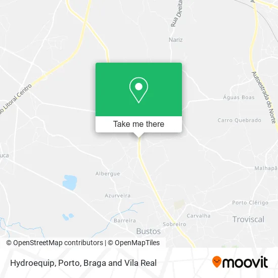
See Hydroequip, Palhaça, on the map
Public Transit to Hydroequip in Palhaça
Wondering how to get to Hydroequip in Palhaça? Moovit helps you find the best way to get to Hydroequip with step-by-step directions from the nearest public transit station.
Moovit provides free maps and live directions to help you navigate through your city. View schedules, routes, timetables, and find out how long does it take to get to Hydroequip in real time.
Looking for the nearest stop or station to Hydroequip? Check out this list of stops closest to your destination: Rotunda Arieiro; Palhaça - Manuel Oliveira.
Bus: 10, 19, 78, 79, 80, 83, 29.
Want to see if there’s another route that gets you there at an earlier time? Moovit helps you find alternative routes or times. Get directions from and directions to Hydroequip easily from the Moovit App or Website.
We make riding to Hydroequip easy, which is why over 1.5 million users, including users in Palhaça, trust Moovit as the best app for public transit. You don’t need to download an individual bus app or train app, Moovit is your all-in-one transit app that helps you find the best bus time or train time available.
For information on prices of bus, costs and ride fares to Hydroequip, please check the Moovit app.
Use the app to navigate to popular places including to the airport, hospital, stadium, grocery store, mall, coffee shop, school, college, and university.
Hydroequip Address: Rua Dr. José de Carvalho Palhaça, 3770-355 Oliveira do Bairro street in Palhaça
- Nicrodur-Acessórios e Equipamentos de Manutenção Industrial,
- Centrauto - Componentes Auto,
- Drogaria Pereira,
- Dropereira - Drogaria e Electrodomésticos,
- Igreja da Palhaça,
- Igreja de São Pedro,
- Cemitério da Palhaça,
- Carla Silva,
- Centro Social Paroquial de São Pedro,
- Alegria - Juntos Erguemos Sonhos,
- Paróquia da Palhaça,
- Suprema - Serviços de Limpeza,
- Olympus Fitness,
- Semente Original, Unipessoal, Lda,
- Violetatendência, Lda,
- Manuel Vieira Samagaio - Serralharia e Serração de Madeiras,
- Silvia Pereira,
- Farmácia Marvone,
- Ana Catarina Lopes - Clínica S.pedro,
- Espaço Infantil da Palhaça
Places Near Hydroequip (Palhaça)
- Leça da Palmeira, Matosinhos e Leça da Palmeira,
- Avintes, Vila Nova De Gaia,
- Valongo, Valongo,
- Espinho, Espinho,
- Rua Calouste Gulbenkian, Lordelo do Ouro e Massarelos,
- Parque Aquatico Amarante - Aqua Aventura, Amarante,
- Maia, Maia,
- VILA do CONDE PORTO FASHION OUTLET, Modivas,
- Senhor de Matosinhos, Matosinhos e Leça da Palmeira,
- Acesso ao Shopping Parque Nascente, Campanhã,
- Hospital da Prelada, Ramalde,
- Hospital de Santo António, Cedofeita, Santo Ildefonso, Sé, Miragaia, São Nicolau e Vitória,
- El Corte Inglés de Gaia, Mafamude e Vilar do Paraíso,
- Exponor, Matosinhos e Leça da Palmeira,
- Hospital Santos Silva, Vila Nova De Gaia,
- Palácio de Cristal, Lordelo do Ouro e Massarelos,
- Zoo Santo Inácio, Vila Nova De Gaia,
- Arrábida Shopping, Santa Marinha e São Pedro da Afurada,
- Canidelo, Vila Nova De Gaia,
- MAR Shopping, Matosinhos e Leça da Palmeira
How to get to popular places in Porto, Braga and Vila Real with public transit
Get around Palhaça by public transit!
Traveling around Palhaça has never been so easy. See step by step directions as you travel to any attraction, street or major public transit station. View bus and train schedules, arrival times, service alerts and detailed routes on a map, so you know exactly how to get to anywhere in Palhaça.
When traveling to any destination around Palhaça use Moovit's Live Directions with Get Off Notifications to know exactly where and how far to walk, how long to wait for your line, and how many stops are left. Moovit will alert you when it's time to get off — no need to constantly re-check whether yours is the next stop.
Wondering how to use public transit in Palhaça or how to pay for public transit in Palhaça? Moovit public transit app can help you navigate your way with public transit easily, and at minimum cost. It includes public transit fees, ticket prices, and costs. Looking for a map of Palhaça public transit lines? Moovit public transit app shows all public transit maps in Palhaça with all Bus, Train, Metro, Ferry, Funicular and Gondola routes and stops on an interactive map.
Porto, Braga and Vila Real has 6 transit type(s), including: Bus, Train, Metro, Ferry, Funicular and Gondola, operated by several transit agencies, including Metro do Porto, Metro do Porto - Metrobus, CP - Comboios de Portugal, STCP, UNIR Mobilidade da Area Metropolitana do Porto, Getbus - Aerobus, Mobiave, Valpibus, TUB - Transportes Urbanos de Braga, TuViana, Guimabus, Ave Mobilidade, Cávado Mobilidade, Transdev and Câmara Municipal de Santo Tirso
Public transit lines with stations closest to Hydroequip in Palhaça
Bus lines with stations closest to Hydroequip in Palhaça
Rotunda Arieiro
 19Aveiro (Terminal) - Cantanhede (Expofacic)
- 78Arieiro (Rotunda) - Oliveira do Bairro (Escola Secundária)
- 79Vila Nova (Igreja) - Oliveira do Bairro (Escola Secundária)
- 80Palhaça (Ribeira do Fontão) - Oliveira do Bairro (Escola Secundária)
- 83Bustos (Junta de Freguesia) - Oliveira do Bairro (Câmara Municipal)