How to get to IMF by bus?
Click on the bus route to see step by step directions with maps, line arrival times and updated time schedules.
From Topkapı Sarayı, Fatih
81 minFrom Taksim ilkyardım hastanesi, Gaziosmanpasa
81 minFrom C ve Sistem Programcıları Derneği, Şişli
79 minFrom Güneşli, Bagcilar
89 minFrom Yerebatan Sarnıcı, Fatih
71 minFrom İstanbul İl Nüfus Müdürlüğü, Fatih
59 minFrom Arena Park AVM, Küçükçekmece
88 minFrom Halkalı Ata Sporları Merkezi, Küçükçekmece
104 minFrom Havaist Halkalı - Isl Havalimanı, Küçükçekmece
85 minFrom SULTANGAZİ, Sultangazi
65 min
How to get to IMF by metro?
Click on the metro route to see step by step directions with maps, line arrival times and updated time schedules.
From Taksim ilkyardım hastanesi, Gaziosmanpasa
71 minFrom C ve Sistem Programcıları Derneği, Şişli
64 minFrom Güneşli, Bagcilar
57 minFrom Yerebatan Sarnıcı, Fatih
65 minFrom İstanbul İl Nüfus Müdürlüğü, Fatih
54 minFrom Arena Park AVM, Küçükçekmece
67 minFrom Havaist Halkalı - Isl Havalimanı, Küçükçekmece
63 min
Bus stop near IMF in Zeytinburnu
- Ülkükent Sitesi - Cevizlibağ Yönü, 4 min walk,VIEW
Dolmus & Minibus station near IMF in Zeytinburnu
- Davutpaşa - Topkapı Yönü, 6 min walk,VIEW
Metro station near IMF in Zeytinburnu
- Davutpaşa - Ytü, 6 min walk,VIEW
Bus lines to IMF in Zeytinburnu
What are the closest stations to IMF?
The closest stations to IMF are:
- Ülkükent Sitesi - Cevizlibağ Yönü is 257 meters away, 4 min walk.
- Davutpaşa - Topkapı Yönü is 399 meters away, 6 min walk.
- Davutpaşa - Ytü is 440 meters away, 6 min walk.
Which bus lines stop near IMF?
These bus lines stop near IMF: 41AT, 92B.
Which metro line stops near IMF?
M1A (Atatürk Havalimanı→Yenikapı)
Which Dolmus & Minibus lines stop near IMF?
These Dolmus & Minibus lines stop near IMF: A27, A30.
What’s the nearest metro station to IMF in Zeytinburnu?
The nearest metro station to IMF in Zeytinburnu is Davutpaşa - Ytü. It’s a 6 min walk away.
What’s the nearest bus station to IMF in Zeytinburnu?
The nearest bus station to IMF in Zeytinburnu is Ülkükent Sitesi - Cevizlibağ Yönü. It’s a 4 min walk away.
What’s the nearest Dolmus & Minibus station to IMF in Zeytinburnu?
The nearest Dolmus & Minibus station to IMF in Zeytinburnu is Davutpaşa - Topkapı Yönü. It’s a 6 min walk away.
What time is the first metro to IMF in Zeytinburnu?
The M1A is the first metro that goes to IMF in Zeytinburnu. It stops nearby at 6:06 AM.
What time is the last metro to IMF in Zeytinburnu?
The M1A is the last metro that goes to IMF in Zeytinburnu. It stops nearby at 12:17 AM.
What time is the first bus to IMF in Zeytinburnu?
The 92B is the first bus that goes to IMF in Zeytinburnu. It stops nearby at 6:42 AM.
What time is the last bus to IMF in Zeytinburnu?
The 41AT is the last bus that goes to IMF in Zeytinburnu. It stops nearby at 12:09 AM.
What time is the first Dolmus & Minibus to IMF in Zeytinburnu?
The A28 is the first Dolmus & Minibus that goes to IMF in Zeytinburnu. It stops nearby at 5:52 AM.
What time is the last Dolmus & Minibus to IMF in Zeytinburnu?
The A30 is the last Dolmus & Minibus that goes to IMF in Zeytinburnu. It stops nearby at 1:36 AM.
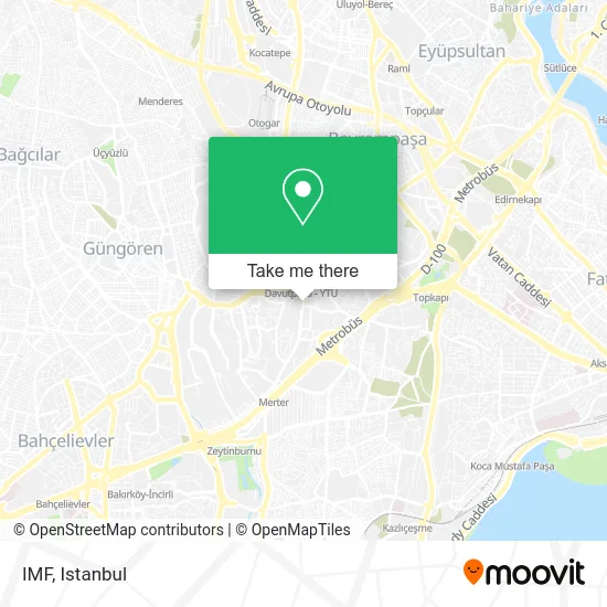
See IMF, Zeytinburnu, on the map
Public Transit to IMF in Zeytinburnu
Wondering how to get to IMF in Zeytinburnu? Moovit helps you find the best way to get to IMF with step-by-step directions from the nearest public transit station.
Moovit provides free maps and live directions to help you navigate through your city. View schedules, routes, timetables, and find out how long does it take to get to IMF in real time.
Looking for the nearest stop or station to IMF? Check out this list of stops closest to your destination: Ülkükent Sitesi - Cevizlibağ Yönü; Davutpaşa - Topkapı Yönü; Davutpaşa - Ytü.
Bus: 41AT, 92B, A27, A27, 33B.Metro: M1A.Dolmus & Minibus: A27, A30, A26, A28, A28.
Want to see if there’s another route that gets you there at an earlier time? Moovit helps you find alternative routes or times. Get directions from and directions to IMF easily from the Moovit App or Website.
We make riding to IMF easy, which is why over 1.5 million users, including users in Zeytinburnu, trust Moovit as the best app for public transit. You don’t need to download an individual bus app or train app, Moovit is your all-in-one transit app that helps you find the best bus time or train time available.
For information on prices of bus, metro, Dolmus & Minibus, tram and Metrobus, costs and ride fares to IMF, please check the Moovit app.
Use the app to navigate to popular places including to the airport, hospital, stadium, grocery store, mall, coffee shop, school, college, and university.
Location: Zeytinburnu, Istanbul
- Revna Erkek Kuaförü,
- cömertkent sitesi, D blok,
- Konkur Sitesi B2 Blok,
- Yılanlı Ayazma Yolu,
- Konkur Evleri,
- davutpasa koska,
- Gazman,
- Vatan Emniyet Müdürlüğü Vatan Hizmet Binası,
- Cömertkent Sitesi,
- Time Out Masa Tenisi,
- Zuhal Erdem Kuaför Salonu,
- Pharmavision,
- Davutpaşa Bircan Eresin Cami,
- Cömertkent Sitesi / Narin Sokak,
- PharmaVision İlaç San.tic.,
- Gözde Amaç Sitesi,
- Terazidere Sanayi Sitesi,
- Italıan Look,
- Yıldız Sanayi Sitesi,
- Ege Tekstıl
Places Near IMF (Zeytinburnu)
- İstanbul,
- Gebze-Harem Minibüs Hattı, Gebze,
- 41 Burda AVM, Kocaeli Merkezi,
- 212 AVM, Bagcilar,
- Topkule Kışlası 47.Komando Tugay Komutanlığı, Esenler,
- VİALAND AVM, Eyüp,
- Beylikdüzü - 4 Nolu Minibüs Hattı, Beylikduzu,
- İstinye Park, Sariyer,
- Mehmet Emin Tokadî Hz. Türbesi, Fatih,
- Bakırköy Sosyete Pazarı, Bakirköy,
- Karaköy Genelevi, Karaköy, Beyoğlu,
- Mall Of İstanbul, Basaksehir,
- Tersane İstanbul, Beyoğlu,
- Şehit Prof. Dr. İlhan Varank Eğitim Ve Araştırma Hastanesi, Sancaktepe,
- Gebze Koop Durağı, Gebze,
- Hilltown AVM, Maltepe,
- 2 Nolu Minibüss, Beylikduzu,
- METROPOL IsTaNBuL, Ataşehir,
- Hz. Yuşa Tepesi, Beykoz,
- Başakşehir Çam Ve Sakura Şehir Hastanesi, Basaksehir
How to get to popular places in Istanbul with public transit
Get around Zeytinburnu by public transit!
Traveling around Zeytinburnu has never been so easy. See step by step directions as you travel to any attraction, street or major public transit station. View bus and train schedules, arrival times, service alerts and detailed routes on a map, so you know exactly how to get to anywhere in Zeytinburnu.
When traveling to any destination around Zeytinburnu use Moovit's Live Directions with Get Off Notifications to know exactly where and how far to walk, how long to wait for your line, and how many stops are left. Moovit will alert you when it's time to get off — no need to constantly re-check whether yours is the next stop.
Wondering how to use public transit in Zeytinburnu or how to pay for public transit in Zeytinburnu? Moovit public transit app can help you navigate your way with public transit easily, and at minimum cost. It includes public transit fees, ticket prices, and costs. Looking for a map of Zeytinburnu public transit lines? Moovit public transit app shows all public transit maps in Zeytinburnu with all Bus, Train, Metro, Tram, Ferry, Metrobus and Dolmus & Minibus routes and stops on an interactive map.
Istanbul has 7 transit type(s), including: Bus, Train, Metro, Tram, Ferry, Metrobus and Dolmus & Minibus, operated by several transit agencies, including Marmaray, Metro İstanbul, Metrobüs, UAB, İETT, İETT ÇIFT KATLI HATLAR, İETT BÖLGESEL HATLAR, TCDD, Şehir Hatları, Dentur Avrasya, Beyden, Turyol, Mavi Marmara, Havaist and Prenstur
