Directions to ING Bank (Bursa) with public transportation
The following transit lines have routes that pass near ING Bank
 Bus: 503, BURSA TERMINALI - İNEGÖL TERMINALI, 610, 610H, 616.
How to get to ING Bank by bus?
Click on the bus route to see step by step directions with maps, line arrival times and updated time schedules.
From Tabiat Binicilik Kulübü, Kestel
114 minFrom BURSA BÜYÜKŞEHİR BELEDİYESİ ERDOĞAN KÖY KENT MEZARLIGI, Kestel
117 minFrom Kazancı Köyü, Kestel
110 minFrom Aksu, Kestel
102 minFrom Kazancı, Kestel
110 minFrom Erdoğan Köyü Kent Mezarlığı, Kestel
116 minFrom Erdoğan köyü, Kestel
109 minFrom Bursa-İnegöl Yolu, İnegöl
57 minFrom Babasultan Köyü, İnegöl
67 min
Bus stops near ING Bank in Bursa
Bus lines to ING Bank in Bursa
- 610, 610 - Alanyurt Ring,VIEW
- 610H, 610h - Alanyurt Ring,VIEW
- 616, 616 - Alanyurt - Ring,VIEW
- 617, Alanyurt - Ring,VIEW
- 620, Akhisar - Ring,VIEW
- 620K, Karalar - Ring,VIEW
- 622, Yeni Toki - Ring,VIEW
- 616H, 616h - Alanyurt Ring,VIEW
- 617H, 617h - Alanyurt Ring,VIEW
- 618, Alanyurt - Ring,VIEW
- 619, Alanyurt - Ring,VIEW
- 621, İnegöl Toki - İnegöl Terminal,VIEW
- 624/K, Kozluören,VIEW
- 611, Edebey Cerrah-Ring,VIEW
- 612, İnegöl Doğu Garajı-Ring,VIEW
- 612T, 612t - İng. Terminal Şehir İçi Ring,VIEW
- 613, Mesudiye-Ring,VIEW
- 615, İnegöl Terminal Ring,VIEW
- 614, Mesudiye-Ring,VIEW
- 623, 623 - Huzur Mah. Ring,VIEW
What are the closest stations to ING Bank?
The closest stations to ING Bank are:
- İnegöl Avm 4 is 153 meters away, 3 min walk.
- İnegöl Avm 5 is 206 meters away, 3 min walk.
- İnegöl Avm is 213 meters away, 3 min walk.
- Yıldırım Cami 2 (İnegöl) is 217 meters away, 3 min walk.
- Yıldırım Cami 1 (İnegöl) is 217 meters away, 3 min walk.
- İnegöl Avm 2 is 412 meters away, 6 min walk.
Which bus lines stop near ING Bank?
These bus lines stop near ING Bank: 503, BURSA TERMINALI - İNEGÖL TERMINALI.
What’s the nearest bus station to ING Bank in Bursa?
The nearest bus stations to ING Bank in Bursa are İnegöl Avm 4, İnegöl Avm 5, İnegöl Avm, Yıldırım Cami 2 (İnegöl) and Yıldırım Cami 1 (İnegöl). The closest one is a 3 min walk away.
What time is the first bus to ING Bank in Bursa?
The 619 is the first bus that goes to ING Bank in Bursa. It stops nearby at 6:46 AM.
What time is the last bus to ING Bank in Bursa?
The 620 is the last bus that goes to ING Bank in Bursa. It stops nearby at 12:38 AM.
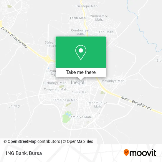
See ING Bank, Bursa, on the map
Public Transit to ING Bank in Bursa
Wondering how to get to ING Bank in Bursa? Moovit helps you find the best way to get to ING Bank with step-by-step directions from the nearest public transit station.
Moovit provides free maps and live directions to help you navigate through your city. View schedules, routes, timetables, and find out how long does it take to get to ING Bank in real time.
Looking for the nearest stop or station to ING Bank? Check out this list of stops closest to your destination: İnegöl Avm 4; İnegöl Avm 5; İnegöl Avm; Yıldırım Cami 2 (İnegöl); Yıldırım Cami 1 (İnegöl); İnegöl Avm 2.
Bus: 503, BURSA TERMINALI - İNEGÖL TERMINALI, 610, 610H, 616, 617, 620, 616H, 617H, 618, 619, 621, 624/K, 614, 611, 612, 612T, 613, 615, 623, 631.
Want to see if there’s another route that gets you there at an earlier time? Moovit helps you find alternative routes or times. Get directions from and directions to ING Bank easily from the Moovit App or Website.
We make riding to ING Bank easy, which is why over 1.5 million users, including users in Bursa, trust Moovit as the best app for public transit. You don’t need to download an individual bus app or train app, Moovit is your all-in-one transit app that helps you find the best bus time or train time available.
For information on prices of bus and cable car, costs and ride fares to ING Bank, please check the Moovit app.
Use the app to navigate to popular places including to the airport, hospital, stadium, grocery store, mall, coffee shop, school, college, and university.
ING Bank Address: Kanal Sokak, 16400 Sinanbey, İnegöl street in Bursa
- Unk Parfum House,
- Eren İnşaat Emlak Müteahhitlik,
- Iklimsa,
- İnegöl Modefiye Center,
- Karadeniz Oto Kiralama,
- İnegöl Kıvılcım Reklam,
- Demirtaş Oto Kiralama İnegöl,
- Helvacı Çeşitoğlu,
- Başarı Sigorta Arc Hiz Ltd Şti,
- Ömrüm Esnaf Çay Evi,
- Carin Oto Kiralama,
- Gımpa Toptan,
- Halil Reklam,
- Yavuzlar Oto Kıralama,
- Akal Sigorta,
- Dızayn Sunger,
- Yalcın Oto Kıralama,
- Garanti Bbva,
- Itimatav,
- Class Men Clup
Places Near ING Bank (Bursa)
- Şehir Hastanesi, Nilüfer,
- Bursa Yüksek İhtisas Eğitim ve Araştırma Hastanesi Nilüfer Ek Binası, Nilüfer,
- ÖzdilekPark Bursa Nilüfer, Nilüfer,
- Bursa Cumalıkızık Köyü, Osmangazi,
- Nilüfer Ağız ve Diş Sağlığı Merkezi, Nilüfer,
- Millet Mahallesi,
- Podyum Park, Nilüfer,
- Bursa Teleferik, Yıldırım,
- Şevket Yılmaz Eğitim ve Araştırma Hastanesi, Yıldırım,
- Dörtçelik Çocuk Hastanesi, Nilüfer,
- Ali Osman Sönmez Onkoloji Hastanesi, Osmangazi,
- Çekirge Devlet Hastanesi Otobüs Durağı, Osmangazi,
- Bursa Terminal, Nilüfer,
- Sur Yapı Marka, Nilüfer,
- Bursa Hayvanat Bahçesi, Osmangazi,
- bursa mudanya, Mudanya,
- FSM Bulvarı, Nilüfer,
- Bursa, Osmangazi,
- Mustafakemalpaşa Karacabey Dolmuş Durağı, Mustafakemalpaşa,
- Sur Yapı Marka Avm, Osmangazi
How to get to popular places in Bursa with public transit
Get around Bursa by public transit!
Traveling around Bursa has never been so easy. See step by step directions as you travel to any attraction, street or major public transit station. View bus and train schedules, arrival times, service alerts and detailed routes on a map, so you know exactly how to get to anywhere in Bursa.
When traveling to any destination around Bursa use Moovit's Live Directions with Get Off Notifications to know exactly where and how far to walk, how long to wait for your line, and how many stops are left. Moovit will alert you when it's time to get off — no need to constantly re-check whether yours is the next stop.
Wondering how to use public transit in Bursa or how to pay for public transit in Bursa? Moovit public transit app can help you navigate your way with public transit easily, and at minimum cost. It includes public transit fees, ticket prices, and costs. Looking for a map of Bursa public transit lines? Moovit public transit app shows all public transit maps in Bursa with all Bus, Metro, Light Rail, Cable Car and Gondola routes and stops on an interactive map.
Bursa has 5 transit type(s), including: Bus, Metro, Light Rail, Cable Car and Gondola, operated by several transit agencies, including BursaRay, BurTram, BBBUS, Burulaş, Minibüs, İlçe Otobüsleri and Bursa Teleferik