Directions to ING Bank (Çekmekoy) with public transportation
The following transit lines have routes that pass near ING Bank
 Bus: 11ÜS, 14A, 14ŞB, 522ST, C77.
- Metro: M5.
- Dolmus & Minibus: BL401, KADIKÖY - ÇEKMEKÖY, MIMAR SINAN MAH.-ÇEKMEKÖY METRO.
How to get to ING Bank by bus?
Click on the bus route to see step by step directions with maps, line arrival times and updated time schedules.
From Kadıköy Tarihi Salı Pazarı, Kadıköy
88 minFrom Kadıköy Cuma Pazarı, Kadıköy
89 minFrom Ümraniye Nikah Sarayı, Ümraniye
62 minFrom Çamlıca Kulesi, Küçükçamlıca, Üsküdar
59 minFrom Palladium, Ataşehir
98 minFrom Ataşehir Dudullu Terminali, Ataşehir
52 minFrom Sancaktepe Ağız ve Diş Sağlığı Merkezi, Sancaktepe
54 minFrom Bostancı Gösteri Merkezi otobüs durağı, Bostancı,Kadıköy
101 minFrom Maltepe SGK Müdürlüğü, Maltepe
102 minFrom Sultanbeyli Ağız ve Diş Sağlığı Merkezi, Sultanbeyli
87 min
How to get to ING Bank by metro?
Click on the metro route to see step by step directions with maps, line arrival times and updated time schedules.
From Kadıköy Tarihi Salı Pazarı, Kadıköy
53 minFrom Kadıköy Cuma Pazarı, Kadıköy
53 minFrom Çamlıca Kulesi, Küçükçamlıca, Üsküdar
52 minFrom Palladium, Ataşehir
69 minFrom Ataşehir Dudullu Terminali, Ataşehir
36 minFrom Sancaktepe Ağız ve Diş Sağlığı Merkezi, Sancaktepe
47 minFrom Bostancı Gösteri Merkezi otobüs durağı, Bostancı,Kadıköy
54 minFrom Maltepe SGK Müdürlüğü, Maltepe
52 min
Bus stops near ING Bank in Çekmekoy
Dolmus & Minibus station near ING Bank in Çekmekoy
- Pazaryeri, 9 min walk,VIEW
Bus lines to ING Bank in Çekmekoy
- C77, Şahinbey,VIEW
- 9H, Çekmeköy Belediyesi-Çok Programlı Lise,VIEW
- 9T, Şehit Erol Olçok-Şehit Şahinbey,VIEW
- 9ÇN, Yeşiltepe Son Durak-Özyeğin Üniversitesi Alt Kapı,VIEW
- 14CE, Yeşiltepe Son Durak-Kadıköy,VIEW
- 14ÇK, Şahinbey - Kadıköy / Ring,VIEW
- 14ŞB, Kadıköy-Şehit Şahinbey,VIEW
- ÇM42, Şehit Şahinbey-Sarıgazi Garajı,VIEW
- 122M, Şehit Şahinbey-Güven Sitesi,VIEW
- 122Y, Yeşiltepe Son Durak-Mecidiyeköy Mezarlık,VIEW
- 122ÇK, Kavacık Aktarma-Şehit Şahinbey,VIEW
- 132ÇK, Yeşiltepe Son Durak-Kartal,VIEW
- 9S, Yeşıltepe/Çekmeköy Metro-Atatürk Mah.,VIEW
- 131K, Yeşiltepe / Şahinbey - Kartal,VIEW
- 131Y, Çekmeköy/Samandıra-Kartal,VIEW
- 132YM, Yeşiltepe-Marmara Eğitim Köyü,VIEW
- ŞL16, Şile - Çekmeköy Metro Garden,VIEW
- C56, Üsküdar - Alemdağ,VIEW
- C56, Ümraniye - Reşadiye,VIEW
- C311, Dudullu-Taşdelen-Yunusemre-Abdurrahmangazi,VIEW
What are the closest stations to ING Bank?
The closest stations to ING Bank are:
- Necip Fazıl Kısakürek Caddesi - Yeşiltepe Yönü is 139 meters away, 2 min walk.
- Pazaryeri - Üsküdar Yönü is 647 meters away, 9 min walk.
- Pazaryeri is 667 meters away, 9 min walk.
- Kemerdere Köprülü Kavşak - Sarıgazi Yönü is 826 meters away, 11 min walk.
Which bus lines stop near ING Bank?
These bus lines stop near ING Bank: 11ÜS, 14A, 14ŞB, 522ST.
Which metro line stops near ING Bank?
M5 (Üsküdar→Samandıra Merkez)
Which Dolmus & Minibus line stops near ING Bank?
BL401 (Dudullu)
What’s the nearest bus station to ING Bank in Çekmekoy?
The nearest bus station to ING Bank in Çekmekoy is Necip Fazıl Kısakürek Caddesi - Yeşiltepe Yönü. It’s a 2 min walk away.
What’s the nearest Dolmus & Minibus station to ING Bank in Çekmekoy?
The nearest Dolmus & Minibus station to ING Bank in Çekmekoy is Pazaryeri. It’s a 9 min walk away.
What time is the first bus to ING Bank in Çekmekoy?
The M5 is the first bus that goes to ING Bank in Çekmekoy. It stops nearby at 3:12 AM.
What time is the last bus to ING Bank in Çekmekoy?
The M5 is the last bus that goes to ING Bank in Çekmekoy. It stops nearby at 3:52 AM.
What time is the first Dolmus & Minibus to ING Bank in Çekmekoy?
The C311 is the first Dolmus & Minibus that goes to ING Bank in Çekmekoy. It stops nearby at 5:39 AM.
What time is the last Dolmus & Minibus to ING Bank in Çekmekoy?
The C56 is the last Dolmus & Minibus that goes to ING Bank in Çekmekoy. It stops nearby at 12:11 AM.
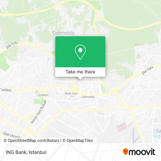
See ING Bank, Çekmekoy, on the map
Public Transit to ING Bank in Çekmekoy
Wondering how to get to ING Bank in Çekmekoy? Moovit helps you find the best way to get to ING Bank with step-by-step directions from the nearest public transit station.
Moovit provides free maps and live directions to help you navigate through your city. View schedules, routes, timetables, and find out how long does it take to get to ING Bank in real time.
Looking for the nearest stop or station to ING Bank? Check out this list of stops closest to your destination: Necip Fazıl Kısakürek Caddesi - Yeşiltepe Yönü; Pazaryeri - Üsküdar Yönü; Pazaryeri; Kemerdere Köprülü Kavşak - Sarıgazi Yönü.
Bus: 11ÜS, 14A, 14ŞB, 522ST, C77, 9H, 9T, 9ÇN, 14CE, 9S, 131K, 131Y, 132YM, ŞL16, C56, C56, C311, C311.Metro: M5.Dolmus & Minibus: BL401, KADIKÖY - ÇEKMEKÖY, MIMAR SINAN MAH.-ÇEKMEKÖY METRO.
Want to see if there’s another route that gets you there at an earlier time? Moovit helps you find alternative routes or times. Get directions from and directions to ING Bank easily from the Moovit App or Website.
We make riding to ING Bank easy, which is why over 1.5 million users, including users in Çekmekoy, trust Moovit as the best app for public transit. You don’t need to download an individual bus app or train app, Moovit is your all-in-one transit app that helps you find the best bus time or train time available.
For information on prices of metro, bus and Dolmus & Minibus, costs and ride fares to ING Bank, please check the Moovit app.
Use the app to navigate to popular places including to the airport, hospital, stadium, grocery store, mall, coffee shop, school, college, and university.
ING Bank Address: Burma Sokak, 34782 Mehmet Akif, İstanbul street in Çekmekoy
- TANER ŞENOL BAYAN KUAFÖRÜ,
- Gespasa Türkiye,
- Çekmeköy İmam Hatip Lisesi,
- Milano cafe_Nargile_Rest,
- Necip Fazıl Kısakürek Caddesi / Ezgi Sokak,
- Görkem Nargile Okey Cafe Canlı Müzik,
- Mehmet Akif Mahallesi,
- Çekmeköy Anadolu İmam Hatip Lisesi,
- Mehmet Akif Mah.,
- Taşdelen,
- Zeytinburnu Anadolu Lisesi,
- Çekmeköy Kapalı Pazar Yeri,
- özel sezin koleji orta okul,
- A101 (A.101),
- Işık Sitesi,
- Çekpa Çağrı Hipermarket,
- fatmA talip kahraman kız anadolu lisesi,
- Çekmeköy kapalı pazar kompleksi,
- Beşyıldız Serena Sitesi,
- K.İsmihan İsmet Süzer Ortaokulu
Places Near ING Bank (Çekmekoy)
- 212 AVM, Bagcilar,
- Beylikdüzü - 4 Nolu Minibüs Hattı, Beylikduzu,
- Topkule Kışlası 47.Komando Tugay Komutanlığı, Esenler,
- Mall Of İstanbul, Basaksehir,
- Mehmet Emin Tokadî Hz. Türbesi, Fatih,
- Hilltown AVM, Maltepe,
- Başakşehir Çam Ve Sakura Şehir Hastanesi, Basaksehir,
- Bakırköy Sosyete Pazarı, Bakirköy,
- Şehit Prof. Dr. İlhan Varank Eğitim Ve Araştırma Hastanesi, Sancaktepe,
- Karaköy Genelevi, Karaköy, Beyoğlu,
- İstanbul,
- Tersane İstanbul, Beyoğlu,
- İstinye Park, Sariyer,
- METROPOL IsTaNBuL, Ataşehir,
- VİALAND AVM, Eyüp,
- Hz. Yuşa Tepesi, Beykoz,
- 2 Nolu Minibüss, Beylikduzu,
- Gebze-Harem Minibüs Hattı, Gebze,
- 41 Burda AVM, Kocaeli Merkezi,
- Gebze Koop Durağı, Gebze
How to get to popular places in Istanbul with public transit
Get around Çekmekoy by public transit!
Traveling around Çekmekoy has never been so easy. See step by step directions as you travel to any attraction, street or major public transit station. View bus and train schedules, arrival times, service alerts and detailed routes on a map, so you know exactly how to get to anywhere in Çekmekoy.
When traveling to any destination around Çekmekoy use Moovit's Live Directions with Get Off Notifications to know exactly where and how far to walk, how long to wait for your line, and how many stops are left. Moovit will alert you when it's time to get off — no need to constantly re-check whether yours is the next stop.
Wondering how to use public transit in Çekmekoy or how to pay for public transit in Çekmekoy? Moovit public transit app can help you navigate your way with public transit easily, and at minimum cost. It includes public transit fees, ticket prices, and costs. Looking for a map of Çekmekoy public transit lines? Moovit public transit app shows all public transit maps in Çekmekoy with all Bus, Train, Metro, Tram, Ferry, Metrobus and Dolmus & Minibus routes and stops on an interactive map.
Istanbul has 7 transit type(s), including: Bus, Train, Metro, Tram, Ferry, Metrobus and Dolmus & Minibus, operated by several transit agencies, including Marmaray, Metro İstanbul, Metrobüs, UAB, İETT, İETT ÇIFT KATLI HATLAR, İETT BÖLGESEL HATLAR, TCDD, Şehir Hatları, Dentur Avrasya, Beyden, Turyol, Mavi Marmara, Havaist and Prenstur
