How to get to INTERSPORT by bus?
Click on the bus route to see step by step directions with maps, line arrival times and updated time schedules.
Bus stops near INTERSPORT in Karmøy
Ferry station near INTERSPORT in Karmøy
- Haugesund Hurtigbåtkai, 62 min walk,VIEW
Bus lines to INTERSPORT in Karmøy
- 202, Vormedal - Amanda terminal,VIEW
- 207, Norheim bussterminal - Vikjå,VIEW
- 209, Haugesund bussterminal - Åkrehamn,VIEW
- 210, Skudeneshavn kai - Haugesund bussterminal,VIEW
- X210, Aibel - Skudeneshavn kai,VIEW
- N283, Sørhauggata/Torggata - Røyksund,VIEW
- N288, Sørhauggata/Torggata - Skudeneshavn kai,VIEW
- SK4910, Norheim bussterminal - Falnes kirke,VIEW
- SK4919, Vikjå - Vardafjellhallen,VIEW
- SK4925, Hordaplass - Snik snuplass,VIEW
- 221, Norheim Via Visnes-Avaldsnes,VIEW
- 224, Norheim Via Kolnes,VIEW
- 226, Norheim,VIEW
- SK4918, Norheim Via Bø,VIEW
- VY190, Ørsta,VIEW
- NW400, Leirvik,VIEW
- SK4908, Vardafjell,VIEW
- SK4923, Vormedal Ungdomsskole,VIEW
- SK0613, Sakkastad,VIEW
What are the closest stations to INTERSPORT?
The closest stations to INTERSPORT are:
- Norheim Bussterminal is 248 meters away, 4 min walk.
- Oasen Storsenter is 382 meters away, 6 min walk.
- Norevegen is 712 meters away, 10 min walk.
- Ystadvegen is 1080 meters away, 15 min walk.
- Haugesund Hurtigbåtkai is 4783 meters away, 62 min walk.
Which bus lines stop near INTERSPORT?
These bus lines stop near INTERSPORT: 202, NW400, VY190.
What’s the nearest bus station to INTERSPORT in Karmøy?
The nearest bus station to INTERSPORT in Karmøy is Norheim Bussterminal. It’s a 4 min walk away.
What time is the first bus to INTERSPORT in Karmøy?
The N288 is the first bus that goes to INTERSPORT in Karmøy. It stops nearby at 3:24 AM.
What time is the last bus to INTERSPORT in Karmøy?
The 202 is the last bus that goes to INTERSPORT in Karmøy. It stops nearby at 12:02 AM.
What time is the first ferry to INTERSPORT in Karmøy?
The 700 is the first ferry that goes to INTERSPORT in Karmøy. It stops nearby at 7:14 AM.
What time is the last ferry to INTERSPORT in Karmøy?
The 700 is the last ferry that goes to INTERSPORT in Karmøy. It stops nearby at 10:25 PM.
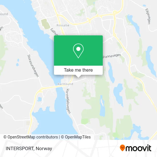
See INTERSPORT, Karmøy, on the map
Public Transit to INTERSPORT in Karmøy
Wondering how to get to INTERSPORT in Karmøy? Moovit helps you find the best way to get to INTERSPORT with step-by-step directions from the nearest public transit station.
Moovit provides free maps and live directions to help you navigate through your city. View schedules, routes, timetables, and find out how long does it take to get to INTERSPORT in real time.
Looking for the nearest stop or station to INTERSPORT? Check out this list of stops closest to your destination: Norheim Bussterminal; Oasen Storsenter; Norevegen; Ystadvegen; Haugesund Hurtigbåtkai.
Bus: 202, NW400, VY190, 207, 209, 210, X210, 221, 224, 226, SK4918, SK4908, SK4923.Ferry: 700.
Want to see if there’s another route that gets you there at an earlier time? Moovit helps you find alternative routes or times. Get directions from and directions to INTERSPORT easily from the Moovit App or Website.
We make riding to INTERSPORT easy, which is why over 1.5 million users, including users in Karmøy, trust Moovit as the best app for public transit. You don’t need to download an individual bus app or train app, Moovit is your all-in-one transit app that helps you find the best bus time or train time available.
For information on prices of bus and ferry, costs and ride fares to INTERSPORT, please check the Moovit app.
Use the app to navigate to popular places including to the airport, hospital, stadium, grocery store, mall, coffee shop, school, college, and university.
INTERSPORT Address: Austbøvegen 16 5542 Karmsund street in Karmøy
- Matthias Christoph Fritzsche,
- Oasen Vaksinasjonssenter,
- Change Oasen,
- Haugesund Samtaleklinikk,
- ELKJØP,
- Ladestasjon for elbiler,
- Nordvegen Pokerklubb,
- Telia,
- Nordvegen,
- Haugesund Aerobicsenter,
- Bjørklund Oasen,
- City Bag,
- Tannlege Marinella Bakken,
- Oasen Storsenter, Karmsund,
- Mira Pizzeria Abbas Baker Shoker,
- Norheim,
- Ditt V & Vel Gr,
- Dressmann,
- Normal,
- Hekla Tannregulering A
Places Near INTERSPORT (Karmøy)
- Ulriken, Bergen,
- Quality Hotel Edvard Grieg, Bergen,
- Bjerke Travbane, Oslo,
- Drammen Sykehus, Drammen,
- Rikshospitalet (trikk), Oslo,
- Color Line Terminal, Oslo,
- IKEA, Oslo,
- Tyholttårnet, Trondheim,
- Voldsløkka, Oslo,
- Nylandsbrua, Oslo,
- Lovisenberg Diakonale Sykehus, Oslo,
- Ikea Leangen, Trondheim,
- Haukeland Universitetssjukehus, Bergen,
- Radiumhospitalet, Oslo,
- Vestby Outlet Store, Vestby,
- Jekta Storsenter, Tromsø,
- IKEA, Bergen,
- Ullevål Stadion (T), Oslo,
- Oslo S spor 19 (Trelastgata), Oslo,
- DFDS Seaways, Oslo
How to get to popular places in Norway with public transit
Get around Karmøy by public transit!
Traveling around Karmøy has never been so easy. See step by step directions as you travel to any attraction, street or major public transit station. View bus and train schedules, arrival times, service alerts and detailed routes on a map, so you know exactly how to get to anywhere in Karmøy.
When traveling to any destination around Karmøy use Moovit's Live Directions with Get Off Notifications to know exactly where and how far to walk, how long to wait for your line, and how many stops are left. Moovit will alert you when it's time to get off — no need to constantly re-check whether yours is the next stop.
Wondering how to use public transit in Karmøy or how to pay for public transit in Karmøy? Moovit public transit app can help you navigate your way with public transit easily, and at minimum cost. It includes public transit fees, ticket prices, and costs. Looking for a map of Karmøy public transit lines? Moovit public transit app shows all public transit maps in Karmøy with all Bus, Train, Subway, Light Rail, Ferry and Cable Car routes and stops on an interactive map.
Norway has 6 transit type(s), including: Bus, Train, Subway, Light Rail, Ferry and Cable Car, operated by several transit agencies, including Ruter, Skyss, AtB, Flytoget, Vy Tåg, SJ, Go-Ahead Norge AS, SJ Nord, Vestfold Kollektivtrafikk as, Snelandia, Innlandstrafikk, FRAM, FlixBus, Kolumbus and Brakar