How to get to ITB by bus?
Click on the bus route to see step by step directions with maps, line arrival times and updated time schedules.
From Jl. Margacinta, Buahbatu, Kota Bandung
43 minFrom ATM Bank BJB Syariah KCP Bojongsoang, Bandung
52 minFrom Jalan Batununggal Indah Raya, Kota Bandung
44 minFrom Bus Primajasa Bandung - Cikarang, Kota Bandung
37 minFrom Pullman hotel, Bandung
77 minFrom Rest Area KM 125, Bandung
76 minFrom Pool Bus NPM, Kota Bandung
42 minFrom jl. asia afrika, Kota Bandung
40 minFrom Bojongsoang, Bandung
52 minFrom Cek Point Prima Jasa Rest Area KM125, Bandung
76 min
Bus stops near ITB in Kota Bandung
Train station near ITB in Kota Bandung
- Stasiun Cikudapateuh, 44 min walk,VIEW
Bus lines to ITB in Kota Bandung
What are the closest stations to ITB?
The closest stations to ITB are:
- Itb Gerbang Sipil is 130 meters away, 2 min walk.
- Tamansari (Bonbin) is 249 meters away, 4 min walk.
- Rumah Sakit Santo Borromeus A is 380 meters away, 5 min walk.
- Sman 1 Bandung is 515 meters away, 7 min walk.
- Surya Kencana is 723 meters away, 10 min walk.
- Stasiun Cikudapateuh is 3415 meters away, 44 min walk.
Which bus lines stop near ITB?
These bus lines stop near ITB: 02, 05, 26, 34.
What’s the nearest bus station to ITB in Kota Bandung?
The nearest bus station to ITB in Kota Bandung is Itb Gerbang Sipil. It’s a 2 min walk away.
What time is the first train to ITB in Kota Bandung?
The B is the first train that goes to ITB in Kota Bandung. It stops nearby at 5:16 AM.
What time is the last train to ITB in Kota Bandung?
The B is the last train that goes to ITB in Kota Bandung. It stops nearby at 1:05 AM.
What time is the first bus to ITB in Kota Bandung?
The TMP 4D is the first bus that goes to ITB in Kota Bandung. It stops nearby at 4:31 AM.
What time is the last bus to ITB in Kota Bandung?
The 02 is the last bus that goes to ITB in Kota Bandung. It stops nearby at 11:14 PM.
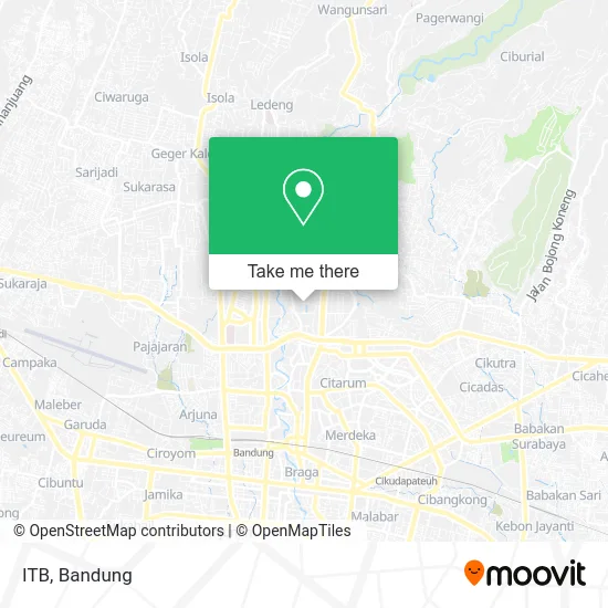
See ITB, Kota Bandung, on the map
Public Transit to ITB in Kota Bandung
Wondering how to get to ITB in Kota Bandung? Moovit helps you find the best way to get to ITB with step-by-step directions from the nearest public transit station.
Moovit provides free maps and live directions to help you navigate through your city. View schedules, routes, timetables, and find out how long does it take to get to ITB in real time.
Looking for the nearest stop or station to ITB? Check out this list of stops closest to your destination: Itb Gerbang Sipil; Tamansari (Bonbin); Rumah Sakit Santo Borromeus A; Sman 1 Bandung; Surya Kencana; Stasiun Cikudapateuh.
Bus: 02, 05, 26, 34, 18, 09, TMP 4D, BS 02, 33.Train: B, C.
Want to see if there’s another route that gets you there at an earlier time? Moovit helps you find alternative routes or times. Get directions from and directions to ITB easily from the Moovit App or Website.
We make riding to ITB easy, which is why over 1.5 million users, including users in Kota Bandung, trust Moovit as the best app for public transit. You don’t need to download an individual bus app or train app, Moovit is your all-in-one transit app that helps you find the best bus time or train time available.
For information on prices of bus, costs and ride fares to ITB, please check the Moovit app.
Use the app to navigate to popular places including to the airport, hospital, stadium, grocery store, mall, coffee shop, school, college, and university.
ITB Address: Jalan Ganeca street in Kota Bandung
- Angkringan ITB,
- Monumen Kubus,
- ITB Kampus Ganesha,
- Taman Ganesha,
- Institut Teknologi Bandung (ITB),
- Koperasi Keluarga Pegawai ITB (KKP ITB),
- Masjid Salman Itb,
- Fisioterapi RS Santo Borromeus,
- Kompleks Masjid Salman ITB,
- Master of Business Administration (MBA) ITB,
- ALSI Teknik sipil ITB,
- Sari Laut Seafood Ganeca,
- Parkir Timur ITB,
- Puskesmas Dago,
- PAS (Pembinaan Anak-anak Salman) ITB,
- Bioskop Kampus - Liga Film Mahasiswa,
- Sekretariat Ikatan Alumni ITB Jawa Barat,
- LFM - Liga Film Mahasiswa ITB,
- Parkiran Kebun Binatang,
- Gps Office Bandung
Places Near ITB (Kota Bandung)
- Taman Hutan Raya (TAHURA), Kota Bandung,
- Pantai Santolo - Pameungpeuk Garut, Bandung,
- Subang, Kota Bandung,
- Cililin, Kab. Bandung Barat, Bandung,
- RSUP Dr. Hasan Sadikin (RSHS), Kota Bandung,
- Bus Damri Dipati Ukur-Jatinangor, Bandung,
- Trans Studio Mall (TSM), Kota Bandung,
- Universitas Pendidikan Indonesia (UPI), Kota Bandung,
- 23 Paskal Shopping Mall, Kota Bandung,
- Batujajar, Bandung,
- Summarecon Mall Bandung, Kota Bandung,
- bus damri “Dago - Leuwi panjang”, Kota Bandung,
- Braga, Kota Bandung,
- Rumah Sakit Hasan Sadikin, Kota Bandung,
- Jl.L.L.R.E.Martadinata no.47,Bandung Regency, Bandung,
- Pasteur, Kota Bandung,
- YYY, Kota Bandung,
- Warung bokep, Bandung,
- Stadion Gelora Bandung Lautan Api (GBLA), Kota Bandung,
- Rs Hasan Sadikin, Kota Bandung
How to get to popular places in Bandung with public transit
Get around Kota Bandung by public transit!
Traveling around Kota Bandung has never been so easy. See step by step directions as you travel to any attraction, street or major public transit station. View bus and train schedules, arrival times, service alerts and detailed routes on a map, so you know exactly how to get to anywhere in Kota Bandung.
When traveling to any destination around Kota Bandung use Moovit's Live Directions with Get Off Notifications to know exactly where and how far to walk, how long to wait for your line, and how many stops are left. Moovit will alert you when it's time to get off — no need to constantly re-check whether yours is the next stop.
Wondering how to use public transit in Kota Bandung or how to pay for public transit in Kota Bandung? Moovit public transit app can help you navigate your way with public transit easily, and at minimum cost. It includes public transit fees, ticket prices, and costs. Looking for a map of Kota Bandung public transit lines? Moovit public transit app shows all public transit maps in Kota Bandung with all Bus and Train routes and stops on an interactive map.
Bandung has 2 transit type(s), including: Bus and Train, operated by several transit agencies, including Trans Metro Bandung, Trans Metro Pasundan - Teman Bus, Angkutan Antarkota Dalam Provinsi, DAMRI, KAI Commuter, Angkutan Kota Bandung, Angkutan Kabupaten Bandung, Kobanter Baru, Bus Wisata DISHUB Kota Bandung, Bus Sekolah DISHUB Kota Bandung and Dinas Perhubungan Provinsi Jawa Barat