How to get to Ica by bus?
Click on the bus route to see step by step directions with maps, line arrival times and updated time schedules.
From Lotto-Annahmestelle, Vereinbarte Verwaltungsgemeinschaft Sinzheim
51 minFrom Grinde-Hütte, Seebach
80 minFrom Krankenhaus Freudenstadt, Vereinbarte Verwaltungsgemeinschaft Freudenstadt
165 minFrom Parkplatz Bauhaus, Verwaltungsgemeinschaft Offenburg
104 minFrom Hopfenschlingel, Vereinbarte Verwaltungsgemeinschaft Rastatt
81 minFrom Panorama-Bad Freudenstadt, Vereinbarte Verwaltungsgemeinschaft Freudenstadt
163 minFrom Epplesee, Rheinstetten
178 minFrom Baden-Baden, Karlsruhe/Baden-Baden Airport, Rheinmünster
47 minFrom Mercedes-Benz Werk Rastatt, Vereinbarte Verwaltungsgemeinschaft Rastatt
96 min
How to get to Ica by train?
Click on the train route to see step by step directions with maps, line arrival times and updated time schedules.
From Lotto-Annahmestelle, Vereinbarte Verwaltungsgemeinschaft Sinzheim
30 minFrom Krankenhaus Freudenstadt, Vereinbarte Verwaltungsgemeinschaft Freudenstadt
134 minFrom Parkplatz Bauhaus, Verwaltungsgemeinschaft Offenburg
48 minFrom Hopfenschlingel, Vereinbarte Verwaltungsgemeinschaft Rastatt
40 minFrom Panorama-Bad Freudenstadt, Vereinbarte Verwaltungsgemeinschaft Freudenstadt
127 minFrom Epplesee, Rheinstetten
57 minFrom Höhenhotel Pfeifle, Baiersbronn
88 min
Bus stops near Ica in Vereinbarte Verwaltungsgemeinschaft Bühl
Train stations near Ica in Vereinbarte Verwaltungsgemeinschaft Bühl
- Bühl (Baden), 11 min walk,VIEW
Bus lines to Ica in Vereinbarte Verwaltungsgemeinschaft Bühl
- 267, Weitenung Alte Post,VIEW
- 268, Freistett Busbahnhof,VIEW
- 268S, Bühl (Baden),VIEW
- 272, Weitenung Wiesenweg,VIEW
- 268, Bühl Gymnasium,VIEW
- 268S, Muckenschopf,VIEW
- 271, Bühl Bühlertalstr/Hauptstr,VIEW
- 271, Bühl A.-Stifter-Straße,VIEW
- 262, Eisental Traube,VIEW
- 262, Kartung Abzw. Winden,VIEW
- 263, Bühl Gymnasium,VIEW
- X44, Bad Herrenalb,VIEW
- 263, Forbach (Schwarzwald) - Bühl ZOB/Bahnhof,VIEW
- 264, Bühl ZOB/Bahnhof - Sand Kapelle,VIEW
- 265, Bühl Gymnasium - Lauf Abzw. Aubach,VIEW
- 266, Unzhurst Schule - Bühl Gymnasium,VIEW
- X44, Bühl ZOB/Bahnhof - Bad Herrenalb Bahnhof,VIEW
- 274, Eisental Abzw. Affental,VIEW
- 274, Bühl (Baden),VIEW
- 274, Bühl Zob/Bahnhof,VIEW
What are the closest stations to Ica?
The closest stations to Ica are:
- Bühl Rheinstraße is 129 meters away, 2 min walk.
- Bühl Zob/Bahnhof is 186 meters away, 3 min walk.
- Bühl Rathaus is 330 meters away, 5 min walk.
- Bühl Im Grün is 354 meters away, 5 min walk.
- Bühl (Baden) is 802 meters away, 11 min walk.
Which train lines stop near Ica?
These train lines stop near Ica: RE 2, RE2, S7.
Which bus lines stop near Ica?
These bus lines stop near Ica: 263, 264, 268, 272, 7135, X34.
What’s the nearest train station to Ica in Vereinbarte Verwaltungsgemeinschaft Bühl?
The nearest train station to Ica in Vereinbarte Verwaltungsgemeinschaft Bühl is Bühl (Baden). It’s a 11 min walk away.
What’s the nearest bus station to Ica in Vereinbarte Verwaltungsgemeinschaft Bühl?
The nearest bus station to Ica in Vereinbarte Verwaltungsgemeinschaft Bühl is Bühl Rheinstraße. It’s a 2 min walk away.
What time is the first train to Ica in Vereinbarte Verwaltungsgemeinschaft Bühl?
The RE2 is the first train that goes to Ica in Vereinbarte Verwaltungsgemeinschaft Bühl. It stops nearby at 5:08 AM.
What time is the last train to Ica in Vereinbarte Verwaltungsgemeinschaft Bühl?
The RB44 is the last train that goes to Ica in Vereinbarte Verwaltungsgemeinschaft Bühl. It stops nearby at 1:26 AM.
What time is the first bus to Ica in Vereinbarte Verwaltungsgemeinschaft Bühl?
The X44 is the first bus that goes to Ica in Vereinbarte Verwaltungsgemeinschaft Bühl. It stops nearby at 5:11 AM.
What time is the last bus to Ica in Vereinbarte Verwaltungsgemeinschaft Bühl?
The 274 is the last bus that goes to Ica in Vereinbarte Verwaltungsgemeinschaft Bühl. It stops nearby at 12:14 AM.
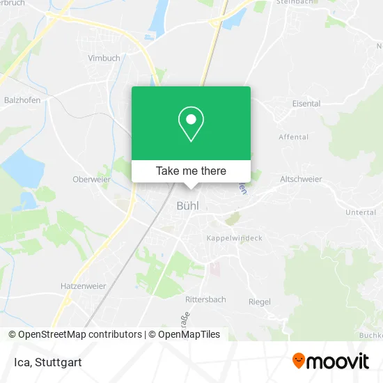
See Ica, Vereinbarte Verwaltungsgemeinschaft Bühl, on the map
Public Transit to Ica in Vereinbarte Verwaltungsgemeinschaft Bühl
Wondering how to get to Ica in Vereinbarte Verwaltungsgemeinschaft Bühl? Moovit helps you find the best way to get to Ica with step-by-step directions from the nearest public transit station.
Moovit provides free maps and live directions to help you navigate through your city. View schedules, routes, timetables, and find out how long does it take to get to Ica in real time.
Looking for the nearest stop or station to Ica? Check out this list of stops closest to your destination: Bühl Rheinstraße; Bühl Zob/Bahnhof; Bühl Rathaus; Bühl Im Grün; Bühl (Baden).
Train: RE 2, RE2, S7, RE7, RB44, S71, S71.Bus: 263, 264, 268, 272, 7135, X34, 267, 268S, 267, 268S, 271, 271.
Want to see if there’s another route that gets you there at an earlier time? Moovit helps you find alternative routes or times. Get directions from and directions to Ica easily from the Moovit App or Website.
We make riding to Ica easy, which is why over 1.5 million users, including users in Vereinbarte Verwaltungsgemeinschaft Bühl, trust Moovit as the best app for public transit. You don’t need to download an individual bus app or train app, Moovit is your all-in-one transit app that helps you find the best bus time or train time available.
For information on prices of bus and train, costs and ride fares to Ica, please check the Moovit app.
Use the app to navigate to popular places including to the airport, hospital, stadium, grocery store, mall, coffee shop, school, college, and university.
Ica Address: Friedrichstraße 11 77815 Bühl street in Vereinbarte Verwaltungsgemeinschaft Bühl
- Dr. med. dent. Isolde Beyer,
- Isolde Beyer,
- Rolf Hezel,
- Rechtsanwalt Rolf Hezel,
- Erika Bechthold Logopädie,
- SV Sparkassenversicherung: SV Service-Büro Bühl,
- Herbert Lechleiter,
- Wüstenrot Versicherung, Hans-Peter Seiter,
- Wüstenrot Immobilien Mittelbaden,
- Praxis für Logopädie Erika Bechtold,
- Georg Beier - Wüstenrot Bausparkasse,
- Wüstenrot Bausparkasse,
- Posselt-Kristall,
- Dr. Med. Gabriel R. Snounou,
- Braun Martin Dipl.Ing. Architektur,
- Gallenschütz,
- Fiba Immohyp,
- Augenzentrum Dr. Med. Liliana Rothmann,
- Berufsausübungsgemeinschaft,
- Gabriel Riad Snounou Facharzt für Mkg - Chirurgie
Places Near Ica (Vereinbarte Verwaltungsgemeinschaft Bühl)
- Waldfriedhof, Degerloch,
- Pariser Platz Stuttgart, Stuttgart-Mitte,
- Porsche Museum, Zuffenhausen,
- Hanns-Martin-Schleyer-Halle, Bad Cannstatt,
- Marmorsaal Im Weissenburgpark, Stuttgart-Süd,
- Mercedes-Benz Museum, Bad Cannstatt,
- SI-Centrum, Möhringen,
- Mettingen Eros-Center Puff Laufhaus, Esslingen Am Neckar,
- Gasometer Pforzheim, Pforzheim,
- Hauptbahnhof Stuttgart, Stuttgart-Mitte,
- FlixBus Haltestelle, Stuttgart,
- Geilhaus Haus 33a, Reutlingen-Betzingen,
- Klinikum Stuttgart - Katharinenhospital, Stuttgart-Mitte,
- Im Wizemann (Halle), Bad Cannstatt,
- Gleis 101/102 (tief), Stuttgart-Mitte,
- Porsche-Arena, Bad Cannstatt,
- Wilhelma (U-Bahn Wilhelma), Bad Cannstatt,
- Mercedes-Benz Museum (Mercedes Museum Stuttgart), Bad Cannstatt,
- Hanns-Martin-Schleyer-Halle (Stuttgart Hans-Martin-Schleyerhalle), Bad Cannstatt,
- Schleyerhalle, Bad Cannstatt
How to get to popular places in Stuttgart with public transit
Get around Vereinbarte Verwaltungsgemeinschaft Bühl by public transit!
Traveling around Vereinbarte Verwaltungsgemeinschaft Bühl has never been so easy. See step by step directions as you travel to any attraction, street or major public transit station. View bus and train schedules, arrival times, service alerts and detailed routes on a map, so you know exactly how to get to anywhere in Vereinbarte Verwaltungsgemeinschaft Bühl.
When traveling to any destination around Vereinbarte Verwaltungsgemeinschaft Bühl use Moovit's Live Directions with Get Off Notifications to know exactly where and how far to walk, how long to wait for your line, and how many stops are left. Moovit will alert you when it's time to get off — no need to constantly re-check whether yours is the next stop.
Wondering how to use public transit in Vereinbarte Verwaltungsgemeinschaft Bühl or how to pay for public transit in Vereinbarte Verwaltungsgemeinschaft Bühl? Moovit public transit app can help you navigate your way with public transit easily, and at minimum cost. It includes public transit fees, ticket prices, and costs. Looking for a map of Vereinbarte Verwaltungsgemeinschaft Bühl public transit lines? Moovit public transit app shows all public transit maps in Vereinbarte Verwaltungsgemeinschaft Bühl with all Bus, Train, Subway, Light Rail, Ferry, S-Bahn and Funicular routes and stops on an interactive map.
Stuttgart has 7 transit type(s), including: Bus, Train, Subway, Light Rail, Ferry, S-Bahn and Funicular, operated by several transit agencies, including SSB - Stadtbahn, SSB, SSB - Seilbahn / Zacke, S-Bahn Stuttgart, Rhein-Neckar-Verkehr GmbH (rnv), Karlsruher Verkehrsverbund, DB AG, DB Regiobus BW, Arverio Baden-Württemberg GmbH, DB RegioNetz Verkehrs GmbH Westfrankenbahn, DB Regio AG Baden-Württemberg, Südwestdeutsche Verkehrs-AG, DB Regio AG Mitte Region Hessen, DB and Bodensee-Oberschwaben-Bahn