How to get to Icc by bus?
Click on the bus route to see step by step directions with maps, line arrival times and updated time schedules.
From Mosaic District, Fairfax County
47 minFrom Inova employee Shuttle, Fairfax County
38 minFrom Vienna, Virginia, Fairfax County
52 minFrom Spa World, Fairfax County
56 minFrom Walmart, Fairfax County
67 minFrom Burke, VA, Fairfax County
46 minFrom Inova Fair Oaks Hospital, Fairfax County
56 minFrom Tysons Corner Center, Fairfax County
48 minFrom Leesburg VA-684, Fairfax County
55 minFrom Centreville, VA, Fairfax County
52 min
Bus stops near Icc in Fairfax
Bus lines to Icc in Fairfax
What are the closest stations to Icc?
The closest stations to Icc are:
- University Dr at Sager Ave (Nb) is 51 yards away, 1 min walk.
- University Dr at Sager Ave is 55 yards away, 2 min walk.
- University Dr+South St is 196 yards away, 3 min walk.
- Fairfax Judicial Center is 436 yards away, 6 min walk.
Which bus lines stop near Icc?
These bus lines stop near Icc: 306, 610, F50, GOLD 1, GREEN 2.
What’s the nearest bus station to Icc in Fairfax?
The nearest bus station to Icc in Fairfax is University Dr at Sager Ave (Nb). It’s a 1 min walk away.
What time is the first bus to Icc in Fairfax?
The F50 is the first bus that goes to Icc in Fairfax. It stops nearby at 5:21 AM.
What time is the last bus to Icc in Fairfax?
The GREEN 1 is the last bus that goes to Icc in Fairfax. It stops nearby at 10:41 PM.
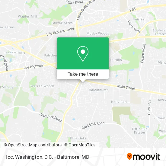
See Icc, Fairfax, on the map
Public Transit to Icc in Fairfax
Wondering how to get to Icc in Fairfax? Moovit helps you find the best way to get to Icc with step-by-step directions from the nearest public transit station.
Moovit provides free maps and live directions to help you navigate through your city. View schedules, routes, timetables, and find out how long does it take to get to Icc in real time.
Looking for the nearest stop or station to Icc? Check out this list of stops closest to your destination: University Dr at Sager Ave (Nb); University Dr at Sager Ave; University Dr+South St; Fairfax Judicial Center.
Bus: 306, 610, F50, GOLD 1, GREEN 2, GOLD 2, GREEN 1, F23.
Want to see if there’s another route that gets you there at an earlier time? Moovit helps you find alternative routes or times. Get directions from and directions to Icc easily from the Moovit App or Website.
We make riding to Icc easy, which is why over 1.5 million users, including users in Fairfax, trust Moovit as the best app for public transit. You don’t need to download an individual bus app or train app, Moovit is your all-in-one transit app that helps you find the best bus time or train time available.
For information on prices of bus and metro, costs and ride fares to Icc, please check the Moovit app.
Use the app to navigate to popular places including to the airport, hospital, stadium, grocery store, mall, coffee shop, school, college, and university.
Icc Address: 4031 University Dr Fairfax, VA 22030 street in Fairfax
- Colin Family Mediation Group,
- Carson Low-Cost Auto Insurance of Fairfax,
- Joe Estabrooks,
- TVRG Homes,
- Arias Defense Components,
- PJ Santiago - Santiago & Perlaza at KW Capital Properties,
- Sytera LLC,
- Universal Title, Fairfax,
- Picasso Homes,
- Lori Boyle Real Estate,
- FGT,
- Arpeggio HSCC JV,
- Keller Williams Realty,
- ADT 24 7 Alarm & Security,
- Case Studies,
- Wti,
- Sheeo Academy,
- Calvary Counseling Center,
- Asten Realty Team - Keller Williams Capital Properties,
- Freytag & Company
Places Near Icc (Fairfax)
- M&T Bank Stadium, Baltimore,
- National Mall, Washington,
- National Museum of African American History and Culture, Washington,
- The Anthem, Washington,
- National Zoo, Washington,
- Warner Theatre, Washington,
- Rock Creek Tennis Center, Washington,
- Amazon Hq2, Arlington County,
- Marriott Marquis Washington, DC, Washington,
- Westfield Montgomery Mall, Montgomery County,
- Georgetown, Washington,
- Basilica of the National Shrine, Washington,
- Sibley Memorial Hospital, Washington,
- Museum Of The Bible, Washington,
- Capital One Arena, Washington,
- Pennsylvania Ave NW (3rd st and pennsylvania), Washington,
- Camden Yards, Baltimore,
- Washington DC VA Medical Center, Washington,
- PG Mall, Prince George's County,
- Washington National Cathedral, Washington
How to get to popular places in Washington, D.C. - Baltimore, MD with public transit
Get around Fairfax by public transit!
Traveling around Fairfax has never been so easy. See step by step directions as you travel to any attraction, street or major public transit station. View bus and train schedules, arrival times, service alerts and detailed routes on a map, so you know exactly how to get to anywhere in Fairfax.
When traveling to any destination around Fairfax use Moovit's Live Directions with Get Off Notifications to know exactly where and how far to walk, how long to wait for your line, and how many stops are left. Moovit will alert you when it's time to get off — no need to constantly re-check whether yours is the next stop.
Wondering how to use public transit in Fairfax or how to pay for public transit in Fairfax? Moovit public transit app can help you navigate your way with public transit easily, and at minimum cost. It includes public transit fees, ticket prices, and costs. Looking for a map of Fairfax public transit lines? Moovit public transit app shows all public transit maps in Fairfax with all Bus, Train, Metro, Light Rail and Ferry routes and stops on an interactive map.
Washington, D.C. - Baltimore, MD has 5 transit type(s), including: Bus, Train, Metro, Light Rail and Ferry, operated by several transit agencies, including WMATA, Montgomery County Ride On, Fairfax Connector, TheBus, PRTC, DASH - Alexandria, Arlington Transit (ART), RTA of Central Maryland, MDOT MTA, MDOT MTA Light RailLink, MDOT MTA Commuter Bus, MDOT MTA Local Bus, FXBGO!, Virginia Railway Express (VRE) and MARC