How to get to Identity Digital Group by bus?
Click on the bus route to see step by step directions with maps, line arrival times and updated time schedules.
From Central Park, Manhattan
48 minFrom Pier 78, Manhattan
41 minFrom Carnegie Hall, Manhattan
53 minFrom East 93rd Street, Manhattan
73 minFrom East 96th Street, Manhattan
49 minFrom Astoria, NY, Queens
80 minFrom Catedral de San Patricio en Nova York, Manhattan
37 minFrom Memorial Sloan-Kettering Cancer Center, Manhattan
58 minFrom New York Presbyterian Hospital, Manhattan
59 min
How to get to Identity Digital Group by train?
Click on the train route to see step by step directions with maps, line arrival times and updated time schedules.
How to get to Identity Digital Group by subway?
Click on the subway route to see step by step directions with maps, line arrival times and updated time schedules.
From Central Park, Manhattan
45 minFrom Pier 78, Manhattan
41 minFrom Carnegie Hall, Manhattan
27 minFrom East 93rd Street, Manhattan
37 minFrom East 96th Street, Manhattan
34 minFrom Astoria, NY, Queens
59 minFrom Catedral de San Patricio en Nova York, Manhattan
29 minFrom Memorial Sloan-Kettering Cancer Center, Manhattan
33 minFrom New York Presbyterian Hospital, Manhattan
41 min
Bus stops near Identity Digital Group in Manhattan
- Broadway Between Exc. Place & Morris St, 2 min walk,VIEW
- Broadway/Morris St, 2 min walk,VIEW
- The Battery, 3 min walk,VIEW
- Trinity Pl/Morris St, 3 min walk,VIEW
- Trinity Pl & Exchange Alley, 3 min walk,VIEW
- Broadway/Exchange Alley, 3 min walk,VIEW
- New York - Greenwich St @ Morris St, 3 min walk,VIEW
- Broadway at Exchange Pl#, 3 min walk,VIEW
- New York - Broadway @ Exchange Pl (Northbound), 3 min walk,VIEW
Subway stations near Identity Digital Group in Manhattan
Bus lines to Identity Digital Group in Manhattan
- SUBURBAN TRANSIT, New York,VIEW
- BXM18, Downtown Wall St Via 5 Av Via Broadway,VIEW
- 120, New York Lower Manhattan,VIEW
- QM65, Laurelton,VIEW
- SIM1, Eltngvlle Trans Ctr Via Hylan Via Rich,VIEW
- SIM1C, Eltngvlle Trans Ctr Via Hylan Via Rich,VIEW
- SIM4, Annadale Via Richmond Av,VIEW
- SIM4C, Huguenot Via Richmond Av Via Arthur Kill,VIEW
- SIM3C, Pt Rchmnd Via Narrows Rd N Via Watchogue,VIEW
- SIM33C, Mariners Harbor Via N Gannon Av,VIEW
- M55, South Ferry,VIEW
- SHORTLINE HUDSON, Nanuet,VIEW
- SHORTLINE HUDSON, Circleville,VIEW
- X27, Bay Ridge Shore Rd Via Broadway,VIEW
- X28, Coney Island Sea Gate Via Broadway,VIEW
- 314, Wall Street to Parkway Express - Ends Monmouth,VIEW
- 404, Wall Street to Route 9 (Pine Street),VIEW
- 604, Route 36 to Wall Street - Highlands Middle Road,VIEW
- 720, Exit 5 to Port Authority - Wall Street,VIEW
- 206, Parkway Express - Wall Street Via Jersey City,VIEW
What are the closest stations to Identity Digital Group?
The closest stations to Identity Digital Group are:
- Broadway Between Exc. Place & Morris St is 40 yards away, 2 min walk.
- Broadway/Morris St is 81 yards away, 2 min walk.
- Wall St is 86 yards away, 2 min walk.
- The Battery is 144 yards away, 3 min walk.
- Trinity Pl/Morris St is 153 yards away, 3 min walk.
- Trinity Pl & Exchange Alley is 186 yards away, 3 min walk.
- Broadway/Exchange Alley is 187 yards away, 3 min walk.
- New York - Greenwich St @ Morris St is 188 yards away, 3 min walk.
- Broadway at Exchange Pl# is 227 yards away, 3 min walk.
- New York - Broadway @ Exchange Pl (Northbound) is 235 yards away, 3 min walk.
- Broad St is 245 yards away, 4 min walk.
- Rector St is 295 yards away, 4 min walk.
Which bus lines stop near Identity Digital Group?
These bus lines stop near Identity Digital Group: BM2, BXM18, M15-SBS, M20.
Which train lines stop near Identity Digital Group?
These train lines stop near Identity Digital Group: GRE, RED.
Which subway lines stop near Identity Digital Group?
These subway lines stop near Identity Digital Group: 1, 3, 4, 5, W.
What’s the nearest subway station to Identity Digital Group in Manhattan?
The nearest subway station to Identity Digital Group in Manhattan is Wall St. It’s a 2 min walk away.
What’s the nearest bus station to Identity Digital Group in Manhattan?
The nearest bus stations to Identity Digital Group in Manhattan are Broadway Between Exc. Place & Morris St and Broadway/Morris St. The closest one is a 2 min walk away.
What time is the first subway to Identity Digital Group in Manhattan?
The 4 is the first subway that goes to Identity Digital Group in Manhattan. It stops nearby at 3:00 AM.
What time is the last subway to Identity Digital Group in Manhattan?
The 4 is the last subway that goes to Identity Digital Group in Manhattan. It stops nearby at 3:57 AM.
What time is the first bus to Identity Digital Group in Manhattan?
The SIM1C is the first bus that goes to Identity Digital Group in Manhattan. It stops nearby at 3:56 AM.
What time is the last bus to Identity Digital Group in Manhattan?
The SIM1C is the last bus that goes to Identity Digital Group in Manhattan. It stops nearby at 2:57 AM.
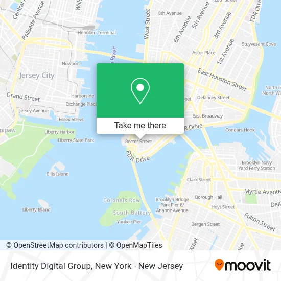
See Identity Digital Group, Manhattan, on the map
Public Transit to Identity Digital Group in Manhattan
Wondering how to get to Identity Digital Group in Manhattan? Moovit helps you find the best way to get to Identity Digital Group with step-by-step directions from the nearest public transit station.
Moovit provides free maps and live directions to help you navigate through your city. View schedules, routes, timetables, and find out how long does it take to get to Identity Digital Group in real time.
Looking for the nearest stop or station to Identity Digital Group? Check out this list of stops closest to your destination: Broadway Between Exc. Place & Morris St; Broadway/Morris St; Wall St; The Battery; Trinity Pl/Morris St; Trinity Pl & Exchange Alley; Broadway/Exchange Alley; New York - Greenwich St @ Morris St; Broadway at Exchange Pl#; New York - Broadway @ Exchange Pl (Northbound); Broad St; Rector St.
Bus: BM2, BXM18, M15-SBS, M20, SUBURBAN TRANSIT.Train: GRE, RED.Subway: 1, 3, 4, 5, W, J, M, Z, N, Q, R.
Want to see if there’s another route that gets you there at an earlier time? Moovit helps you find alternative routes or times. Get directions from and directions to Identity Digital Group easily from the Moovit App or Website.
We make riding to Identity Digital Group easy, which is why over 1.5 million users, including users in Manhattan, trust Moovit as the best app for public transit. You don’t need to download an individual bus app or train app, Moovit is your all-in-one transit app that helps you find the best bus time or train time available.
For information on prices of subway, bus and train, costs and ride fares to Identity Digital Group, please check the Moovit app.
Use the app to navigate to popular places including to the airport, hospital, stadium, grocery store, mall, coffee shop, school, college, and university.
Identity Digital Group Address: 42 Broadway street in Manhattan
- Online Trading Academy New York City,
- Opus Virtual Offices,
- 360 Protective Solutions,
- Neu Global Networks,
- Sector Security Of Ny, Inc.,
- Sphere Card, Llc,
- Tej Solpro,
- Platta Law Firm,
- Immortelle Therapy,
- Game Over Game Bus,
- Design by Yanih,
- Hrg,
- Miro Creative,
- Passport Health New York Financial District Travel Clinic,
- Purpleroyalty,
- Global Excellence Assembly,
- Premier Home Health Care Services,
- Merrick Capital Cash Advance,
- Abogadalinastillman,
- One Life Coaching Nyc
Places Near Identity Digital Group (Manhattan)
- 376 Hudson Street, Manhattan,
- 26 Federal Plaza, Manhattan,
- 111 Centre New York City Supreme Court, Manhattan,
- 3 Stone St, Manhattan,
- qqqq, Manhattan,
- 1 Police Plaza, Manhattan,
- Wall Street, Manhattan,
- Mountainside Hospital, Glen Ridge,
- Queens Center Mall, Queens,
- Rockefeller Center, Manhattan,
- Bellevue Hospital, Manhattan,
- San Gennaro Feast, Manhattan,
- 66 John Street, Manhattan,
- Hudson Yards, Manhattan,
- Katz's Deli, Manhattan,
- 911 Memorial, Manhattan,
- SoHo, Manhattan,
- Times Square, Manhattan,
- Pier 83, Manhattan,
- Chinatown, Manhattan
How to get to popular places in New York - New Jersey with public transit
Get around Manhattan by public transit!
Traveling around Manhattan has never been so easy. See step by step directions as you travel to any attraction, street or major public transit station. View bus and train schedules, arrival times, service alerts and detailed routes on a map, so you know exactly how to get to anywhere in Manhattan.
When traveling to any destination around Manhattan use Moovit's Live Directions with Get Off Notifications to know exactly where and how far to walk, how long to wait for your line, and how many stops are left. Moovit will alert you when it's time to get off — no need to constantly re-check whether yours is the next stop.
Wondering how to use public transit in Manhattan or how to pay for public transit in Manhattan? Moovit public transit app can help you navigate your way with public transit easily, and at minimum cost. It includes public transit fees, ticket prices, and costs. Looking for a map of Manhattan public transit lines? Moovit public transit app shows all public transit maps in Manhattan with all Bus, Train, Subway, Light Rail, Ferry and Cable Car routes and stops on an interactive map.
New York - New Jersey has 6 transit type(s), including: Bus, Train, Subway, Light Rail, Ferry and Cable Car, operated by several transit agencies, including MTA Subway, Metro-North Railroad, LIRR, PATH, MTA New York City Transit - Express routes, MTA Bus, NJ Transit, NYC Ferry, NICE bus, Bee-Line Bus, NJ Transit Rail, Norwalk Transit District, Hartford Line, River Valley Transit and HART