How to get to Ifix Tech Repair by bus?
Click on the bus route to see step by step directions with maps, line arrival times and updated time schedules.
From Tri-Rail-Pompano Beach Station, Pompano Beach
73 minFrom Tri-Rail-Deerfield Beach Station, Deerfield Beach
63 minFrom Ollie's Bargain Outlet, Boynton Beach-Delray Beach
67 minFrom Military Trail & Yamato Rd., Boca Raton
58 minFrom Amazon Fulfillment Center-DMF3, Pompano Beach
79 minFrom Pretty in Palm Beach, Boynton Beach-Delray Beach
77 minFrom Sample Rd, Deerfield Beach
78 minFrom Lynn University, Boca Raton
61 minFrom Brazzers, Boca Raton
29 min
How to get to Ifix Tech Repair by train?
Click on the train route to see step by step directions with maps, line arrival times and updated time schedules.
Bus stops near Ifix Tech Repair in Boca Raton
Train station near Ifix Tech Repair in Boca Raton
- Boca Raton, 50 min walk,VIEW
Bus lines to Ifix Tech Repair in Boca Raton
What are the closest stations to Ifix Tech Repair?
The closest stations to Ifix Tech Repair are:
- E PALMETTO PK RD at SE 1 AVE is 248 yards away, 4 min walk.
- US 1/Palmetto Park Road is 303 yards away, 4 min walk.
- FEDERAL HWY at PALMETTO PK RD is 306 yards away, 4 min walk.
- Boca Raton is 4228 yards away, 50 min walk.
Which bus lines stop near Ifix Tech Repair?
These bus lines stop near Ifix Tech Repair: 1, 10, 94.
Which train line stops near Ifix Tech Repair?
BLFM (Ekw)
What’s the nearest bus station to Ifix Tech Repair in Boca Raton?
The nearest bus stations to Ifix Tech Repair in Boca Raton are E PALMETTO PK RD at SE 1 AVE, US 1/Palmetto Park Road and FEDERAL HWY at PALMETTO PK RD. The closest one is a 4 min walk away.
What time is the first train to Ifix Tech Repair in Boca Raton?
The BLFM is the first train that goes to Ifix Tech Repair in Boca Raton. It stops nearby at 6:14 AM.
What time is the last train to Ifix Tech Repair in Boca Raton?
The BLFM is the last train that goes to Ifix Tech Repair in Boca Raton. It stops nearby at 11:53 PM.
What time is the first bus to Ifix Tech Repair in Boca Raton?
The 10 is the first bus that goes to Ifix Tech Repair in Boca Raton. It stops nearby at 5:26 AM.
What time is the last bus to Ifix Tech Repair in Boca Raton?
The 10 is the last bus that goes to Ifix Tech Repair in Boca Raton. It stops nearby at 12:14 AM.
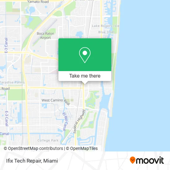
See Ifix Tech Repair, Boca Raton, on the map
Public Transit to Ifix Tech Repair in Boca Raton
Wondering how to get to Ifix Tech Repair in Boca Raton? Moovit helps you find the best way to get to Ifix Tech Repair with step-by-step directions from the nearest public transit station.
Moovit provides free maps and live directions to help you navigate through your city. View schedules, routes, timetables, and find out how long does it take to get to Ifix Tech Repair in real time.
Looking for the nearest stop or station to Ifix Tech Repair? Check out this list of stops closest to your destination: E PALMETTO PK RD at SE 1 AVE; US 1/Palmetto Park Road; FEDERAL HWY at PALMETTO PK RD; Boca Raton.
Bus: 1, 10, 94, 92.Train: BLFM.
Want to see if there’s another route that gets you there at an earlier time? Moovit helps you find alternative routes or times. Get directions from and directions to Ifix Tech Repair easily from the Moovit App or Website.
We make riding to Ifix Tech Repair easy, which is why over 1.5 million users, including users in Boca Raton, trust Moovit as the best app for public transit. You don’t need to download an individual bus app or train app, Moovit is your all-in-one transit app that helps you find the best bus time or train time available.
For information on prices of bus and train, costs and ride fares to Ifix Tech Repair, please check the Moovit app.
Use the app to navigate to popular places including to the airport, hospital, stadium, grocery store, mall, coffee shop, school, college, and university.
Ifix Tech Repair Address: 102 NE 2nd St Boca Raton, FL 33432 street in Boca Raton
- Happy Paws Pet Expo,
- Vital Red Light,
- Skipper's Review,
- National Relocation,
- Omit Studios,
- Tropicana Capital Management,
- Cricket Turf,
- Herbaheal Animal Health,
- Soflo Entertainment,
- Perfect Wedding Guide,
- Ferrer Associates General Contractors,
- Construct A Holics,
- Art Plumbing & Air Conditioning,
- Water and Wastewater Industries,
- Shred Nations,
- Vino Wine Bar & Italian Kitchen,
- Antonia Dry Clean and Alterations,
- Six Tables A Restaurant,
- The Bites! Network,
- Weisman Brodie Star and Margolies Pa
Places Near Ifix Tech Repair (Boca Raton)
- Aventura Mall, Miami Beach,
- Zoo Miami, Miami,
- Bayside Marketplace, Miami,
- Sawgrass mall ( FL ), Miami Beach,
- Keiser University Flagship Campus, West Palm Beach,
- Dolphin Mall, Miami,
- Sawgrass Mall, Miami,
- Little Havana, Miami,
- Wynwood, Miami,
- Aventura Mall, Miami,
- Richard E. Gerstein Justice Building, Miami,
- Miami Freedom Park, Miami,
- Brickell City Centre, Miami,
- Hard Rock Stadium, Miami Gardens,
- Port of Miami Cruise Terminal, Miami,
- Miami-Dade County Courthouse, Miami,
- Miami Design District, Miami,
- Dolphin Mall Bus, Miami,
- Marlins Park, Miami,
- Miami VA Hospital, Miami
How to get to popular places in Miami with public transit
Get around Boca Raton by public transit!
Traveling around Boca Raton has never been so easy. See step by step directions as you travel to any attraction, street or major public transit station. View bus and train schedules, arrival times, service alerts and detailed routes on a map, so you know exactly how to get to anywhere in Boca Raton.
When traveling to any destination around Boca Raton use Moovit's Live Directions with Get Off Notifications to know exactly where and how far to walk, how long to wait for your line, and how many stops are left. Moovit will alert you when it's time to get off — no need to constantly re-check whether yours is the next stop.
Wondering how to use public transit in Boca Raton or how to pay for public transit in Boca Raton? Moovit public transit app can help you navigate your way with public transit easily, and at minimum cost. It includes public transit fees, ticket prices, and costs. Looking for a map of Boca Raton public transit lines? Moovit public transit app shows all public transit maps in Boca Raton with all Bus, Train, Light Rail and Ferry routes and stops on an interactive map.
Miami has 4 transit type(s), including: Bus, Train, Light Rail and Ferry, operated by several transit agencies, including Broward County Transit, Miami-Dade Transit, Metrorail, Palm Tran, Tri-Rail, Brightline, MARTY, City of Homestead Trolley, Key West Transit, Treasure Coast Connector, GoLine IRT, Amtrak, Greyhound-us, FlixBus-us and Aventura Express Shuttle Bus