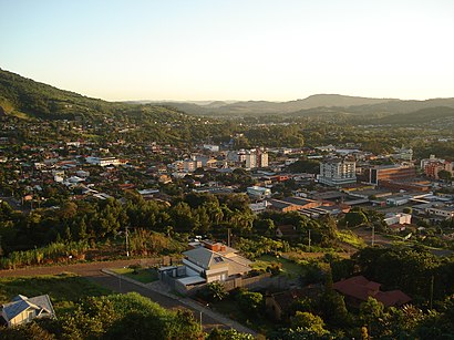
Directions to Igrejinha with public transportation
The following transit lines have routes that pass near Igrejinha
How to get to Igrejinha by bus?
Click on the bus route to see step by step directions with maps, line arrival times and updated time schedules.
Bus stops near Igrejinha
- Independência - Rodoviária De Igrejinha, 1 min walk,
- Rodoviária De Igrejinha, 1 min walk,
Bus lines to Igrejinha
- 0508 SÃO LEOPOLDO - CANELA (VIA TAQUARA), Canela Via Blos / Faixa Em Igrejinha,
- 0692 PORTO ALEGRE - CANELA (VIA GRAMADO), [Sd] ✈ Gramado / Canela Via Taquara / Igrejinha / Três Coroas,
- 0722 TAQUARA - CANELA (VIA RS-115), Canela Via Faixa,
- 1685 CAXIAS DO SUL - SANTO ANTÔNIO (VIA GRAMADO), Taquara / Gramado / Caxias Do Sul,
- 2272 PORTO ALEGRE / TRÊS COROAS, [Semidireto] ✈ Porto Alegre Via Taquara,
What are the closest stations to Igrejinha?
The closest stations to Igrejinha are:
- Independência - Rodoviária De Igrejinha is 11 meters away, 1 min walk.
- Rodoviária De Igrejinha is 47 meters away, 1 min walk.
Which bus lines stop near Igrejinha?
These bus lines stop near Igrejinha: 0508 SÃO LEOPOLDO - CANELA (VIA TAQUARA), 1685 CAXIAS DO SUL - SANTO ANTÔNIO (VIA GRAMADO).
What’s the nearest bus station to Igrejinha?
The nearest bus stations to Igrejinha are Independência - Rodoviária De Igrejinha and Rodoviária De Igrejinha. The closest one is a 1 min walk away.
What time is the first bus to Igrejinha?
The 0722 TAQUARA - CANELA (VIA RS-115) is the first bus that goes to Igrejinha. It stops nearby at 5:49 AM.
What time is the last bus to Igrejinha?
The 0692 PORTO ALEGRE - CANELA (VIA GRAMADO) is the last bus that goes to Igrejinha. It stops nearby at 9:45 PM.
See Igrejinha on the map
Public Transportation to Igrejinha
Wondering how to get to Igrejinha? Moovit helps you find the best way to get to Igrejinha with step-by-step directions from the nearest public transit station.
Moovit provides free maps and live directions to help you navigate through your city. View schedules, routes, timetables, and find out how long does it take to get to Igrejinha in real time.
Looking for the nearest stop or station to Igrejinha? Check out this list of stops closest to your destination: Independência - Rodoviária De Igrejinha; Rodoviária De Igrejinha.
Bus: 0508 SÃO LEOPOLDO - CANELA (VIA TAQUARA), 1685 CAXIAS DO SUL - SANTO ANTÔNIO (VIA GRAMADO), 0692 PORTO ALEGRE - CANELA (VIA GRAMADO), 0722 TAQUARA - CANELA (VIA RS-115), 2272 PORTO ALEGRE / TRÊS COROAS.
Want to see if there’s another route that gets you there at an earlier time? Moovit helps you find alternative routes or times. Get directions from and directions to Igrejinha easily from the Moovit App or Website.
We make riding to Igrejinha easy, which is why over 1.5 million users, including users in Porto Alegre Region, trust Moovit as the best app for public transit. You don’t need to download an individual bus app or train app, Moovit is your all-in-one transit app that helps you find the best bus time or train time available.
For information on prices of bus, costs and ride fares to Igrejinha, please check the Moovit app.
Use the app to navigate to popular places including to the airport, hospital, stadium, grocery store, mall, coffee shop, school, college, and university.
Location: Porto Alegre Region
Popular routes to Igrejinha
Popular routes from Igrejinha
Places Near Igrejinha
How to get to popular places in Porto Alegre Region with public transit
Get around Porto Alegre Region by public transit!
Traveling around Porto Alegre Region has never been so easy. See step by step directions as you travel to any attraction, street or major public transit station. View bus and train schedules, arrival times, service alerts and detailed routes on a map, so you know exactly how to get to anywhere in Porto Alegre Region.
When traveling to any destination around Porto Alegre Region use Moovit's Live Directions with Get Off Notifications to know exactly where and how far to walk, how long to wait for your line, and how many stops are left. Moovit will alert you when it's time to get off — no need to constantly re-check whether yours is the next stop.
Wondering how to use public transit in Porto Alegre Region or how to pay for public transit in Porto Alegre Region? Moovit public transit app can help you navigate your way with public transit easily, and at minimum cost. It includes public transit fees, ticket prices, and costs. Looking for a map of Porto Alegre Region public transit lines? Moovit public transit app shows all public transit maps in Porto Alegre Region with all Bus, Metro and Ferry routes and stops on an interactive map.
Porto Alegre Region has 3 transit type(s), including: Bus, Metro and Ferry, operated by several transit agencies, including Trensurb, CatSul, ATL (Porto Alegre - Táxi-Lotação), CARRIS, CONSÓRCIO MAIS, CONSÓRCIO VIA LESTE, CONSÓRCIO MOB, CONSÓRCIO VIVA SUL, Consórcio Metropolitano de Transportes, Sogil - Metroplan, Sogil - Urbano Gravataí, SIT Canoas (Sogal), Turis Silva, Guaíba - Metroplan e DAER and Expresso Assur (Guaíba)