Directions to Ilha De Villegagnon (Centro) with public transportation
The following transit lines have routes that pass near Ilha De Villegagnon
 Bus: 167, 202, 2146D (EXECUTIVO), 232, 2951C (EXECUTIVO).
- Metro: L1, L4, L2.
- Light Rail: L1.
- Ferry: ILHA DO GOVERNADOR - PRAÇA XV.
How to get to Ilha De Villegagnon by bus?
Click on the bus route to see step by step directions with maps, line arrival times and updated time schedules.
How to get to Ilha De Villegagnon by metro?
Click on the metro route to see step by step directions with maps, line arrival times and updated time schedules.
How to get to Ilha De Villegagnon by light rail?
Click on the light rail route to see step by step directions with maps, line arrival times and updated time schedules.
Light Rail stations near Ilha De Villegagnon in Centro
- Cinelândia, 1 min walk,
Bus stop near Ilha De Villegagnon in Centro
- Aeroporto Santos Dumont ✈, 4 min walk,
Metro station near Ilha De Villegagnon in Centro
- Cinelândia, 6 min walk,
Ferry station near Ilha De Villegagnon in Centro
- Praça XV, 33 min walk,
Bus lines to Ilha De Villegagnon in Centro
- 110, São Gonçalo X Passeio,
- 2110, São Gonçalo X Castelo,
- 4110, São Gonçalo X Castelo,
- 4545, Alcântara X Castelo,
- ITAIPAVA - CASTELO, Itaipava - Castelo,
- PETRÓPOLIS - CASTELO, Petrópolis - Castelo,
- 127C, Magé - Castelo (via Túnel Marcello Alencar),
- 167, Terminal Gentileza - Urca (Circular - Via Praia do Flamengo),
- 169, Terminal Gentileza - General Osório (BRS 1 - via Aterro),
- 202, Rio Comprido - Castelo (BRS 1 - via Catumbi / Central),
- 232, Lins - Castelo (Brs 4 - Via Boca do Mato),
- SN 232, Lins - Castelo (Brs 4 - Via Boca do Mato),
- 292, Engenho da Rainha - Castelo (Brs 4 - Via Bonsucesso / Av. Brasil),
- 298, Acari - Castelo (Brs 4 - Via Norte Shopping),
- 321, Bancários - Castelo (Brs 4 - Via Linha Vermelha),
- 325, Ribeira - Castelo (Brs 4 - Via Jardim Guanabara / Linha Vermelha),
- 342, Jardim América - Castelo (Brs 4),
- SR 342, Jardim América - Castelo (Rápido),
- SV 474, Jacaré - Copacabana (Brs 2 - Via Túnel Marcello Alencar),
- 483, Penha - Ipanema (Brs 3 - Via Bonsucesso / Expressa / Aterro),
What are the closest stations to Ilha De Villegagnon?
The closest stations to Ilha De Villegagnon are:
- Cinelândia is 32 meters away, 1 min walk.
- Aeroporto Santos Dumont ✈ is 270 meters away, 4 min walk.
- Praça XV is 2563 meters away, 33 min walk.
Which bus lines stop near Ilha De Villegagnon?
These bus lines stop near Ilha De Villegagnon: 167, 202, 2146D (EXECUTIVO), 232, 2951C (EXECUTIVO), 483, 492.
Which metro lines stop near Ilha De Villegagnon?
These metro lines stop near Ilha De Villegagnon: L1, L4, L2.
Which light rail line stops near Ilha De Villegagnon?
L1 (Santos Dumont ✈)
What’s the nearest light rail station to Ilha De Villegagnon in Centro?
The nearest light rail station to Ilha De Villegagnon in Centro is Cinelândia. It’s a 1 min walk away.
What’s the nearest metro station to Ilha De Villegagnon in Centro?
The nearest metro station to Ilha De Villegagnon in Centro is Cinelândia. It’s a 6 min walk away.
What’s the nearest bus station to Ilha De Villegagnon in Centro?
The nearest bus station to Ilha De Villegagnon in Centro is Aeroporto Santos Dumont ✈. It’s a 4 min walk away.
What time is the first light rail to Ilha De Villegagnon in Centro?
The L1 is the first light rail that goes to Ilha De Villegagnon in Centro. It stops nearby at 5:00 AM.
What time is the last light rail to Ilha De Villegagnon in Centro?
The L1 is the last light rail that goes to Ilha De Villegagnon in Centro. It stops nearby at 11:30 PM.
What time is the first metro to Ilha De Villegagnon in Centro?
The L2 is the first metro that goes to Ilha De Villegagnon in Centro. It stops nearby at 5:08 AM.
What time is the last metro to Ilha De Villegagnon in Centro?
The L2 is the last metro that goes to Ilha De Villegagnon in Centro. It stops nearby at 12:42 AM.
What time is the first bus to Ilha De Villegagnon in Centro?
The 342 is the first bus that goes to Ilha De Villegagnon in Centro. It stops nearby at 3:05 AM.
What time is the last bus to Ilha De Villegagnon in Centro?
The 342 is the last bus that goes to Ilha De Villegagnon in Centro. It stops nearby at 3:05 AM.
What time is the first ferry to Ilha De Villegagnon in Centro?
The ILHA DO GOVERNADOR - PRAÇA XV is the first ferry that goes to Ilha De Villegagnon in Centro. It stops nearby at 7:45 AM.
What time is the last ferry to Ilha De Villegagnon in Centro?
The ILHA DO GOVERNADOR - PRAÇA XV is the last ferry that goes to Ilha De Villegagnon in Centro. It stops nearby at 6:30 PM.
See Ilha De Villegagnon, Centro, on the map
Public Transit to Ilha De Villegagnon in Centro
Wondering how to get to Ilha De Villegagnon in Centro? Moovit helps you find the best way to get to Ilha De Villegagnon with step-by-step directions from the nearest public transit station.
Moovit provides free maps and live directions to help you navigate through your city. View schedules, routes, timetables, and find out how long does it take to get to Ilha De Villegagnon in real time.
Looking for the nearest stop or station to Ilha De Villegagnon? Check out this list of stops closest to your destination: Cinelândia; Aeroporto Santos Dumont ✈; Praça XV.
Bus: 167, 202, 2146D (EXECUTIVO), 232, 2951C (EXECUTIVO), 483, 492, 110, 2110, 4110, 4545, ITAIPAVA - CASTELO.Metro: L1, L4, L2.Light Rail: L1.Ferry: ILHA DO GOVERNADOR - PRAÇA XV.
Want to see if there’s another route that gets you there at an earlier time? Moovit helps you find alternative routes or times. Get directions from and directions to Ilha De Villegagnon easily from the Moovit App or Website.
We make riding to Ilha De Villegagnon easy, which is why over 1.5 million users, including users in Centro, trust Moovit as the best app for public transit. You don’t need to download an individual bus app or train app, Moovit is your all-in-one transit app that helps you find the best bus time or train time available.
For information on prices of bus, metro and light rail, costs and ride fares to Ilha De Villegagnon, please check the Moovit app.
Use the app to navigate to popular places including to the airport, hospital, stadium, grocery store, mall, coffee shop, school, college, and university.
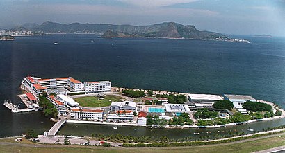
Ilha De Villegagnon Address: Avenida Almirante Silvio de Noronha street in Centro
- Avenida Almirante Silvio de Noronha s / n,
- Escola Naval,
- Avenida Almirante Sílvio de Noronha,
- Terminal de Cargas da TAM - Santos Dumont,
- SDU,
- Rio de Janeiro,
- Aeroporto Santos Dumont,
- Alamo,
- N6 Bar E Restaurante,
- Orla 21 Club,
- Xian Rio,
- Prodigy Santos Dumont Rio de Janeiro,
- Xian,
- Voo Gol 1049 - Santos Dumont RJ X SP Congonhas,
- Estacionamento Bossa Nova Mall,
- Aeroporto Santos Dumont,
- Prodigy Hotel Santos Dumont,
- Burger King,
- Voo Gol G3 1009,
- Aeroporto do Rio de Janeiro / Santos Dumont (SDU)
Places Near Ilha De Villegagnon (Centro)
- Shopping Downtown, Barra Da Tijuca,
- Rua Ulysses Guimarães 16, Cidade Nova,
- Avenida Venezuela 134, Saúde,
- Feirão De Malhas, Duque De Caxias,
- Rodoviária Novo Rio (Rodoviária do Rio de Janeiro), Santo Cristo,
- Rio De Janeiro,
- Shopping RioSul, Botafogo,
- Shopping Rio Sul, Botafogo,
- Shopping Nova América, Del Castilho,
- Hospital Municipal Ronaldo Gazolla, Acari,
- Feira Livre da Gloria, Glória,
- Hospital Federal Cardoso Fontes, Jacarepaguá,
- Norte Shopping, Cachambi,
- Museu Do Amanhã, Centro,
- Barra Shopping, Barra Da Tijuca,
- BRT - Estação Via Parque, Barra Da Tijuca,
- Hospital Federal Do Andaraí, Andaraí,
- Hospital Pedro Ernesto, Vila Isabel,
- Rua Licínio Cardoso, São Francisco Xavier,
- Niterói, Niterói
How to get to popular places in Rio de Janeiro Region with public transit
Get around Centro by public transit!
Traveling around Centro has never been so easy. See step by step directions as you travel to any attraction, street or major public transit station. View bus and train schedules, arrival times, service alerts and detailed routes on a map, so you know exactly how to get to anywhere in Centro.
When traveling to any destination around Centro use Moovit's Live Directions with Get Off Notifications to know exactly where and how far to walk, how long to wait for your line, and how many stops are left. Moovit will alert you when it's time to get off — no need to constantly re-check whether yours is the next stop.
Wondering how to use public transit in Centro or how to pay for public transit in Centro? Moovit public transit app can help you navigate your way with public transit easily, and at minimum cost. It includes public transit fees, ticket prices, and costs. Looking for a map of Centro public transit lines? Moovit public transit app shows all public transit maps in Centro with all Bus, Train, Metro, Light Rail, Ferry, Cable Car, Gondola and Funicular routes and stops on an interactive map.
Rio de Janeiro Region has 8 transit type(s), including: Bus, Train, Metro, Light Rail, Ferry, Cable Car, Gondola and Funicular, operated by several transit agencies, including SuperVia, Metrô Rio, VLT Carioca, Barcas Rio, BRT MOBI-Rio, Auto Viação Alpha, Auto Viação Tijuca, Gire Transportes, Transurb, Viação Nossa Senhora das Graças, Consórcio INTERSUL, Braso Lisboa (Municipal), Caprichosa Auto Ônibus, Auto Viação Três Amigos and Rodoviária Âncora Matias