How to get to Illerspitze by bus?
Click on the bus route to see step by step directions with maps, line arrival times and updated time schedules.
From Kloster Untermarchtal, Verwaltungsgemeinschaft Munderkingen
113 minFrom Amazon-DBX8, Herbrechtingen
224 minFrom HORNBACH, Vereinbarte Verwaltungsgemeinschaft Der Stadt Göppingen
232 minFrom Kaufland Geislingen, Vereinbarte Verwaltungsgemeinschaft Der Stadt Geislingen An Der Steige
142 minFrom Heidenheim an der Brenz, Heidenheim An Der Brenz
141 minFrom Media Markt, Gemeindeverwaltungsverband Eislingen-Ottenbach-Salach
230 minFrom Möbel Rieger, Vereinbarte Verwaltungsgemeinschaft Der Stadt Göppingen
242 minFrom Action, Gemeindeverwaltungsverband Eislingen-Ottenbach-Salach
235 min
How to get to Illerspitze by train?
Click on the train route to see step by step directions with maps, line arrival times and updated time schedules.
Light Rail stations near Illerspitze in Stuttgart
Bus stops near Illerspitze in Stuttgart
Train stations near Illerspitze in Stuttgart
- Ulm Hauptbahnhof, 18 min walk,VIEW
Bus lines to Illerspitze in Stuttgart
- E, Dellmensingen Hirsch,VIEW
- N8, Ulm Zob,VIEW
- 10, Ulm Blautal-Center Bstg B - Ulm Ehinger Tor Bstg E,VIEW
- 11, Ulm ZOB Bstg D1 - Ulm ZOB Bstg D2,VIEW
- 12, Unterweiler Hartstraße Bstg A - Ulm ZOB Bstg E,VIEW
- 21, Erbach Bahnhof Bstg 1 - Ehingen Busbahnhof Bstg 5,VIEW
- 23, Beuren,VIEW
- 24, Hüttisheim Rathaus,VIEW
- 4, Ulm Willy-Brandt-Platz,VIEW
- 70, Illertissen Bahnhof West,VIEW
- N7, Ulm Zob,VIEW
- 49, Ulm Kuhberg Schulzentrum,VIEW
What are the closest stations to Illerspitze?
The closest stations to Illerspitze are:
- Ulm Martin-Luther-Kirche Bstg B is 299 meters away, 5 min walk.
- Ulm Saarlandstraße Bstg A is 377 meters away, 5 min walk.
- Ulm Haßlerstraße Bstg A is 443 meters away, 7 min walk.
- Neu-Ulm Donaubad is 454 meters away, 6 min walk.
- Ulm Blücherstraße Bstg B is 515 meters away, 7 min walk.
- Ulm Römerplatz is 574 meters away, 8 min walk.
- Ulm Hauptbahnhof is 1318 meters away, 18 min walk.
Which bus lines stop near Illerspitze?
These bus lines stop near Illerspitze: 21, 4, 46, 585, 7.
Which train lines stop near Illerspitze?
These train lines stop near Illerspitze: MEX16, RE5, RS5.
Which light rail line stops near Illerspitze?
2 (Ulm Kuhberg Schulzentrum)
What’s the nearest light rail station to Illerspitze in Stuttgart?
The nearest light rail station to Illerspitze in Stuttgart is Ulm Martin-Luther-Kirche Bstg B. It’s a 5 min walk away.
What’s the nearest train station to Illerspitze in Stuttgart?
The nearest train station to Illerspitze in Stuttgart is Ulm Hauptbahnhof. It’s a 18 min walk away.
What’s the nearest bus station to Illerspitze in Stuttgart?
The nearest bus station to Illerspitze in Stuttgart is Ulm Saarlandstraße Bstg A. It’s a 5 min walk away.
What time is the first light rail to Illerspitze in Stuttgart?
The 2 is the first light rail that goes to Illerspitze in Stuttgart. It stops nearby at 4:40 AM.
What time is the last light rail to Illerspitze in Stuttgart?
The 1 is the last light rail that goes to Illerspitze in Stuttgart. It stops nearby at 1:11 AM.
What time is the first train to Illerspitze in Stuttgart?
The RE50 is the first train that goes to Illerspitze in Stuttgart. It stops nearby at 4:25 AM.
What time is the last train to Illerspitze in Stuttgart?
The 62N is the last train that goes to Illerspitze in Stuttgart. It stops nearby at 7:39 AM.
What time is the first bus to Illerspitze in Stuttgart?
The 4 is the first bus that goes to Illerspitze in Stuttgart. It stops nearby at 4:51 AM.
What time is the last bus to Illerspitze in Stuttgart?
The 70 is the last bus that goes to Illerspitze in Stuttgart. It stops nearby at 12:35 AM.
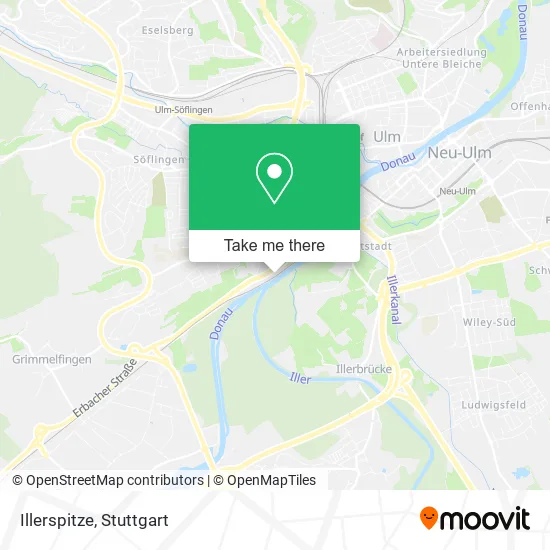
See Illerspitze, Stuttgart, on the map
Public Transit to Illerspitze in Stuttgart
Wondering how to get to Illerspitze in Stuttgart? Moovit helps you find the best way to get to Illerspitze with step-by-step directions from the nearest public transit station.
Moovit provides free maps and live directions to help you navigate through your city. View schedules, routes, timetables, and find out how long does it take to get to Illerspitze in real time.
Looking for the nearest stop or station to Illerspitze? Check out this list of stops closest to your destination: Ulm Martin-Luther-Kirche Bstg B; Ulm Saarlandstraße Bstg A; Ulm Haßlerstraße Bstg A; Neu-Ulm Donaubad; Ulm Blücherstraße Bstg B; Ulm Römerplatz; Ulm Hauptbahnhof.
Bus: 21, 4, 46, 585, 7, E, N8, 23, 24, 70, N7, 10, 11, 12, 49.Train: MEX16, RE5, RS5, RE200, SAB, RS2, RE3, RE3, RS3.Light Rail: 2.
Want to see if there’s another route that gets you there at an earlier time? Moovit helps you find alternative routes or times. Get directions from and directions to Illerspitze easily from the Moovit App or Website.
We make riding to Illerspitze easy, which is why over 1.5 million users, including users in Stuttgart, trust Moovit as the best app for public transit. You don’t need to download an individual bus app or train app, Moovit is your all-in-one transit app that helps you find the best bus time or train time available.
For information on prices of bus, train and light rail, costs and ride fares to Illerspitze, please check the Moovit app.
Use the app to navigate to popular places including to the airport, hospital, stadium, grocery store, mall, coffee shop, school, college, and university.
Illerspitze Address: Illerstraße 69 89079 Ulm street in Stuttgart
- Ulmer Kerzenwe,
- Kuhbergverein,
- Vereinsheim Des Kuhbergvereins,
- Kriegerdenkmal,
- Häckselplatz Unterer Kuhberg,
- Freie Waldorfschule am Illerblick,
- Laderaumplaner,
- Lro24,
- Zilles-It,
- Kehlcaponniere,
- Häckselplatz Verlängerung St.-Barbarastraße (Parkplatz Kga),
- Dıdf Ulm,
- Dieter Hirt - Studio Ulm,
- Ungarischer Kulturverein,
- Christliches,
- Ulmer Film- und Fotoamateure,
- Theater in der Bastion,
- Narrenzunft Ulm,
- Spasenije,
- Kindergarten Hort der Freien Waldorfschule in Ulm
Places Near Illerspitze (Stuttgart)
- Hanns-Martin-Schleyer-Halle, Bad Cannstatt,
- Hanns-Martin-Schleyer-Halle (Stuttgart Hans-Martin-Schleyerhalle), Bad Cannstatt,
- Mercedes-Benz Museum, Bad Cannstatt,
- SI-Centrum, Möhringen,
- Porsche-Arena, Bad Cannstatt,
- Klinikum Stuttgart - Katharinenhospital, Stuttgart-Mitte,
- Porsche Museum, Zuffenhausen,
- FlixBus Haltestelle, Stuttgart,
- Im Wizemann (Halle), Bad Cannstatt,
- Mettingen Eros-Center Puff Laufhaus, Esslingen Am Neckar,
- Waldfriedhof, Degerloch,
- Marmorsaal Im Weissenburgpark, Stuttgart-Süd,
- Mercedes-Benz Museum (Mercedes Museum Stuttgart), Bad Cannstatt,
- Geilhaus Haus 33a, Reutlingen-Betzingen,
- Wilhelma (U-Bahn Wilhelma), Bad Cannstatt,
- Hauptbahnhof Stuttgart, Stuttgart-Mitte,
- Schleyerhalle, Bad Cannstatt,
- Pariser Platz Stuttgart, Stuttgart-Mitte,
- Gleis 101/102 (tief), Stuttgart-Mitte,
- Gasometer Pforzheim, Pforzheim
How to get to popular places in Stuttgart with public transit
Get around Stuttgart by public transit!
Traveling around Stuttgart has never been so easy. See step by step directions as you travel to any attraction, street or major public transit station. View bus and train schedules, arrival times, service alerts and detailed routes on a map, so you know exactly how to get to anywhere in Stuttgart.
When traveling to any destination around Stuttgart use Moovit's Live Directions with Get Off Notifications to know exactly where and how far to walk, how long to wait for your line, and how many stops are left. Moovit will alert you when it's time to get off — no need to constantly re-check whether yours is the next stop.
Wondering how to use public transit in Stuttgart or how to pay for public transit in Stuttgart? Moovit public transit app can help you navigate your way with public transit easily, and at minimum cost. It includes public transit fees, ticket prices, and costs. Looking for a map of Stuttgart public transit lines? Moovit public transit app shows all public transit maps in Stuttgart with all Bus, Train, Subway, Light Rail, Ferry, S-Bahn and Funicular routes and stops on an interactive map.
Stuttgart has 7 transit type(s), including: Bus, Train, Subway, Light Rail, Ferry, S-Bahn and Funicular, operated by several transit agencies, including SSB - Stadtbahn, SSB, SSB - Seilbahn / Zacke, S-Bahn Stuttgart, Rhein-Neckar-Verkehr GmbH (rnv), Karlsruher Verkehrsverbund, DB AG, DB Regiobus BW, Arverio Baden-Württemberg GmbH, DB RegioNetz Verkehrs GmbH Westfrankenbahn, DB Regio AG Baden-Württemberg, Südwestdeutsche Verkehrs-AG, DB Regio AG Mitte Region Hessen, DB and Bodensee-Oberschwaben-Bahn