How to get to Im Manufacturing by bus?
Click on the bus route to see step by step directions with maps, line arrival times and updated time schedules.
From Rose Gaming Resort, Prince William County
249 minFrom Lorton, VA - Amtrak Auto Train Station (LOR), Fairfax County
239 minFrom Lorton, VA, Fairfax County
233 minFrom Potomac Mills Mall, Prince William County
224 minFrom Amazon Fulfillment Center-Ric3, Richmond
39 minFrom Woodbridge, VA, Prince William County
162 minFrom UVA Hospital Medical Center, Charlottesville
313 min
Bus stop near Im Manufacturing in Richmond
- Richmond Hwy + Halifax, 3 min walk,VIEW
Train station near Im Manufacturing in Richmond
- Pathrichmond Main Street Amtrak Station, 54 min walk,VIEW
Bus lines to Im Manufacturing in Richmond
What are the closest stations to Im Manufacturing?
The closest stations to Im Manufacturing are:
- Richmond Hwy + Halifax is 221 yards away, 3 min walk.
- Pathrichmond Main Street Amtrak Station is 4576 yards away, 54 min walk.
Which bus lines stop near Im Manufacturing?
These bus lines stop near Im Manufacturing: 1A, 1B, 3A, 3B.
What’s the nearest bus station to Im Manufacturing in Richmond?
The nearest bus station to Im Manufacturing in Richmond is Richmond Hwy + Halifax. It’s a 3 min walk away.
What time is the first train to Im Manufacturing in Richmond?
The NORTHEAST REGIONAL is the first train that goes to Im Manufacturing in Richmond. It stops nearby at 5:19 AM.
What time is the last train to Im Manufacturing in Richmond?
The NORTHEAST REGIONAL is the last train that goes to Im Manufacturing in Richmond. It stops nearby at 6:57 PM.
What time is the first bus to Im Manufacturing in Richmond?
The 3A is the first bus that goes to Im Manufacturing in Richmond. It stops nearby at 5:12 AM.
What time is the last bus to Im Manufacturing in Richmond?
The 3C is the last bus that goes to Im Manufacturing in Richmond. It stops nearby at 12:55 AM.
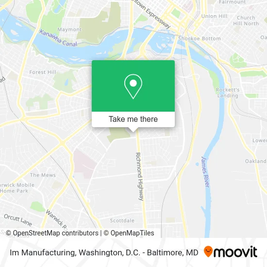
See Im Manufacturing, Richmond, on the map
Public Transit to Im Manufacturing in Richmond
Wondering how to get to Im Manufacturing in Richmond? Moovit helps you find the best way to get to Im Manufacturing with step-by-step directions from the nearest public transit station.
Moovit provides free maps and live directions to help you navigate through your city. View schedules, routes, timetables, and find out how long does it take to get to Im Manufacturing in real time.
Looking for the nearest stop or station to Im Manufacturing? Check out this list of stops closest to your destination: Richmond Hwy + Halifax; Pathrichmond Main Street Amtrak Station.
Bus: 1A, 1B, 3A, 3B, 3C.Train: NORTHEAST REGIONAL.
Want to see if there’s another route that gets you there at an earlier time? Moovit helps you find alternative routes or times. Get directions from and directions to Im Manufacturing easily from the Moovit App or Website.
We make riding to Im Manufacturing easy, which is why over 1.5 million users, including users in Richmond, trust Moovit as the best app for public transit. You don’t need to download an individual bus app or train app, Moovit is your all-in-one transit app that helps you find the best bus time or train time available.
For information on prices of bus and train, costs and ride fares to Im Manufacturing, please check the Moovit app.
Use the app to navigate to popular places including to the airport, hospital, stadium, grocery store, mall, coffee shop, school, college, and university.
Im Manufacturing Address: 1100 Richmond Hwy Richmond, VA 23224 street in Richmond
- Elliott Grays Marker-Jefferson Davis Highway,
- Redbox,
- 7-Eleven,
- International Paper,
- E T Moore Manufacturing Inc,
- Agape Christian Academy,
- Redeemed Assembly Of Jesus Christ Apostolic Church,
- Maury Cemetery,
- Four Strings,
- Mt. Olivet Cemetery,
- Central Transport,
- Philip Morris,
- Maury Street Marker, Jefferson Davis Highway,
- 301 Express,
- Oakland Church,
- Wfth-Am (Richmond),
- Triple Stamp Press,
- Brown Enterprise Pallets,
- Oak Grove School Annex,
- Faith, Hope And Charity Apostolic Church
Places Near Im Manufacturing (Richmond)
- National Zoo, Washington,
- National Theatre, Washington,
- The Anthem, Washington,
- Marriott Marquis Washington, DC, Washington,
- Washington DC VA Medical Center, Washington,
- Pennsylvania Ave NW (3rd st and pennsylvania), Washington,
- Warner Theatre, Washington,
- Basilica of the National Shrine, Washington,
- National Museum of African American History and Culture, Washington,
- Capital One Arena, Washington,
- Sibley Memorial Hospital, Washington,
- Georgetown, Washington,
- Amazon Hq2, Arlington County,
- Westfield Montgomery Mall, Montgomery County,
- Camden Yards, Baltimore,
- Rock Creek Tennis Center, Washington,
- Museum Of The Bible, Washington,
- Washington National Cathedral, Washington,
- PG Mall, Prince George's County,
- M&T Bank Stadium, Baltimore
How to get to popular places in Washington, D.C. - Baltimore, MD with public transit
Get around Richmond by public transit!
Traveling around Richmond has never been so easy. See step by step directions as you travel to any attraction, street or major public transit station. View bus and train schedules, arrival times, service alerts and detailed routes on a map, so you know exactly how to get to anywhere in Richmond.
When traveling to any destination around Richmond use Moovit's Live Directions with Get Off Notifications to know exactly where and how far to walk, how long to wait for your line, and how many stops are left. Moovit will alert you when it's time to get off — no need to constantly re-check whether yours is the next stop.
Wondering how to use public transit in Richmond or how to pay for public transit in Richmond? Moovit public transit app can help you navigate your way with public transit easily, and at minimum cost. It includes public transit fees, ticket prices, and costs. Looking for a map of Richmond public transit lines? Moovit public transit app shows all public transit maps in Richmond with all Bus, Train, Metro, Light Rail and Ferry routes and stops on an interactive map.
Washington, D.C. - Baltimore, MD has 5 transit type(s), including: Bus, Train, Metro, Light Rail and Ferry, operated by several transit agencies, including WMATA, Montgomery County Ride On, Fairfax Connector, TheBus, PRTC, DASH - Alexandria, Arlington Transit (ART), RTA of Central Maryland, MDOT MTA, MDOT MTA Light RailLink, MDOT MTA Commuter Bus, MDOT MTA Local Bus, FXBGO!, Virginia Railway Express (VRE) and MARC