How to get to Immigration Services Help by bus?
Click on the bus route to see step by step directions with maps, line arrival times and updated time schedules.
From The Shed, Manhattan
76 minFrom Hotel Chelsea, Manhattan
70 minFrom Flatiron Building, Manhattan
65 minFrom The Shops at SkyView Center, Queens
83 minFrom Central Park Zoo, Manhattan
61 minFrom 200 Park, Manhattan
55 minFrom Chelsea, Manhattan
71 minFrom Harry Potter New York, Manhattan
66 minFrom Harry Potter, Manhattan
66 minFrom Moma, Manhattan
57 min
How to get to Immigration Services Help by train?
Click on the train route to see step by step directions with maps, line arrival times and updated time schedules.
From The Shed, Manhattan
84 minFrom Hotel Chelsea, Manhattan
86 minFrom Flatiron Building, Manhattan
59 minFrom The Shops at SkyView Center, Queens
84 minFrom Central Park Zoo, Manhattan
58 minFrom 200 Park, Manhattan
34 minFrom Chelsea, Manhattan
82 minFrom Harry Potter New York, Manhattan
59 minFrom Harry Potter, Manhattan
60 minFrom Moma, Manhattan
50 min
How to get to Immigration Services Help by subway?
Click on the subway route to see step by step directions with maps, line arrival times and updated time schedules.
From The Shed, Manhattan
46 minFrom Hotel Chelsea, Manhattan
40 minFrom Flatiron Building, Manhattan
38 minFrom The Shops at SkyView Center, Queens
76 minFrom Central Park Zoo, Manhattan
36 minFrom 200 Park, Manhattan
35 minFrom Chelsea, Manhattan
44 minFrom Harry Potter New York, Manhattan
40 minFrom Harry Potter, Manhattan
41 minFrom Moma, Manhattan
51 min
Bus stops near Immigration Services Help in Bronx
Subway stations near Immigration Services Help in Bronx
Bus lines to Immigration Services Help in Bronx
What are the closest stations to Immigration Services Help?
The closest stations to Immigration Services Help are:
- 3 Av/E 144 St is 229 yards away, 3 min walk.
- Willis Av/E 146 St is 269 yards away, 4 min walk.
- 3 Av/E 149 St is 324 yards away, 5 min walk.
- E 149 St/Courtlandt Av is 336 yards away, 5 min walk.
- Morris Av/E 144 St is 375 yards away, 5 min walk.
- 3rd Avenue 2838 is 383 yards away, 5 min walk.
- 3 Av-138 St is 431 yards away, 6 min walk.
- 149 St-Grand Concourse is 809 yards away, 10 min walk.
Which bus lines stop near Immigration Services Help?
These bus lines stop near Immigration Services Help: BX21, M125.
Which train lines stop near Immigration Services Help?
These train lines stop near Immigration Services Help: 1, 2.
Which subway lines stop near Immigration Services Help?
These subway lines stop near Immigration Services Help: 2, 5.
What’s the nearest subway station to Immigration Services Help in Bronx?
The nearest subway station to Immigration Services Help in Bronx is 3 Av-138 St. It’s a 6 min walk away.
What’s the nearest bus station to Immigration Services Help in Bronx?
The nearest bus station to Immigration Services Help in Bronx is 3 Av/E 144 St. It’s a 3 min walk away.
What time is the first subway to Immigration Services Help in Bronx?
The 4 is the first subway that goes to Immigration Services Help in Bronx. It stops nearby at 3:01 AM.
What time is the last subway to Immigration Services Help in Bronx?
The 2 is the last subway that goes to Immigration Services Help in Bronx. It stops nearby at 4:07 AM.
What time is the first bus to Immigration Services Help in Bronx?
The BX21 is the first bus that goes to Immigration Services Help in Bronx. It stops nearby at 3:02 AM.
What time is the last bus to Immigration Services Help in Bronx?
The BX21 is the last bus that goes to Immigration Services Help in Bronx. It stops nearby at 3:03 AM.
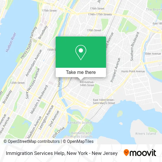
See Immigration Services Help, Bronx, on the map
Public Transit to Immigration Services Help in Bronx
Wondering how to get to Immigration Services Help in Bronx? Moovit helps you find the best way to get to Immigration Services Help with step-by-step directions from the nearest public transit station.
Moovit provides free maps and live directions to help you navigate through your city. View schedules, routes, timetables, and find out how long does it take to get to Immigration Services Help in real time.
Looking for the nearest stop or station to Immigration Services Help? Check out this list of stops closest to your destination: 3 Av/E 144 St; Willis Av/E 146 St; 3 Av/E 149 St; E 149 St/Courtlandt Av; Morris Av/E 144 St; 3rd Avenue 2838; 3 Av-138 St; 149 St-Grand Concourse.
Bus: BX21, M125, BX2, BX41-SBS, BX19.Train: 1, 2.Subway: 2, 5, 6, 6X, 4.
Want to see if there’s another route that gets you there at an earlier time? Moovit helps you find alternative routes or times. Get directions from and directions to Immigration Services Help easily from the Moovit App or Website.
We make riding to Immigration Services Help easy, which is why over 1.5 million users, including users in Bronx, trust Moovit as the best app for public transit. You don’t need to download an individual bus app or train app, Moovit is your all-in-one transit app that helps you find the best bus time or train time available.
For information on prices of subway, bus and train, costs and ride fares to Immigration Services Help, please check the Moovit app.
Use the app to navigate to popular places including to the airport, hospital, stadium, grocery store, mall, coffee shop, school, college, and university.
Immigration Services Help Address: 342 E 146th St Apt 5E street in Bronx
- Jadi Lash,
- The Haus Nyc,
- Children's Haven,
- La Tormenta Car Wash,
- Saint Rita's Roman Catholic Church,
- C-Town,
- Blimpie,
- College Ave & E 145th St,
- E 146th St (146th street 3rd),
- Essen Health Care,
- Csd7 Bx,
- E 145 3rd Ave,
- 3rd Ave (145th street and 3rd Ave),
- Third Avenue Imaging Llc.,
- Charles A Pastor Md,
- Third Avenue Open Mri,
- Third Avenue Radiology and Imaging PC,
- Mocha May Aesthetics,
- Allen Health Care Services,
- Masa
Places Near Immigration Services Help (Bronx)
- San Gennaro Feast, Manhattan,
- Rockefeller Center, Manhattan,
- 26 Federal Plaza, Manhattan,
- Times Square, Manhattan,
- Katz's Deli, Manhattan,
- qqqq, Manhattan,
- 376 Hudson Street, Manhattan,
- Hudson Yards, Manhattan,
- 1 Police Plaza, Manhattan,
- Queens Center Mall, Queens,
- SoHo, Manhattan,
- Chinatown, Manhattan,
- 66 John Street, Manhattan,
- 911 Memorial, Manhattan,
- Pier 83, Manhattan,
- Bellevue Hospital, Manhattan,
- Mountainside Hospital, Glen Ridge,
- 111 Centre New York City Supreme Court, Manhattan,
- Wall Street, Manhattan,
- 3 Stone St, Manhattan
How to get to popular places in New York - New Jersey with public transit
Get around Bronx by public transit!
Traveling around Bronx has never been so easy. See step by step directions as you travel to any attraction, street or major public transit station. View bus and train schedules, arrival times, service alerts and detailed routes on a map, so you know exactly how to get to anywhere in Bronx.
When traveling to any destination around Bronx use Moovit's Live Directions with Get Off Notifications to know exactly where and how far to walk, how long to wait for your line, and how many stops are left. Moovit will alert you when it's time to get off — no need to constantly re-check whether yours is the next stop.
Wondering how to use public transit in Bronx or how to pay for public transit in Bronx? Moovit public transit app can help you navigate your way with public transit easily, and at minimum cost. It includes public transit fees, ticket prices, and costs. Looking for a map of Bronx public transit lines? Moovit public transit app shows all public transit maps in Bronx with all Bus, Train, Subway, Light Rail, Ferry and Cable Car routes and stops on an interactive map.
New York - New Jersey has 6 transit type(s), including: Bus, Train, Subway, Light Rail, Ferry and Cable Car, operated by several transit agencies, including MTA Subway, Metro-North Railroad, LIRR, PATH, MTA New York City Transit - Express routes, MTA Bus, NJ Transit, NYC Ferry, NICE bus, Bee-Line Bus, NJ Transit Rail, Norwalk Transit District, Hartford Line, River Valley Transit and HART