Directions to Importel (Sítio Dos Pintos) with public transportation
The following transit lines have routes that pass near Importel
How to get to Importel by bus?
Click on the bus route to see step by step directions with maps, line arrival times and updated time schedules.
From Hospital Nossa Senhora de Lourdes, Cavaleiro
87 minFrom Novo Atacarejo, San Martin
53 minFrom Estação Central do Recife (CBTU/Metrorec), São José
75 minFrom Rua da Glória, Boa Vista
56 minFrom Hospital Correia Picanço - HCP, Tamarineira
37 minFrom Cotel, Abreu E Lima
71 minFrom Av. Mascarenhas de Moraes, Imbiribeira
62 minFrom U P A - Jardim Paulista Baixo, Paulista
50 minFrom UniNassau - Bloco A, Graças
57 minFrom Real Hospital Português, Paissandu
60 min
Bus stops near Importel in Sítio Dos Pintos
Bus lines to Importel in Sítio Dos Pintos
What are the closest stations to Importel?
The closest stations to Importel are:
- R. Da Jaqueira 2-8 - Dois Irmãos Recife - Pe Brasil is 172 meters away, 3 min walk.
- Rua Córrego Da Fortuna 107 is 403 meters away, 6 min walk.
- 100139 - Rua Pintos 112 is 973 meters away, 13 min walk.
Which bus lines stop near Importel?
These bus lines stop near Importel: 202, 2490 TI CAMARAGIBE / TI MACAXEIRA - BRT, 2930 TI RIO DOCE / DOIS IRMÃOS, 524 SÍTIO DOS PINTOS (DOIS IRMÃOS), 532 CASA AMARELA (CABUGÁ).
What’s the nearest bus station to Importel in Sítio Dos Pintos?
The nearest bus station to Importel in Sítio Dos Pintos is R. Da Jaqueira 2-8 - Dois Irmãos Recife - Pe Brasil. It’s a 3 min walk away.
What time is the first bus to Importel in Sítio Dos Pintos?
The 524 SÍTIO DOS PINTOS (DOIS IRMÃOS) is the first bus that goes to Importel in Sítio Dos Pintos. It stops nearby at 5:00 AM.
What time is the last bus to Importel in Sítio Dos Pintos?
The 532 CASA AMARELA (CABUGÁ) is the last bus that goes to Importel in Sítio Dos Pintos. It stops nearby at 12:28 AM.
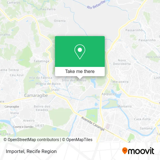
See Importel, Sítio Dos Pintos, on the map
Public Transit to Importel in Sítio Dos Pintos
Wondering how to get to Importel in Sítio Dos Pintos? Moovit helps you find the best way to get to Importel with step-by-step directions from the nearest public transit station.
Moovit provides free maps and live directions to help you navigate through your city. View schedules, routes, timetables, and find out how long does it take to get to Importel in real time.
Looking for the nearest stop or station to Importel? Check out this list of stops closest to your destination: R. Da Jaqueira 2-8 - Dois Irmãos Recife - Pe Brasil; Rua Córrego Da Fortuna 107; 100139 - Rua Pintos 112.
Bus: 202, 2490 TI CAMARAGIBE / TI MACAXEIRA - BRT, 2930 TI RIO DOCE / DOIS IRMÃOS, 524 SÍTIO DOS PINTOS (DOIS IRMÃOS), 532 CASA AMARELA (CABUGÁ).
Want to see if there’s another route that gets you there at an earlier time? Moovit helps you find alternative routes or times. Get directions from and directions to Importel easily from the Moovit App or Website.
We make riding to Importel easy, which is why over 1.5 million users, including users in Sítio Dos Pintos, trust Moovit as the best app for public transit. You don’t need to download an individual bus app or train app, Moovit is your all-in-one transit app that helps you find the best bus time or train time available.
For information on prices of bus and subway, costs and ride fares to Importel, please check the Moovit app.
Use the app to navigate to popular places including to the airport, hospital, stadium, grocery store, mall, coffee shop, school, college, and university.
Importel Address: Rua Jaqueira, 330 Sítio dos Pintos Recife-PE 52171-290 street in Sítio Dos Pintos
- Granja Cinco Irmãos,
- Crediario Moveis,
- Mro - Informática,
- Scala Shopping Plaza,
- Auto Escola Saepe,
- Instituto Raid,
- Sítio Bar,
- Camila Maia de,
- Ruffo,
- Dr Viagens,
- Dalva Confeitaria,
- Cvc PE - Shopping Plaza,
- VALE DO AMANHECER - Nerano do Amanhecer Dois Irmãos.,
- Rua da Meiguice 346,
- Xiquesertao,
- Vale do Amanhecer - Nerano do Amanhecer Dois Irmãos.,
- Travessa Córrego da Fortuna,
- Emsgf,
- Menininha,
- Marcos Antonio Mendonca do Nascimento
Places Near Importel (Sítio Dos Pintos)
- Shopping Patteo Olinda, Olinda,
- Hospital Agamenon Magalhães, Tamarineira,
- SHOPPING GUARARAPES, Jaboatão Dos Guararapes,
- Arena de Pernambuco, São Lourenço Da Mata,
- llll, Fundão,
- Centro de Convenções de Pernambuco, Olinda,
- SHOPPING TACARUNA, Santo Amaro,
- Imbiribeira, Imbiribeira,
- Shopping RioMar Recife, Pina,
- hospital otavio de freitas - UTI, Tejipió,
- Hospital Geral De Areias, Areias,
- Marco Zero, Bairro Do Recife,
- tuuuuu, Olinda,
- Hospital Eduardo Campus Da Pessoa Idosa, Areias,
- Imip (Instituto Materno-Infantil De Pernambuco), Coelhos,
- Hospital Altino Ventura, Iputinga,
- Shopping Recife, Boa Viagem,
- Parque da Jaqueira, Jaqueira,
- Hospital Maria Lucinda, Parnamirim,
- Hospital Universitário Oswaldo Cruz, Santo Amaro
How to get to popular places in Recife Region with public transit
Get around Sítio Dos Pintos by public transit!
Traveling around Sítio Dos Pintos has never been so easy. See step by step directions as you travel to any attraction, street or major public transit station. View bus and train schedules, arrival times, service alerts and detailed routes on a map, so you know exactly how to get to anywhere in Sítio Dos Pintos.
When traveling to any destination around Sítio Dos Pintos use Moovit's Live Directions with Get Off Notifications to know exactly where and how far to walk, how long to wait for your line, and how many stops are left. Moovit will alert you when it's time to get off — no need to constantly re-check whether yours is the next stop.
Wondering how to use public transit in Sítio Dos Pintos or how to pay for public transit in Sítio Dos Pintos? Moovit public transit app can help you navigate your way with public transit easily, and at minimum cost. It includes public transit fees, ticket prices, and costs. Looking for a map of Sítio Dos Pintos public transit lines? Moovit public transit app shows all public transit maps in Sítio Dos Pintos with all Bus, Train, Subway and Ferry routes and stops on an interactive map.
Recife Region has 4 transit type(s), including: Bus, Train, Subway and Ferry, operated by several transit agencies, including CBTU (Metrorec), BRT (Via Livre), Grande Recife, BORBOREMA IMPERIAL (TIP), BORBOREMA IMPERIAL (B.V), RODOVIÁRIA POTENGY, EMPRESA METROPOLITANA, CONSÓRCIO RECIFE, SÃO JUDAS TADEU, Expresso 1002, Rodotur Turismo, Complementar Recife, Sistema Municipal - Jaboatão, Sistema Municipal - Cabo and Sistema Municipal - Ipojuca