How to get to In An Uber by bus?
Click on the bus route to see step by step directions with maps, line arrival times and updated time schedules.
From Intelligence Community Campus—Bethesda, Montgomery County
114 minFrom Inova employee Shuttle, Fairfax County
70 minFrom Defense Health Headquarters (DHHQ), Fairfax County
65 minFrom Hollywood Casino at Charles Town Races, Fairfax County
80 minFrom Bullis School, Montgomery County
127 minFrom George H.W. Bush Center For Intelligence (CIA Headquarters), Fairfax County
90 minFrom Eden Center, Falls Church
60 minFrom Defense Health Agency Headquarters, Fairfax County
66 minFrom Kaiser Permanente - Falls Church Medical Center, Falls Church
74 min
How to get to In An Uber by metro?
Click on the metro route to see step by step directions with maps, line arrival times and updated time schedules.
Bus stop near In An Uber in Fairfax County
- Leesburg Pike @ Wolftrap Run Rd, 3 min walk,VIEW
Metro station near In An Uber in Fairfax County
- Spring Hill, 54 min walk,VIEW
Bus lines to In An Uber in Fairfax County
- 574, 574 Reston - Town Ctr,VIEW
What are the closest stations to In An Uber?
The closest stations to In An Uber are:
- Leesburg Pike @ Wolftrap Run Rd is 213 yards away, 3 min walk.
- Spring Hill is 4640 yards away, 54 min walk.
Which bus lines stop near In An Uber?
These bus lines stop near In An Uber: 427, 574, 798.
Which metro line stops near In An Uber?
SILVER (Ashburn)
What’s the nearest bus station to In An Uber in Fairfax County?
The nearest bus station to In An Uber in Fairfax County is Leesburg Pike @ Wolftrap Run Rd. It’s a 3 min walk away.
What time is the first metro to In An Uber in Fairfax County?
The SILVER is the first metro that goes to In An Uber in Fairfax County. It stops nearby at 5:07 AM.
What time is the last metro to In An Uber in Fairfax County?
The SILVER is the last metro that goes to In An Uber in Fairfax County. It stops nearby at 12:43 AM.
What time is the first bus to In An Uber in Fairfax County?
The 574 is the first bus that goes to In An Uber in Fairfax County. It stops nearby at 5:23 AM.
What time is the last bus to In An Uber in Fairfax County?
The 574 is the last bus that goes to In An Uber in Fairfax County. It stops nearby at 10:00 PM.
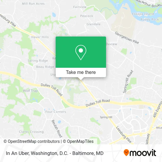
See In An Uber, Fairfax County, on the map
Public Transit to In An Uber in Fairfax County
Wondering how to get to In An Uber in Fairfax County? Moovit helps you find the best way to get to In An Uber with step-by-step directions from the nearest public transit station.
Moovit provides free maps and live directions to help you navigate through your city. View schedules, routes, timetables, and find out how long does it take to get to In An Uber in real time.
Looking for the nearest stop or station to In An Uber? Check out this list of stops closest to your destination: Leesburg Pike @ Wolftrap Run Rd; Spring Hill.
Bus: 427, 574, 798.Metro: SILVER.
Want to see if there’s another route that gets you there at an earlier time? Moovit helps you find alternative routes or times. Get directions from and directions to In An Uber easily from the Moovit App or Website.
We make riding to In An Uber easy, which is why over 1.5 million users, including users in Fairfax County, trust Moovit as the best app for public transit. You don’t need to download an individual bus app or train app, Moovit is your all-in-one transit app that helps you find the best bus time or train time available.
For information on prices of bus and metro, costs and ride fares to In An Uber, please check the Moovit app.
Use the app to navigate to popular places including to the airport, hospital, stadium, grocery store, mall, coffee shop, school, college, and university.
Location: Fairfax County, Washington, D.C. - Baltimore, MD
- Southern Baptist Convention,
- Ambleside School,
- Shakespeare Opera Theatre,
- Achilles Shield,
- McLean Bible Church,
- Accessibility Summit,
- Act2impact,
- Tysons Kid's Quest,
- Liya Music Camp-USA,
- Emo's Basement Pub,
- Bethel Washington Primitive Baptist Church,
- McLean Hundred Real Estate,
- Andrew musalla Preschool,
- St Athanasius Roman Catholic Church,
- Old Grv VA-7,
- Wolf Trap Concert Hall,
- Gildas,
- Barn,
- Filene Center,
- Choose Wisely Group
Places Near In An Uber (Fairfax County)
- The Anthem, Washington,
- National Zoo, Washington,
- PG Mall, Prince George's County,
- National Mall, Washington,
- Westfield Montgomery Mall, Montgomery County,
- Museum Of The Bible, Washington,
- Washington National Cathedral, Washington,
- Capital One Arena, Washington,
- National Museum of African American History and Culture, Washington,
- M&T Bank Stadium, Baltimore,
- Camden Yards, Baltimore,
- Basilica of the National Shrine, Washington,
- Georgetown, Washington,
- Pennsylvania Ave NW (3rd st and pennsylvania), Washington,
- Rock Creek Tennis Center, Washington,
- Warner Theatre, Washington,
- Marriott Marquis Washington, DC, Washington,
- Washington DC VA Medical Center, Washington,
- Sibley Memorial Hospital, Washington,
- Amazon Hq2, Arlington County
How to get to popular places in Washington, D.C. - Baltimore, MD with public transit
Get around Fairfax County by public transit!
Traveling around Fairfax County has never been so easy. See step by step directions as you travel to any attraction, street or major public transit station. View bus and train schedules, arrival times, service alerts and detailed routes on a map, so you know exactly how to get to anywhere in Fairfax County.
When traveling to any destination around Fairfax County use Moovit's Live Directions with Get Off Notifications to know exactly where and how far to walk, how long to wait for your line, and how many stops are left. Moovit will alert you when it's time to get off — no need to constantly re-check whether yours is the next stop.
Wondering how to use public transit in Fairfax County or how to pay for public transit in Fairfax County? Moovit public transit app can help you navigate your way with public transit easily, and at minimum cost. It includes public transit fees, ticket prices, and costs. Looking for a map of Fairfax County public transit lines? Moovit public transit app shows all public transit maps in Fairfax County with all Bus, Train, Metro, Light Rail and Ferry routes and stops on an interactive map.
Washington, D.C. - Baltimore, MD has 5 transit type(s), including: Bus, Train, Metro, Light Rail and Ferry, operated by several transit agencies, including WMATA, Montgomery County Ride On, Fairfax Connector, TheBus, PRTC, DASH - Alexandria, Arlington Transit (ART), RTA of Central Maryland, MDOT MTA, MDOT MTA Light RailLink, MDOT MTA Commuter Bus, MDOT MTA Local Bus, FXBGO!, Virginia Railway Express (VRE) and MARC