How to get to In Dental Active by bus?
Click on the bus route to see step by step directions with maps, line arrival times and updated time schedules.
From Estación de Madrid-Chamartín, Madrid
44 minFrom Kiosko Ramón Y Cajal, Madrid
43 minFrom ILUNION Pio XII, Madrid
51 minFrom Gran Via, Madrid
54 minFrom Calle Princesa de Éboli 29, Madrid
30 minFrom Palacio De Hielo, Área Metropolitana De Madrid Y Corredor Del Henares
65 minFrom Ronda de la COMUNICACION, S/N, Madrid
33 minFrom Paracuellos de Jarama, Paracuellos De Jarama
57 minFrom Parque Europa, Madrid
42 minFrom Calle Barquillo, Madrid
44 min
How to get to In Dental Active by train?
Click on the train route to see step by step directions with maps, line arrival times and updated time schedules.
How to get to In Dental Active by metro?
Click on the metro route to see step by step directions with maps, line arrival times and updated time schedules.
Bus stops near In Dental Active in San Sebastián De Los Reyes
Metro station near In Dental Active in San Sebastián De Los Reyes
- Reyes Católicos, 6 min walk,VIEW
Train station near In Dental Active in San Sebastián De Los Reyes
- Alcobendas - San Sebastián De Los Reyes, 13 min walk,VIEW
Bus lines to In Dental Active in San Sebastián De Los Reyes
- 5, San Sebastián de los Reyes,VIEW
- 7, Circular (Estación FF.CC. - Polígonos - Estación FF.CC.),VIEW
- 4, Moscatelares,VIEW
- 158, Av. San Luis - Av. Burgos,VIEW
- 154C, Av. Quiñones - Cerro Del Baile,VIEW
- N102, Intercambiador De Plaza De Castilla (Nivel 0, Isla 4),VIEW
- 154, Av. Colmenar Viejo - Ntra. Sra. Carmen,VIEW
- 827A, Iván Pavlov - Rectorado,VIEW
- 153, Pza. Universidad Popular - Est. Baunatal,VIEW
What are the closest stations to In Dental Active?
The closest stations to In Dental Active are:
- Av. Independencia - Sevilla is 222 meters away, 3 min walk.
- Av. Aragón - Parque Velódromo is 276 meters away, 4 min walk.
- Av. Baunatal - Pza. Andrés Caballero is 388 meters away, 6 min walk.
- Reyes Católicos is 406 meters away, 6 min walk.
- Pza. Universidad Popular - Est. Baunatal is 486 meters away, 7 min walk.
- Alcobendas - San Sebastián De Los Reyes is 980 meters away, 13 min walk.
Which bus lines stop near In Dental Active?
These bus lines stop near In Dental Active: 154, 154C, 158.
Which train line stops near In Dental Active?
C4A (Alcobendas - S. S. De Los Reyes)
Which metro line stops near In Dental Active?
M-10 (Hospital Infanta Sofía)
What’s the nearest metro station to In Dental Active in San Sebastián De Los Reyes?
The nearest metro station to In Dental Active in San Sebastián De Los Reyes is Reyes Católicos. It’s a 6 min walk away.
What’s the nearest train station to In Dental Active in San Sebastián De Los Reyes?
The nearest train station to In Dental Active in San Sebastián De Los Reyes is Alcobendas - San Sebastián De Los Reyes. It’s a 13 min walk away.
What’s the nearest bus station to In Dental Active in San Sebastián De Los Reyes?
The nearest bus station to In Dental Active in San Sebastián De Los Reyes is Av. Independencia - Sevilla. It’s a 3 min walk away.
What time is the first metro to In Dental Active in San Sebastián De Los Reyes?
The M-10 is the first metro that goes to In Dental Active in San Sebastián De Los Reyes. It stops nearby at 6:05 AM.
What time is the last metro to In Dental Active in San Sebastián De Los Reyes?
The M-10 is the last metro that goes to In Dental Active in San Sebastián De Los Reyes. It stops nearby at 1:52 AM.
What time is the first train to In Dental Active in San Sebastián De Los Reyes?
The C4A is the first train that goes to In Dental Active in San Sebastián De Los Reyes. It stops nearby at 5:30 AM.
What time is the last train to In Dental Active in San Sebastián De Los Reyes?
The C4A is the last train that goes to In Dental Active in San Sebastián De Los Reyes. It stops nearby at 12:02 AM.
What time is the first bus to In Dental Active in San Sebastián De Los Reyes?
The N102 is the first bus that goes to In Dental Active in San Sebastián De Los Reyes. It stops nearby at 3:24 AM.
What time is the last bus to In Dental Active in San Sebastián De Los Reyes?
The N102 is the last bus that goes to In Dental Active in San Sebastián De Los Reyes. It stops nearby at 2:28 AM.
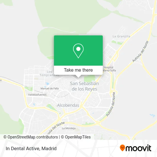
See In Dental Active, San Sebastián De Los Reyes, on the map
Public Transit to In Dental Active in San Sebastián De Los Reyes
Wondering how to get to In Dental Active in San Sebastián De Los Reyes? Moovit helps you find the best way to get to In Dental Active with step-by-step directions from the nearest public transit station.
Moovit provides free maps and live directions to help you navigate through your city. View schedules, routes, timetables, and find out how long does it take to get to In Dental Active in real time.
Looking for the nearest stop or station to In Dental Active? Check out this list of stops closest to your destination: Av. Independencia - Sevilla; Av. Aragón - Parque Velódromo; Av. Baunatal - Pza. Andrés Caballero; Reyes Católicos; Pza. Universidad Popular - Est. Baunatal; Alcobendas - San Sebastián De Los Reyes.
Bus: 154, 154C, 158, 5, 7, 4, N102, 827A, 153.Train: C4A.Metro: M-10.
Want to see if there’s another route that gets you there at an earlier time? Moovit helps you find alternative routes or times. Get directions from and directions to In Dental Active easily from the Moovit App or Website.
We make riding to In Dental Active easy, which is why over 1.5 million users, including users in San Sebastián De Los Reyes, trust Moovit as the best app for public transit. You don’t need to download an individual bus app or train app, Moovit is your all-in-one transit app that helps you find the best bus time or train time available.
For information on prices of bus, metro and train, costs and ride fares to In Dental Active, please check the Moovit app.
Use the app to navigate to popular places including to the airport, hospital, stadium, grocery store, mall, coffee shop, school, college, and university.
In Dental Active Address: Avenida Andalucía, 2 28702 San Sebastián de los Reyes street in San Sebastián De Los Reyes
- House,
- Estructuras de Hormigón Ingenieria y Arquitectura Carbati,
- Floristería La Novia,
- Alimentación y Frutos Secos,
- Piscina Munic Ajalvir,
- Papelería y La Tacita de Plata,
- Cafeteria Las Pirámides,
- Feama Perfumería Regalos y Complementos,
- Centro Comercial El Zoco - Las Pirámides,
- Caja España-Duero,
- Gómez del Agua S,
- Bar Fratello,
- Top Nails Studio,
- Cafetería Rio Duero,
- Cabana del Tio Juanan,
- M-C Entrenamiento Personal,
- Rotecer,
- Reparacion Inyección Diesel,
- Tres Culturas Vision,
- Oasis
Places Near In Dental Active (San Sebastián De Los Reyes)
- Hospital Universitario Ramón y Cajal, Madrid,
- Plenilunio, Área Metropolitana De Madrid Y Corredor Del Henares,
- Centro Comercial Islazul, Área Metropolitana De Madrid Y Corredor Del Henares,
- Centro Comercial La Vaguada, Área Metropolitana De Madrid Y Corredor Del Henares,
- Centro Comercial La Gavia, Área Metropolitana De Madrid Y Corredor Del Henares,
- Plaza Mayor, Madrid,
- Hospital Universitario La Paz, Madrid,
- Mercadillo de Majadahonda, Majadahonda,
- Mendez Alvaro, Madrid,
- Calle de López de Hoyos 169, Madrid,
- Sala La Riviera, Madrid,
- Palacio De Vistalegre, Área Metropolitana De Madrid Y Corredor Del Henares,
- Tres Aguas, Alcorcón,
- Wizink Center, Madrid,
- Nassica, Área Metropolitana De Madrid Y Corredor Del Henares,
- Rastro De Madrid, Área Metropolitana De Madrid Y Corredor Del Henares,
- Estadio Wanda Metropolitano, Área Metropolitana De Madrid Y Corredor Del Henares,
- Centro Comercial Oasiz Madrid, Área Metropolitana De Madrid Y Corredor Del Henares,
- Hospital Clínico Universitario San Carlos, Madrid,
- Estacion de Chamartin, Madrid
How to get to popular places in Madrid with public transit
Get around San Sebastián De Los Reyes by public transit!
Traveling around San Sebastián De Los Reyes has never been so easy. See step by step directions as you travel to any attraction, street or major public transit station. View bus and train schedules, arrival times, service alerts and detailed routes on a map, so you know exactly how to get to anywhere in San Sebastián De Los Reyes.
When traveling to any destination around San Sebastián De Los Reyes use Moovit's Live Directions with Get Off Notifications to know exactly where and how far to walk, how long to wait for your line, and how many stops are left. Moovit will alert you when it's time to get off — no need to constantly re-check whether yours is the next stop.
Wondering how to use public transit in San Sebastián De Los Reyes or how to pay for public transit in San Sebastián De Los Reyes? Moovit public transit app can help you navigate your way with public transit easily, and at minimum cost. It includes public transit fees, ticket prices, and costs. Looking for a map of San Sebastián De Los Reyes public transit lines? Moovit public transit app shows all public transit maps in San Sebastián De Los Reyes with all Bus, Train, Metro and Light Rail routes and stops on an interactive map.
Madrid has 4 transit type(s), including: Bus, Train, Metro and Light Rail, operated by several transit agencies, including Metro de Madrid, Metro Ligero, Tranvía de Parla, Renfe Cercanías - Servicios de Autobús especiales, Renfe Cercanias, Renfe Cercanías, EMT, Interurbanos, Urbanos de Alcalá de Henares, Urbanos de Alcobendas, Urbanos de Alcorcón, Urbanos de Algete, Urbanos de Aranjuez, Urbanos de Arganda del Rey and Urbanos de Arroyomolinos