How to get to In-Shape Studio by bus?
Click on the bus route to see step by step directions with maps, line arrival times and updated time schedules.
From Ramada by Wyndham Miami Springs Miami International Airport, Miami
54 minFrom Zezgo Miami Rent A Car, Miami
100 minFrom Miami Airport Rental Car Center, Miami
111 minFrom Terminal Aeropuerto Internacional del Miami, Miami
114 minFrom Tri Rail Metrorail Transfer Station, Miami
114 minFrom Miami Dade College Hialeah Campus, Hialeah
111 minFrom Hialeah Park Casino, Hialeah
124 minFrom NW 37th Ave, Miami
120 minFrom Le Jeune Rd / E 49th St, Hialeah
104 minFrom Mall Of The Americas, North Westside
58 min
Bus stops near In-Shape Studio in North Westside
Bus lines to In-Shape Studio in North Westside
What are the closest stations to In-Shape Studio?
The closest stations to In-Shape Studio are:
- Morgan Leavy Park Nw 52 St@nw 102 Ave is 404 yards away, 5 min walk.
- NW 102 Ave & NW 52 St is 573 yards away, 7 min walk.
Which bus lines stop near In-Shape Studio?
These bus lines stop near In-Shape Studio: 132, 36, 87, DLOOP3, DLOOP4.
What’s the nearest bus station to In-Shape Studio in North Westside?
The nearest bus station to In-Shape Studio in North Westside is Morgan Leavy Park Nw 52 St@nw 102 Ave. It’s a 5 min walk away.
What time is the first bus to In-Shape Studio in North Westside?
The DLOOP3 is the first bus that goes to In-Shape Studio in North Westside. It stops nearby at 6:09 AM.
What time is the last bus to In-Shape Studio in North Westside?
The DLOOP1 is the last bus that goes to In-Shape Studio in North Westside. It stops nearby at 9:45 PM.
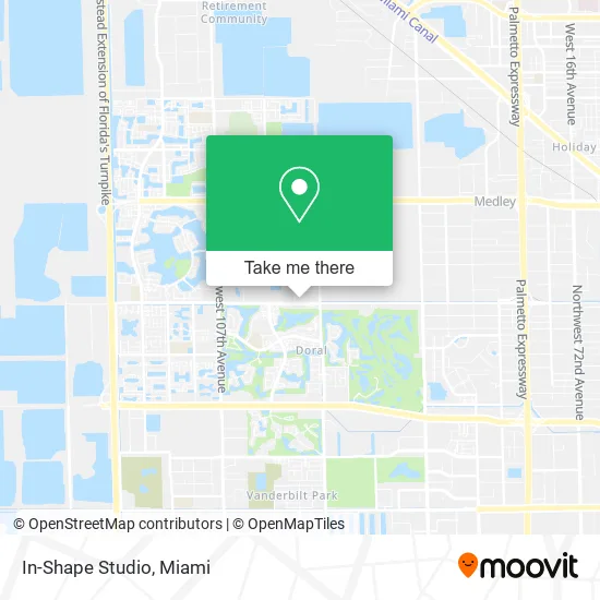
See In-Shape Studio, North Westside, on the map
Public Transit to In-Shape Studio in North Westside
Wondering how to get to In-Shape Studio in North Westside? Moovit helps you find the best way to get to In-Shape Studio with step-by-step directions from the nearest public transit station.
Moovit provides free maps and live directions to help you navigate through your city. View schedules, routes, timetables, and find out how long does it take to get to In-Shape Studio in real time.
Looking for the nearest stop or station to In-Shape Studio? Check out this list of stops closest to your destination: Morgan Leavy Park Nw 52 St@nw 102 Ave; NW 102 Ave & NW 52 St.
Bus: 132, 36, 87, DLOOP3, DLOOP4, DLOOP1.
Want to see if there’s another route that gets you there at an earlier time? Moovit helps you find alternative routes or times. Get directions from and directions to In-Shape Studio easily from the Moovit App or Website.
We make riding to In-Shape Studio easy, which is why over 1.5 million users, including users in North Westside, trust Moovit as the best app for public transit. You don’t need to download an individual bus app or train app, Moovit is your all-in-one transit app that helps you find the best bus time or train time available.
For information on prices of bus and train, costs and ride fares to In-Shape Studio, please check the Moovit app.
Use the app to navigate to popular places including to the airport, hospital, stadium, grocery store, mall, coffee shop, school, college, and university.
In-Shape Studio Address: 9851 NW 58th St Miami, FL 33178 street in North Westside
- JGL Health Lab Corporation,
- Sanabria & Associates,
- Iglesia Cristiana Camino Nuevo, Miami,
- Eight Bistro Lounge,
- Beauty Key Studio,
- Tttur Global Services,
- Kobi Foods,
- Impact Centre at Doral Commerce Park,
- Quality International Tours,
- Latin Hotdogs,
- Xexi Hair & Spa,
- Miso Picante,
- Harlequin Title,
- National Podiatric Network,
- smart Miami Realty,
- Don Goyo,
- Nice Cream,
- Inversiones Conquistador,
- Sonix Wireless,
- Touch-Up Enterprises
Places Near In-Shape Studio (North Westside)
- Little Havana, Miami,
- Aventura Mall, Miami,
- Bayside Marketplace, Miami,
- Miami Freedom Park, Miami,
- Dolphin Mall Bus, Miami,
- Zoo Miami, Miami,
- Keiser University Flagship Campus, West Palm Beach,
- Miami Design District, Miami,
- Aventura Mall, Miami Beach,
- Miami-Dade County Courthouse, Miami,
- Hard Rock Stadium, Miami Gardens,
- Dolphin Mall, Miami,
- Marlins Park, Miami,
- Miami VA Hospital, Miami,
- Wynwood, Miami,
- Sawgrass Mall, Miami,
- Port of Miami Cruise Terminal, Miami,
- Brickell City Centre, Miami,
- Richard E. Gerstein Justice Building, Miami,
- Sawgrass mall ( FL ), Miami Beach
How to get to popular places in Miami with public transit
Get around North Westside by public transit!
Traveling around North Westside has never been so easy. See step by step directions as you travel to any attraction, street or major public transit station. View bus and train schedules, arrival times, service alerts and detailed routes on a map, so you know exactly how to get to anywhere in North Westside.
When traveling to any destination around North Westside use Moovit's Live Directions with Get Off Notifications to know exactly where and how far to walk, how long to wait for your line, and how many stops are left. Moovit will alert you when it's time to get off — no need to constantly re-check whether yours is the next stop.
Wondering how to use public transit in North Westside or how to pay for public transit in North Westside? Moovit public transit app can help you navigate your way with public transit easily, and at minimum cost. It includes public transit fees, ticket prices, and costs. Looking for a map of North Westside public transit lines? Moovit public transit app shows all public transit maps in North Westside with all Bus, Train, Light Rail and Ferry routes and stops on an interactive map.
Miami has 4 transit type(s), including: Bus, Train, Light Rail and Ferry, operated by several transit agencies, including Broward County Transit, Miami-Dade Transit, Metrorail, Palm Tran, Tri-Rail, Brightline, MARTY, City of Homestead Trolley, Key West Transit, Treasure Coast Connector, GoLine IRT, Amtrak, Greyhound-us, FlixBus-us and Aventura Express Shuttle Bus