Directions to In Stitches Embroidery (Spotsylvania County) with public transportation
The following transit lines have routes that pass near In Stitches Embroidery
 Bus: ROUTE 33.
- Train: FREDERICKSBURG LINE.
How to get to In Stitches Embroidery by bus?
Click on the bus route to see step by step directions with maps, line arrival times and updated time schedules.
How to get to In Stitches Embroidery by train?
Click on the train route to see step by step directions with maps, line arrival times and updated time schedules.
Bus stop near In Stitches Embroidery in Spotsylvania County
- 33 - Lee Hill School Rd. (Timber Ridge Clubhouse), 24 min walk,VIEW
Train station near In Stitches Embroidery in Spotsylvania County
- Spotsylvania, 51 min walk,VIEW
Bus lines to In Stitches Embroidery in Spotsylvania County
- ROUTE 33, Outbound,VIEW
What are the closest stations to In Stitches Embroidery?
The closest stations to In Stitches Embroidery are:
- 33 - Lee Hill School Rd. (Timber Ridge Clubhouse) is 1988 yards away, 24 min walk.
- Spotsylvania is 4345 yards away, 51 min walk.
Which bus line stops near In Stitches Embroidery?
ROUTE 33 (Outbound)
Which train line stops near In Stitches Embroidery?
FREDERICKSBURG LINE (Spotsylvania)
What time is the first train to In Stitches Embroidery in Spotsylvania County?
The FREDERICKSBURG LINE is the first train that goes to In Stitches Embroidery in Spotsylvania County. It stops nearby at 4:52 AM.
What time is the last train to In Stitches Embroidery in Spotsylvania County?
The FREDERICKSBURG LINE is the last train that goes to In Stitches Embroidery in Spotsylvania County. It stops nearby at 8:37 PM.
What time is the first bus to In Stitches Embroidery in Spotsylvania County?
The ROUTE 33 is the first bus that goes to In Stitches Embroidery in Spotsylvania County. It stops nearby at 8:19 AM.
What time is the last bus to In Stitches Embroidery in Spotsylvania County?
The ROUTE 33 is the last bus that goes to In Stitches Embroidery in Spotsylvania County. It stops nearby at 7:19 PM.
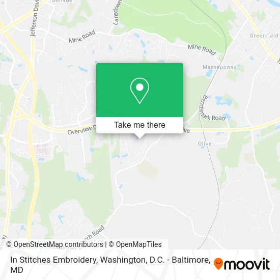
See In Stitches Embroidery, Spotsylvania County, on the map
Public Transit to In Stitches Embroidery in Spotsylvania County
Wondering how to get to In Stitches Embroidery in Spotsylvania County? Moovit helps you find the best way to get to In Stitches Embroidery with step-by-step directions from the nearest public transit station.
Moovit provides free maps and live directions to help you navigate through your city. View schedules, routes, timetables, and find out how long does it take to get to In Stitches Embroidery in real time.
Looking for the nearest stop or station to In Stitches Embroidery? Check out this list of stops closest to your destination: 33 - Lee Hill School Rd. (Timber Ridge Clubhouse); Spotsylvania.
Bus: ROUTE 33.Train: FREDERICKSBURG LINE.
Want to see if there’s another route that gets you there at an earlier time? Moovit helps you find alternative routes or times. Get directions from and directions to In Stitches Embroidery easily from the Moovit App or Website.
We make riding to In Stitches Embroidery easy, which is why over 1.5 million users, including users in Spotsylvania County, trust Moovit as the best app for public transit. You don’t need to download an individual bus app or train app, Moovit is your all-in-one transit app that helps you find the best bus time or train time available.
For information on prices of bus and train, costs and ride fares to In Stitches Embroidery, please check the Moovit app.
Use the app to navigate to popular places including to the airport, hospital, stadium, grocery store, mall, coffee shop, school, college, and university.
In Stitches Embroidery Address: 3709 Layton St Fredericksburg, VA 22408 street in Spotsylvania County
- American Prestige Contracting,
- Tims Carpet Cleaning,
- Timberlake Hoa,
- Spotsylvania County School,
- ATM Transportation,
- Gator Paving,
- Commonwealth Irrigation & Landscape,
- Advanced Pneumatics,
- Goqpi,
- Design Storage & Handling,
- Mechem Electronics,
- St Jude Catholic Church,
- Jhonsam Carpentry,
- Integrity Contracting & Remodeling,
- Vine Christian Homeschool Community,
- Lee's Hill Houses with Anna Lee,
- Monster Joe's Truck & Tow,
- Spotsylvania Station,
- Lee's Hill Fitness Trail,
- Automatic Rolls
Places Near In Stitches Embroidery (Spotsylvania County)
- PG Mall, Prince George's County,
- Pennsylvania Ave NW (3rd st and pennsylvania), Washington,
- National Zoo, Washington,
- The Anthem, Washington,
- Museum Of The Bible, Washington,
- Rock Creek Tennis Center, Washington,
- Warner Theatre, Washington,
- Washington National Cathedral, Washington,
- Camden Yards, Baltimore,
- Capital One Arena, Washington,
- Washington DC VA Medical Center, Washington,
- Basilica of the National Shrine, Washington,
- Georgetown, Washington,
- Marriott Marquis Washington, DC, Washington,
- National Museum of African American History and Culture, Washington,
- Westfield Montgomery Mall, Montgomery County,
- Sibley Memorial Hospital, Washington,
- Amazon Hq2, Arlington County,
- M&T Bank Stadium, Baltimore,
- National Mall, Washington
How to get to popular places in Washington, D.C. - Baltimore, MD with public transit
Get around Spotsylvania County by public transit!
Traveling around Spotsylvania County has never been so easy. See step by step directions as you travel to any attraction, street or major public transit station. View bus and train schedules, arrival times, service alerts and detailed routes on a map, so you know exactly how to get to anywhere in Spotsylvania County.
When traveling to any destination around Spotsylvania County use Moovit's Live Directions with Get Off Notifications to know exactly where and how far to walk, how long to wait for your line, and how many stops are left. Moovit will alert you when it's time to get off — no need to constantly re-check whether yours is the next stop.
Wondering how to use public transit in Spotsylvania County or how to pay for public transit in Spotsylvania County? Moovit public transit app can help you navigate your way with public transit easily, and at minimum cost. It includes public transit fees, ticket prices, and costs. Looking for a map of Spotsylvania County public transit lines? Moovit public transit app shows all public transit maps in Spotsylvania County with all Bus, Train, Metro, Light Rail and Ferry routes and stops on an interactive map.
Washington, D.C. - Baltimore, MD has 5 transit type(s), including: Bus, Train, Metro, Light Rail and Ferry, operated by several transit agencies, including WMATA, Montgomery County Ride On, Fairfax Connector, TheBus, PRTC, DASH - Alexandria, Arlington Transit (ART), RTA of Central Maryland, MDOT MTA, MDOT MTA Light RailLink, MDOT MTA Commuter Bus, MDOT MTA Local Bus, FXBGO!, Virginia Railway Express (VRE) and MARC