How to get to In Telecommunications Association by bus?
Click on the bus route to see step by step directions with maps, line arrival times and updated time schedules.
From Chipotle, Indianapolis City (Balance)
39 minFrom Affirmative Insurance Holdings, Speedway
39 minFrom 2040 Shadeland Avenue, Indianapolis
69 minFrom Coinstar - Bitcoin ATM, Indianapolis City (Balance)
45 minFrom Rainbowshops, Indianapolis City (Balance)
29 minFrom CMC 7244 Indianapolis, Indianapolis City (Balance)
51 minFrom Northern Tool Equipment, Indianapolis City (Balance)
46 minFrom Letha Anne Tetrick, do, Indianapolis City (Balance)
69 minFrom Wayne Township Bus Depot, Indianapolis City (Balance)
43 minFrom Ecoatm, Indianapolis City (Balance)
45 min
Bus stops near In Telecommunications Association in Indianapolis City (Balance)
- Ohio St & Meridian St, 4 min walk,VIEW
- Washington St & Illinois St, 4 min walk,VIEW
- Statehouse Station Nb, 5 min walk,VIEW
- Indianapolis (E Washington St), 7 min walk,VIEW
- Ctc-F, 8 min walk,VIEW
- Ctc-E, 8 min walk,VIEW
- Ctc-T, 8 min walk,VIEW
- Ctc-H, 8 min walk,VIEW
- Ctc-S, 8 min walk,VIEW
- Ctc-J, 8 min walk,VIEW
- Ctc-R, 10 min walk,VIEW
Bus lines to In Telecommunications Association in Indianapolis City (Balance)
- 11, East 16th St,VIEW
- 25, W 16th St,VIEW
- 8, Indy Zoo,VIEW
- 24, Ameriplex,VIEW
- 90, 66th,VIEW
- 92, Transit Center,VIEW
- FLIXBUS 2511, Milwaukee - Chicago - Columbus,VIEW
- FLIXBUS 2512, Chicago - Louisville - Atlanta,VIEW
- FLIXBUS 2514, Madison - Chicago - Cincinnati,VIEW
- FLIXBUS 2515, Chicago - Indianapolis - Bloomington,IN,VIEW
- FLIXBUS N2640, NYC - Pittsburgh - Chicago,VIEW
- FLIXBUS N2642, NYC - Cincinnati - Chicago,VIEW
- 3, Arlington & 46th,VIEW
- 19, Butler University,VIEW
- 37, Transit Center,VIEW
- 10, Meijer Avon,VIEW
- 2, Transit Center,VIEW
- 13, Keystone & National,VIEW
- 56, Emerson/Thompson,VIEW
- 5, East 25th St,VIEW
What are the closest stations to In Telecommunications Association?
The closest stations to In Telecommunications Association are:
- Ohio St & Meridian St is 269 yards away, 4 min walk.
- Washington St & Illinois St is 288 yards away, 4 min walk.
- Statehouse Station Nb is 361 yards away, 5 min walk.
- Indianapolis (E Washington St) is 586 yards away, 7 min walk.
- Ctc-F is 603 yards away, 8 min walk.
- Ctc-E is 617 yards away, 8 min walk.
- Ctc-T is 633 yards away, 8 min walk.
- Ctc-H is 633 yards away, 8 min walk.
- Ctc-S is 657 yards away, 8 min walk.
- Ctc-J is 659 yards away, 8 min walk.
- Ctc-R is 796 yards away, 10 min walk.
Which bus lines stop near In Telecommunications Association?
These bus lines stop near In Telecommunications Association: 10, 24, 37, 56, 8.
What’s the nearest bus station to In Telecommunications Association in Indianapolis City (Balance)?
The nearest bus stations to In Telecommunications Association in Indianapolis City (Balance) are Ohio St & Meridian St and Washington St & Illinois St. The closest one is a 4 min walk away.
What time is the first bus to In Telecommunications Association in Indianapolis City (Balance)?
The FLIXBUS N2640 is the first bus that goes to In Telecommunications Association in Indianapolis City (Balance). It stops nearby at 3:15 AM.
What time is the last bus to In Telecommunications Association in Indianapolis City (Balance)?
The FLIXBUS N2642 is the last bus that goes to In Telecommunications Association in Indianapolis City (Balance). It stops nearby at 4:10 PM.
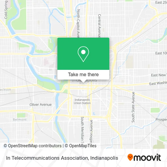
See In Telecommunications Association, Indianapolis City (Balance), on the map
Public Transit to In Telecommunications Association in Indianapolis City (Balance)
Wondering how to get to In Telecommunications Association in Indianapolis City (Balance)? Moovit helps you find the best way to get to In Telecommunications Association with step-by-step directions from the nearest public transit station.
Moovit provides free maps and live directions to help you navigate through your city. View schedules, routes, timetables, and find out how long does it take to get to In Telecommunications Association in real time.
Looking for the nearest stop or station to In Telecommunications Association? Check out this list of stops closest to your destination: Ohio St & Meridian St; Washington St & Illinois St; Statehouse Station Nb; Indianapolis (E Washington St); Ctc-F; Ctc-E; Ctc-T; Ctc-H; Ctc-S; Ctc-J; Ctc-R.
Bus: 10, 24, 37, 56, 8, 11, 25, 90, 92, FLIXBUS 2511, FLIXBUS 2512, FLIXBUS 2514, FLIXBUS 2515, FLIXBUS N2640, 3, 19.
Want to see if there’s another route that gets you there at an earlier time? Moovit helps you find alternative routes or times. Get directions from and directions to In Telecommunications Association easily from the Moovit App or Website.
We make riding to In Telecommunications Association easy, which is why over 1.5 million users, including users in Indianapolis City (Balance), trust Moovit as the best app for public transit. You don’t need to download an individual bus app or train app, Moovit is your all-in-one transit app that helps you find the best bus time or train time available.
For information on prices of bus, costs and ride fares to In Telecommunications Association, please check the Moovit app.
Use the app to navigate to popular places including to the airport, hospital, stadium, grocery store, mall, coffee shop, school, college, and university.
In Telecommunications Association Address: 54 Monument Cir Ste 200 street in Indianapolis City (Balance)
- Integrity Mobile Signing Service,
- Star Financial Bank,
- CIB Bank,
- CC Holdings - Nat,
- Dish Network,
- au bon pain,
- Sushi Boss,
- Small Engine Disposal,
- Diem & Noctem,
- Certasite - HPP/VT,
- Octiv,
- New Opportunities for Revenue,
- Site Strategies,
- Conga,
- Xfinity,
- Ink'd Pmu by Sue Ellen,
- Motto-Indianapolis,
- Mariah's Cookies,
- Guy Fieri's Flavortown Kitchen,
- Yourencore (Your Encore)
Places Near In Telecommunications Association (Indianapolis City (Balance))
- Lilly Corporate Center (Eli Lilly & Co), Indianapolis City (Balance),
- St. Vincent Hospital - Indianapolis, Indianapolis City (Balance),
- Castleton Square Mall, Indianapolis,
- I U Health Methodist Hospital, Indianapolis City (Balance),
- Lucas Oil Stadium, Indianapolis City (Balance),
- Methodist Hospital of Indianapolis, Indianapolis City (Balance),
- Indianapolis Motor Speedway, Speedway,
- 119 W 19th St Parking, Indianapolis City (Balance),
- Train Ride At Castleton Mall, Indianapolis City (Balance),
- THE BALT, Indianapolis City (Balance),
- Jersey Barn, Indianapolis City (Balance),
- Eskenazi Hospital, Indianapolis City (Balance),
- Indiana Convention Center, Indianapolis City (Balance),
- Cotter's Massage Parlor With Happy Endings, Indianapolis City (Balance),
- St. Vincent entrance #1, Indianapolis City (Balance),
- Plainfield, IN, Plainfield,
- Gainbridge Fieldhouse, Indianapolis City (Balance),
- I-465 / I-65 Interchange, Indianapolis City (Balance),
- Indiana, Indianapolis City (Balance),
- Indianapolis Airport Zone 2, Indianapolis City (Balance)
How to get to popular places in Indianapolis with public transit
Get around Indianapolis City (Balance) by public transit!
Traveling around Indianapolis City (Balance) has never been so easy. See step by step directions as you travel to any attraction, street or major public transit station. View bus and train schedules, arrival times, service alerts and detailed routes on a map, so you know exactly how to get to anywhere in Indianapolis City (Balance).
When traveling to any destination around Indianapolis City (Balance) use Moovit's Live Directions with Get Off Notifications to know exactly where and how far to walk, how long to wait for your line, and how many stops are left. Moovit will alert you when it's time to get off — no need to constantly re-check whether yours is the next stop.
Wondering how to use public transit in Indianapolis City (Balance) or how to pay for public transit in Indianapolis City (Balance)? Moovit public transit app can help you navigate your way with public transit easily, and at minimum cost. It includes public transit fees, ticket prices, and costs. Looking for a map of Indianapolis City (Balance) public transit lines? Moovit public transit app shows all public transit maps in Indianapolis City (Balance) with all bus routes and stops on an interactive map.
Indianapolis has 1 transit type(s), including: bus, operated by several transit agencies, including IndyGo, FlixBus-us and Greyhound-us